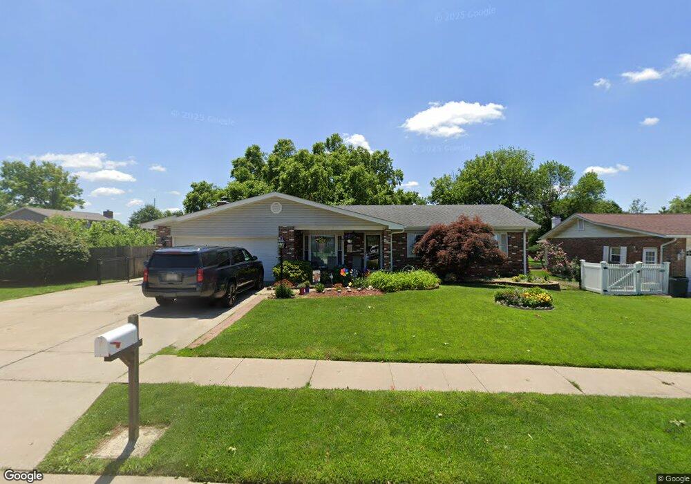
4186 Avery Ln Bridgeton, MO 63044
Estimated Value: $262,000 - $280,000
3
Beds
2
Baths
1,400
Sq Ft
$193/Sq Ft
Est. Value
About This Home
This home is located at 4186 Avery Ln, Bridgeton, MO 63044 and is currently estimated at $269,989, approximately $192 per square foot. 4186 Avery Ln is a home located in St. Louis County with nearby schools including Robert Drummond Elementary School, Holman Middle School, and Pattonville High School.
Ownership History
Date
Name
Owned For
Owner Type
Purchase Details
Closed on
Jan 15, 2010
Sold by
Arnold David P and Arnold Cheryl A
Bought by
Arnold David P and Revocab Cheryl
Current Estimated Value
Purchase Details
Closed on
Apr 3, 1998
Sold by
White Albert F and White Mary F
Bought by
Arnold David P and Arnold Cheryl A
Home Financials for this Owner
Home Financials are based on the most recent Mortgage that was taken out on this home.
Original Mortgage
$118,935
Outstanding Balance
$22,795
Interest Rate
7.21%
Estimated Equity
$247,194
Create a Home Valuation Report for This Property
The Home Valuation Report is an in-depth analysis detailing your home's value as well as a comparison with similar homes in the area
Home Values in the Area
Average Home Value in this Area
Purchase History
We collect this data history from publicly available records. To have your information removed, we recommend requesting removal directly through your county’s website.
| Date | Buyer | Sale Price | Title Company |
|---|---|---|---|
| Arnold David P | -- | None Available | |
| Arnold David P | -- | -- |
Source: Public Records
Mortgage History
We collect this data history from publicly available records. To have your information removed, we recommend requesting removal directly through your county’s website.
| Date | Status | Borrower | Loan Amount |
|---|---|---|---|
| Open | Arnold David P | $118,935 |
Source: Public Records
Tax History
| Year | Tax Paid | Tax Assessment Tax Assessment Total Assessment is a certain percentage of the fair market value that is determined by local assessors to be the total taxable value of land and additions on the property. | Land | Improvement |
|---|---|---|---|---|
| 2025 | $4,616 | $48,130 | $13,700 | $34,430 |
| 2024 | $4,616 | $40,410 | $10,030 | $30,380 |
| 2023 | $4,629 | $40,410 | $10,030 | $30,380 |
| 2022 | $4,434 | $34,300 | $7,300 | $27,000 |
| 2021 | $4,388 | $34,300 | $7,300 | $27,000 |
| 2020 | $4,164 | $31,220 | $8,040 | $23,180 |
| 2019 | $4,171 | $31,220 | $8,040 | $23,180 |
| 2018 | $3,956 | $26,810 | $5,470 | $21,340 |
| 2017 | $2,636 | $26,810 | $5,470 | $21,340 |
| 2016 | $2,530 | $25,290 | $5,470 | $19,820 |
| 2015 | $2,507 | $25,290 | $5,470 | $19,820 |
| 2014 | $2,741 | $27,550 | $5,930 | $21,620 |
Source: Public Records
Map
Nearby Homes
- 4079 Lockport Dr
- 11768 Parish Dr
- 3833 Midview Ave
- 3772 Three Oaks Ln
- 6 Al Lin Ct
- 3728 Fee Rd
- 4325 Saint Dominic Ln
- 3623 Bridgeton Valley Cir
- 11717 Beaverton Dr
- 11218 Saint Shawn Ln
- 3720 High Dr
- 10655 Saint Stephen Ln
- 4224 Ashby Rd
- 11378 Burgess Ave
- 11108 Bernice Ave
- 11269 Oak Hill Manor Dr
- 11805 Birmington Dr
- 11021 Bernice Ave
- 11036 Bernice Ave
- 3554 Theresa Ave
Your Personal Tour Guide
Ask me questions while you tour the home.