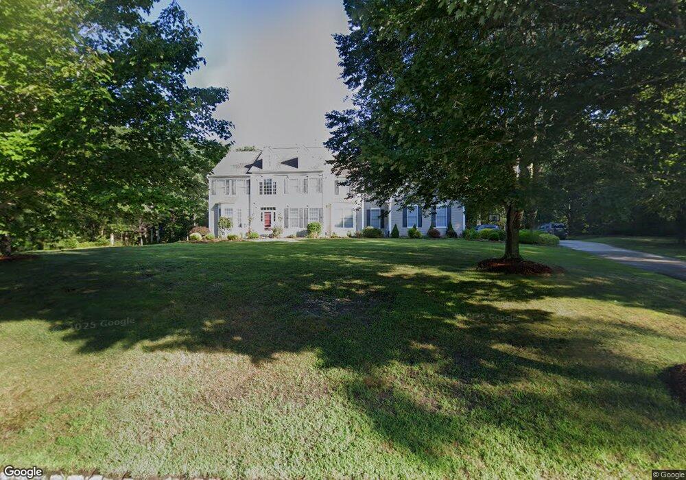
419 Pine Ave Egg Harbor Township, NJ 08234
Estimated Value: $700,290 - $939,000
Studio
--
Bath
3,500
Sq Ft
$241/Sq Ft
Est. Value
About This Home
This home is located at 419 Pine Ave, Egg Harbor Township, NJ 08234 and is currently estimated at $843,823, approximately $241 per square foot. 419 Pine Ave is a home located in Atlantic County with nearby schools including Egg Harbor Township High School.
Ownership History
Date
Name
Owned For
Owner Type
Purchase Details
Closed on
Mar 15, 2004
Sold by
E H T Land Llc
Bought by
Pond & Spitz Homes At Hainesport Llc
Current Estimated Value
Purchase Details
Closed on
Nov 18, 2001
Sold by
Pond & Spitz Homes At Hainesport Llc
Bought by
Garrabrant Daniel A and Garrabrant Jessica
Home Financials for this Owner
Home Financials are based on the most recent Mortgage that was taken out on this home.
Original Mortgage
$300,000
Interest Rate
5.79%
Mortgage Type
Fannie Mae Freddie Mac
Create a Home Valuation Report for This Property
The Home Valuation Report is an in-depth analysis detailing your home's value as well as a comparison with similar homes in the area
Home Values in the Area
Average Home Value in this Area
Purchase History
| Date | Buyer | Sale Price | Title Company |
|---|---|---|---|
| Pond & Spitz Homes At Hainesport Llc | $1,675,000 | -- | |
| Garrabrant Daniel A | $522,350 | Liberty Title Agency |
Source: Public Records
Mortgage History
| Date | Status | Borrower | Loan Amount |
|---|---|---|---|
| Previous Owner | Garrabrant Daniel A | $300,000 |
Source: Public Records
Tax History
| Year | Tax Paid | Tax Assessment Tax Assessment Total Assessment is a certain percentage of the fair market value that is determined by local assessors to be the total taxable value of land and additions on the property. | Land | Improvement |
|---|---|---|---|---|
| 2025 | $13,674 | $407,700 | $104,400 | $303,300 |
| 2024 | $13,674 | $407,700 | $104,400 | $303,300 |
| 2023 | $13,597 | $407,700 | $104,400 | $303,300 |
| 2022 | $13,597 | $407,700 | $104,400 | $303,300 |
| 2021 | $13,707 | $407,700 | $104,400 | $303,300 |
| 2020 | $13,458 | $407,700 | $104,400 | $303,300 |
| 2019 | $13,091 | $407,700 | $104,400 | $303,300 |
| 2018 | $12,810 | $407,700 | $104,400 | $303,300 |
| 2017 | $12,765 | $407,700 | $104,400 | $303,300 |
| 2016 | $12,260 | $407,700 | $104,400 | $303,300 |
| 2015 | $12,080 | $407,700 | $104,400 | $303,300 |
| 2014 | $11,840 | $407,700 | $104,400 | $303,300 |
Source: Public Records
Map
Nearby Homes
- 13 Welshire Dr
- 199 Betsy Scull Rd
- 11 Princeton Ave
- L7 Betsy Scull Rd
- 212 Pine Ave
- 1242 Somers Point Rd
- 15 Forest View Ct
- 1319 Somers Point Rd
- 1384 Somers Point Rd Trlr 16 Rd
- 6 English Ln
- 1099 Somers Point Rd
- 135 Thompson Unit 38 Ln
- 135 Thompson Ln
- 135 Thompson #82 Ln
- 29 Buckingham Dr
- 217 Zion Rd
- 4546 Ocean Heights Ave
- 4465 Ocean Heights Ave
- 607 Sea Ranch Ave
- 172 Pine Ave
Your Personal Tour Guide
Ask me questions while you tour the home.