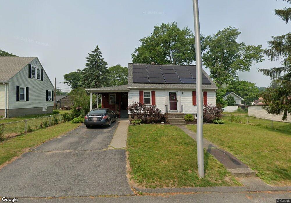
42 Anderson Ave Worcester, MA 01604
Grafton Hill NeighborhoodEstimated Value: $362,000 - $432,000
3
Beds
2
Baths
1,200
Sq Ft
$332/Sq Ft
Est. Value
About This Home
This home is located at 42 Anderson Ave, Worcester, MA 01604 and is currently estimated at $398,819, approximately $332 per square foot. 42 Anderson Ave is a home located in Worcester County with nearby schools including Jacob Hiatt Magnet School, Chandler Magnet, and Lake View Elementary School.
Ownership History
Date
Name
Owned For
Owner Type
Purchase Details
Closed on
Nov 1, 2007
Sold by
Lefurgey Marjorie A
Bought by
Smith Edward C
Current Estimated Value
Home Financials for this Owner
Home Financials are based on the most recent Mortgage that was taken out on this home.
Original Mortgage
$150,000
Outstanding Balance
$95,151
Interest Rate
6.43%
Mortgage Type
Purchase Money Mortgage
Estimated Equity
$303,668
Create a Home Valuation Report for This Property
The Home Valuation Report is an in-depth analysis detailing your home's value as well as a comparison with similar homes in the area
Home Values in the Area
Average Home Value in this Area
Purchase History
We collect this data history from publicly available records. To have your information removed, we recommend requesting removal directly through your county’s website.
| Date | Buyer | Sale Price | Title Company |
|---|---|---|---|
| Smith Edward C | $150,000 | -- |
Source: Public Records
Mortgage History
We collect this data history from publicly available records. To have your information removed, we recommend requesting removal directly through your county’s website.
| Date | Status | Borrower | Loan Amount |
|---|---|---|---|
| Open | Smith Edward C | $150,000 |
Source: Public Records
Tax History
| Year | Tax Paid | Tax Assessment Tax Assessment Total Assessment is a certain percentage of the fair market value that is determined by local assessors to be the total taxable value of land and additions on the property. | Land | Improvement |
|---|---|---|---|---|
| 2025 | $4,536 | $343,900 | $110,500 | $233,400 |
| 2024 | $4,450 | $323,600 | $110,500 | $213,100 |
| 2023 | $4,262 | $297,200 | $96,100 | $201,100 |
| 2022 | $3,901 | $256,500 | $76,900 | $179,600 |
| 2021 | $3,751 | $230,400 | $61,500 | $168,900 |
| 2020 | $3,657 | $215,100 | $61,500 | $153,600 |
| 2019 | $3,476 | $193,100 | $55,300 | $137,800 |
| 2018 | $3,481 | $184,100 | $55,300 | $128,800 |
| 2017 | $3,335 | $173,500 | $55,300 | $118,200 |
| 2016 | $3,291 | $159,700 | $41,400 | $118,300 |
| 2015 | $3,205 | $159,700 | $41,400 | $118,300 |
| 2014 | $3,121 | $159,700 | $41,400 | $118,300 |
Source: Public Records
Map
Nearby Homes
- 42 Ernest Ave
- 360 Hamilton St
- 34 Marjorie St
- 21 Middlesex Ave Unit 305
- Lot B Crawford St
- 6 Harrington Way
- 12 Hyannis Place
- 143 Dorcester
- 135 Cohasset St
- 80 Delmont Ave
- 76 Valmor St
- 4 Ayrshire Rd
- 43 Robin Rd
- 81 Pilgrim Ave
- 1 Ayrshire Rd
- 109 Hamilton St
- 12 Lamar Ave
- 34 Dartmouth St
- 56 Cohasset St
- 133 Puritan Ave
Your Personal Tour Guide
Ask me questions while you tour the home.