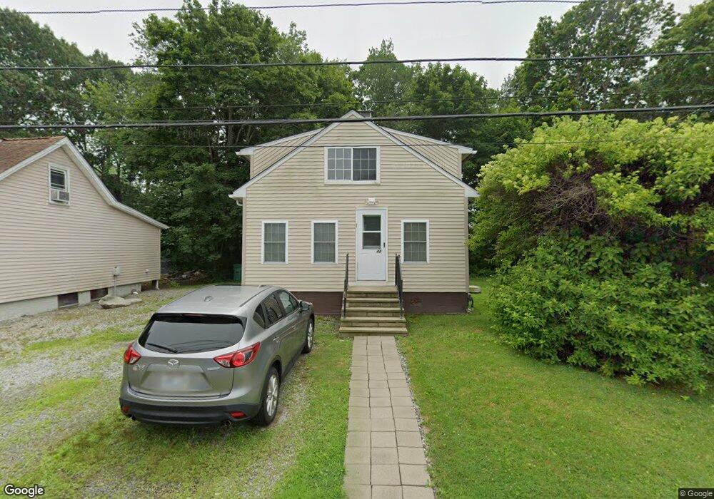
42 Millard Ave Warwick, RI 02889
Warwick Neck NeighborhoodEstimated Value: $340,477 - $461,000
4
Beds
1
Bath
1,012
Sq Ft
$393/Sq Ft
Est. Value
About This Home
This home is located at 42 Millard Ave, Warwick, RI 02889 and is currently estimated at $397,369, approximately $392 per square foot. 42 Millard Ave is a home located in Kent County with nearby schools including Saint Kevin School and Bishop Hendricken High School.
Ownership History
Date
Name
Owned For
Owner Type
Purchase Details
Closed on
Aug 30, 1999
Sold by
Vanasse Ronald J and Vanasse Joan A
Bought by
Swanton Paul C and Swanton Tina L
Current Estimated Value
Home Financials for this Owner
Home Financials are based on the most recent Mortgage that was taken out on this home.
Original Mortgage
$74,900
Outstanding Balance
$19,741
Interest Rate
7.53%
Mortgage Type
Purchase Money Mortgage
Estimated Equity
$377,628
Create a Home Valuation Report for This Property
The Home Valuation Report is an in-depth analysis detailing your home's value as well as a comparison with similar homes in the area
Home Values in the Area
Average Home Value in this Area
Purchase History
| Date | Buyer | Sale Price | Title Company |
|---|---|---|---|
| Swanton Paul C | $75,000 | -- |
Source: Public Records
Mortgage History
| Date | Status | Borrower | Loan Amount |
|---|---|---|---|
| Open | Swanton Paul C | $74,900 | |
| Previous Owner | Swanton Paul C | $30,000 | |
| Previous Owner | Swanton Paul C | $25,000 |
Source: Public Records
Tax History
| Year | Tax Paid | Tax Assessment Tax Assessment Total Assessment is a certain percentage of the fair market value that is determined by local assessors to be the total taxable value of land and additions on the property. | Land | Improvement |
|---|---|---|---|---|
| 2025 | $3,706 | $291,800 | $102,700 | $189,100 |
| 2024 | $3,372 | $233,000 | $89,300 | $143,700 |
| 2023 | $3,306 | $233,000 | $89,300 | $143,700 |
| 2022 | $3,045 | $162,600 | $53,600 | $109,000 |
| 2021 | $3,045 | $162,600 | $53,600 | $109,000 |
| 2020 | $3,045 | $162,600 | $53,600 | $109,000 |
| 2019 | $3,045 | $162,600 | $53,600 | $109,000 |
| 2018 | $2,729 | $131,200 | $53,600 | $77,600 |
| 2017 | $2,655 | $131,200 | $53,600 | $77,600 |
| 2016 | $2,655 | $131,200 | $53,600 | $77,600 |
| 2015 | $2,465 | $118,800 | $59,900 | $58,900 |
| 2014 | $2,383 | $118,800 | $59,900 | $58,900 |
| 2013 | $2,351 | $118,800 | $59,900 | $58,900 |
Source: Public Records
Map
Nearby Homes
- 585 Meadow View Ave
- 43 Beaver Ave
- 0 Meadow View Ave
- 26 Barton Ave
- 357 Warwick Neck Ave
- 21 Hampton Ave
- 1785 W Shore Rd
- 1853 W Shore Rd
- 76 Medford St
- 283 Palmer Ave
- 320 Palmer Ave
- 0 Quonset Ave
- 00 Grove Ave
- 19 Wood St Unit A
- 19 Wood St
- 357 Pequot Ave
- 205 Payton Ave
- 285 Randall Ave
- 90 Huron St
- 31 Oakhurst Ave
Your Personal Tour Guide
Ask me questions while you tour the home.