Estimated Value: $210,000 - $252,000
3
Beds
2
Baths
1,718
Sq Ft
$136/Sq Ft
Est. Value
About This Home
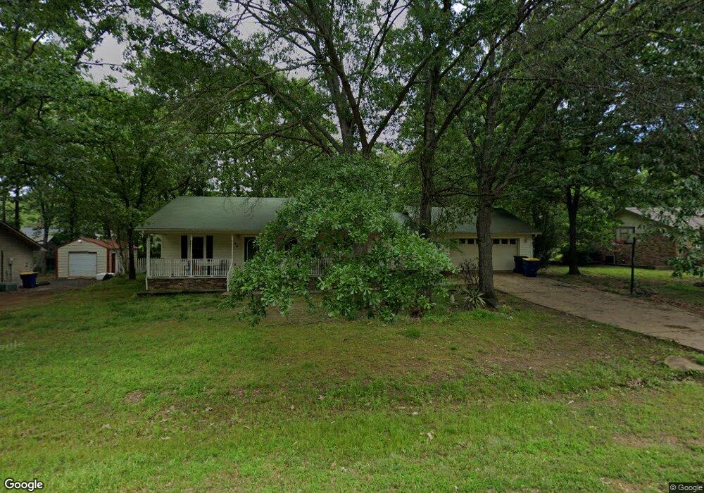
This home is located at 42 Sunset Ln, Cabot, AR 72023 and is currently estimated at $233,604, approximately $135 per square foot. 42 Sunset Ln is a home located in Lonoke County with nearby schools including Northside Elementary School, Cabot Junior High North, and Cabot Middle School North.
Ownership History
Date
Name
Owned For
Owner Type
Purchase Details
Closed on
Jun 6, 2018
Sold by
Stort John
Bought by
Mcvay Amy
Current Estimated Value
Home Financials for this Owner
Home Financials are based on the most recent Mortgage that was taken out on this home.
Original Mortgage
$130,099
Outstanding Balance
$110,645
Interest Rate
4.5%
Mortgage Type
FHA
Estimated Equity
$122,959
Purchase Details
Closed on
Oct 18, 1999
Purchase Details
Closed on
Aug 3, 1998
Bought by
Parrent
Purchase Details
Closed on
Dec 1, 1995
Bought by
Hollman and Wife Lucy
Purchase Details
Closed on
Jun 25, 1993
Bought by
Freeman
Purchase Details
Closed on
Feb 25, 1992
Bought by
Duell
Purchase Details
Closed on
Sep 25, 1991
Bought by
Taylor
Purchase Details
Closed on
May 28, 1991
Bought by
Sunland
Create a Home Valuation Report for This Property
The Home Valuation Report is an in-depth analysis detailing your home's value as well as a comparison with similar homes in the area
Purchase History
| Date | Buyer | Sale Price | Title Company |
|---|---|---|---|
| Mcvay Amy | $132,500 | Realty Title & Escrow | |
| -- | -- | -- | |
| Parrent | $105,000 | -- | |
| Parrent | $105,000 | -- | |
| Hollman | $98,000 | -- | |
| Freeman | $88,000 | -- | |
| Duell | $77,000 | -- | |
| Taylor | $5,900 | -- | |
| Sunland | -- | -- |
Source: Public Records
Mortgage History
| Date | Status | Borrower | Loan Amount |
|---|---|---|---|
| Open | Mcvay Amy | $130,099 |
Source: Public Records
Tax History
| Year | Tax Paid | Tax Assessment Tax Assessment Total Assessment is a certain percentage of the fair market value that is determined by local assessors to be the total taxable value of land and additions on the property. | Land | Improvement |
|---|---|---|---|---|
| 2025 | $1,388 | $27,260 | $3,800 | $23,460 |
| 2024 | $1,388 | $27,260 | $3,800 | $23,460 |
| 2023 | $1,388 | $27,260 | $3,800 | $23,460 |
| 2022 | $1,388 | $27,260 | $3,800 | $23,460 |
| 2021 | $1,388 | $27,260 | $3,800 | $23,460 |
| 2020 | $1,383 | $27,170 | $3,800 | $23,370 |
| 2019 | $1,383 | $27,170 | $3,800 | $23,370 |
| 2018 | $1,342 | $27,170 | $3,800 | $23,370 |
| 2017 | $1,247 | $27,170 | $3,800 | $23,370 |
| 2016 | $992 | $27,170 | $3,800 | $23,370 |
| 2015 | $1,248 | $27,180 | $3,800 | $23,380 |
| 2014 | $993 | $27,180 | $3,800 | $23,380 |
Source: Public Records
Map
Nearby Homes
- 34 Ridge Rd
- 24 Sunset Ln
- 3A W Main St
- 0 Tract F Hwy 89
- 0 Tract G Hwy 89
- 0 Tract E Hwy 89
- 0 Tract C Hwy 89
- 35 N Sunland Dr
- 0 N Rockwood Rd Unit W. Main Street
- 00 Sun Vista Ln
- 504 Sweet Gum Ct
- 519 Crepe Myrtle Loop
- 222 N Summit Dr
- 509 Crepe Myrtle Loop
- 218 N Summit Dr
- 21 Blanchard Dr
- 55 Mount Tabor W
- 15 Blanchard Dr
- 3060 W Main St Unit Hwy 89
- 3060 W Main St Unit Hwy 89
Your Personal Tour Guide
Ask me questions while you tour the home.