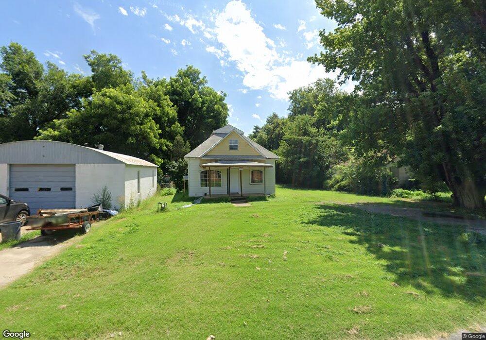
420 N Forrest St Apache, OK 73006
Estimated Value: $32,312 - $61,000
2
Beds
1
Bath
768
Sq Ft
$63/Sq Ft
Est. Value
About This Home
This home is located at 420 N Forrest St, Apache, OK 73006 and is currently estimated at $48,437, approximately $63 per square foot. 420 N Forrest St is a home with nearby schools including Apache Elementary School, Apache Middle School, and Apache High School.
Ownership History
Date
Name
Owned For
Owner Type
Purchase Details
Closed on
Jan 24, 2022
Sold by
Le Pickard Terry Alan
Bought by
Heminokeky Donahue Conan and Heminokeky Jennifer M
Current Estimated Value
Purchase Details
Closed on
Jul 10, 2018
Sold by
Nealis Leah
Bought by
Pickard Terry Allen
Purchase Details
Closed on
Feb 10, 2015
Bought by
Nealis Leah
Purchase Details
Closed on
Jan 2, 2015
Purchase Details
Closed on
Jun 1, 1988
Create a Home Valuation Report for This Property
The Home Valuation Report is an in-depth analysis detailing your home's value as well as a comparison with similar homes in the area
Purchase History
We collect this data history from publicly available records. To have your information removed, we recommend requesting removal directly through your county’s website.
| Date | Buyer | Sale Price | Title Company |
|---|---|---|---|
| Heminokeky Donahue Conan | $20,000 | None Listed On Document | |
| Pickard Terry Allen | $20,000 | None Available | |
| Nealis Leah | -- | -- | |
| -- | $15,000 | -- | |
| -- | $12,500 | -- |
Source: Public Records
Tax History
| Year | Tax Paid | Tax Assessment Tax Assessment Total Assessment is a certain percentage of the fair market value that is determined by local assessors to be the total taxable value of land and additions on the property. | Land | Improvement |
|---|---|---|---|---|
| 2025 | $230 | $2,426 | $337 | $2,089 |
| 2024 | $230 | $2,310 | $321 | $1,989 |
| 2023 | $225 | $2,200 | $305 | $1,895 |
| 2022 | $193 | $2,109 | $644 | $1,465 |
| 2021 | $232 | $2,009 | $644 | $1,365 |
| 2020 | $192 | $1,913 | $644 | $1,269 |
| 2019 | $225 | $2,201 | $644 | $1,557 |
| 2018 | $201 | $1,820 | $644 | $1,176 |
| 2017 | $181 | $1,733 | $644 | $1,089 |
| 2016 | $176 | $1,650 | $644 | $1,006 |
| 2015 | $4 | $2,048 | $644 | $1,404 |
| 2014 | $5 | $2,055 | $644 | $1,411 |
Source: Public Records
Map
Nearby Homes
- TBD U S Highway 62
- 223 Oak St
- 401 S Coblake St
- TBD NE King Rd
- 1100 NE King Rd
- 175 Whippoorwill St
- 207 N Hillside Rd
- 124 Ellsworth Dr
- 116 N Lakeside Dr
- 115 N Brookdale
- TBD Hilltop Rd
- 133 S Hillside Rd
- 13145 NE Clearwater Cir
- 40001 U S 281
- 21168 County Road 1480
- 14320 NE 75th St
- 344 NE Wichita Meadows Ln
- 108 London Dr
- 5812 NE Cornwallis Dr
- 5854 NE Cornwallis Dr
- 417 E Lorrist Ave
- 413 E Lorrist Ave
- 408 N Forrest St
- 410 N Forrest St
- 407 E Lorrist Ave
- 418 E Lorrist St
- 416 N Forrest St
- 405 E Lorrist St
- 406 E Lorrist Ave
- 422 E Lorrist Ave
- 40156 Statehighway 281
- 7060 Rr 1
- 5565 Rr 1
- 804 Linda Place
- 512 E Lorrist St
- 315 E Lorrist Ave
- 416 E Apache Trail Rd
- 409 E Anderson St
- 413 E Anderson St
- 421 E Anderson St
Your Personal Tour Guide
Ask me questions while you tour the home.