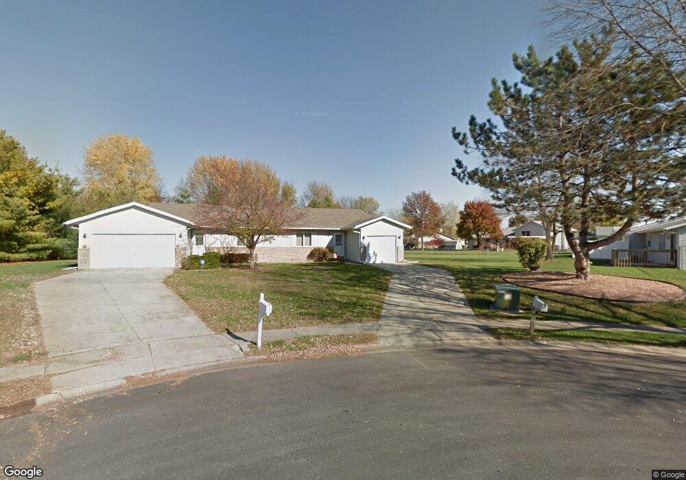
4202 Pickfair Rd Unit 2 Springfield, IL 62703
Franklin Park NeighborhoodEstimated Value: $144,000 - $160,556
2
Beds
2
Baths
1,200
Sq Ft
$130/Sq Ft
Est. Value
About This Home
This home is located at 4202 Pickfair Rd Unit 2, Springfield, IL 62703 and is currently estimated at $155,639, approximately $129 per square foot. 4202 Pickfair Rd Unit 2 is a home located in Sangamon County with nearby schools including Hazel Dell Elementary School, Jefferson Middle School, and Springfield Southeast High School.
Ownership History
Date
Name
Owned For
Owner Type
Purchase Details
Closed on
Sep 27, 2023
Sold by
Mabie Thomas J
Bought by
Kong Lian and Cheng Li
Current Estimated Value
Purchase Details
Closed on
Sep 26, 2023
Sold by
Mabie Thomas J
Bought by
Kong Lian and Cheng Li
Purchase Details
Closed on
Jul 15, 2003
Purchase Details
Closed on
Jun 28, 2000
Purchase Details
Closed on
Dec 22, 1995
Create a Home Valuation Report for This Property
The Home Valuation Report is an in-depth analysis detailing your home's value as well as a comparison with similar homes in the area
Home Values in the Area
Average Home Value in this Area
Purchase History
| Date | Buyer | Sale Price | Title Company |
|---|---|---|---|
| Kong Lian | $137,000 | None Listed On Document | |
| Kong Lian | $137,000 | None Listed On Document | |
| -- | $85,500 | -- | |
| -- | -- | -- | |
| -- | $75,000 | -- |
Source: Public Records
Tax History
| Year | Tax Paid | Tax Assessment Tax Assessment Total Assessment is a certain percentage of the fair market value that is determined by local assessors to be the total taxable value of land and additions on the property. | Land | Improvement |
|---|---|---|---|---|
| 2024 | $3,482 | $41,452 | $6,760 | $34,692 |
| 2023 | $2,454 | $33,751 | $6,176 | $27,575 |
| 2022 | $2,331 | $32,015 | $5,858 | $26,157 |
| 2021 | $2,234 | $30,817 | $5,639 | $25,178 |
| 2020 | $2,190 | $30,863 | $5,647 | $25,216 |
| 2019 | $2,148 | $30,755 | $5,627 | $25,128 |
| 2018 | $1,838 | $27,748 | $5,600 | $22,148 |
| 2017 | $1,793 | $27,390 | $5,528 | $21,862 |
| 2016 | $2,064 | $35,755 | $5,447 | $30,308 |
| 2015 | $2,034 | $35,328 | $5,382 | $29,946 |
| 2014 | $1,433 | $35,100 | $5,347 | $29,753 |
| 2013 | $1,401 | $33,641 | $5,347 | $28,294 |
Source: Public Records
Map
Nearby Homes
- 2208 Trowbridge Rd
- 0 Varsity Ct
- 2100 E Hood St Unit 1
- 3518 Sheffield Rd Unit 1
- 33 Sarah Ave
- 3300 Stanton St Unit 1
- 3301 Stanton St Unit 1
- 128 Volare Ln
- 3305 Saint Francis Dr
- 1527 Chalmers St Unit 1
- 180 E Hazel Dell Unit 1
- 3100 Butler St Unit 1833
- 130 Genoa Dr
- 3420 S 4th St Unit 1
- 5306 S 2nd St
- 3001 Hoover Ave
- 2941 Hoover Ave
- 3236 S 5th St Unit 1
- 3357 S 3rd St Unit 1
- 2942 S 11th St
- 4203 Pickfair Rd
- 4201 Pickfair Rd
- 1807 Wren Dr
- 4200 Pickfair Rd
- 1801 Wren Dr
- 1800 Reading Rd
- 1804 Reading Rd
- 4159 Pickfair Rd
- 4161 Pickfair Rd
- 4205 Pickfair Rd
- 1805 Wren Dr
- 4207 Pickfair Rd
- 4209 Pickfair Rd
- 1808 Reading Rd
- 4211 Pickfair Rd
- 4301 Pickfair Rd
- 4213 Deming Dr
- 1802 Wren Dr Unit 2
- 4319 Pickfair Rd Unit 2
- 4313 Pickfair Rd
Your Personal Tour Guide
Ask me questions while you tour the home.