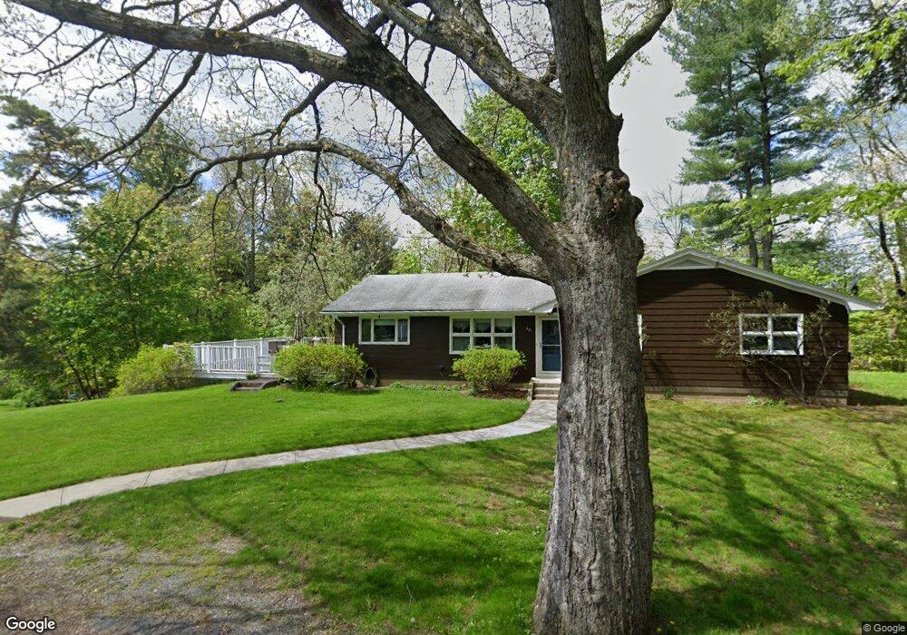
421 Smith Rd Thomaston, CT 06787
Thomaston AreaEstimated Value: $373,000 - $394,673
About This Home
This home is located at 421 Smith Rd, Thomaston, CT 06787 and is currently estimated at $384,418, approximately $255 per square foot. 421 Smith Rd is a home located in Litchfield County with nearby schools including Black Rock School, Thomaston Center School, and Thomaston High School.
Ownership History
We collect this data history from publicly available records. To have your information removed, we recommend requesting removal directly through your county’s website.
Purchase Details
Purchase Details
Home Values in the Area
Average Home Value in this Area
Purchase History
We collect this data history from publicly available records. To have your information removed, we recommend requesting removal directly through your county’s website.
| Date | Buyer | Sale Price | Title Company |
|---|---|---|---|
| $200,000 | -- | ||
| $60,000 | -- |
Tax History
We collect this data history from publicly available records. To have your information removed, we recommend requesting removal directly through your county’s website.
| Year | Tax Paid | Tax Assessment Tax Assessment Total Assessment is a certain percentage of the fair market value that is determined by local assessors to be the total taxable value of land and additions on the property. | Land | Improvement |
|---|---|---|---|---|
| 2025 | $5,643 | $157,570 | $70,980 | $86,590 |
| 2024 | $5,414 | $157,570 | $70,980 | $86,590 |
| 2023 | $5,299 | $157,570 | $70,980 | $86,590 |
| 2022 | $5,060 | $157,570 | $70,980 | $86,590 |
| 2021 | $5,324 | $147,350 | $64,540 | $82,810 |
| 2020 | $5,324 | $147,350 | $64,540 | $82,810 |
| 2019 | $5,383 | $147,350 | $64,540 | $82,810 |
| 2018 | $5,274 | $147,350 | $64,540 | $82,810 |
| 2017 | $5,165 | $147,350 | $64,540 | $82,810 |
| 2016 | $5,151 | $151,200 | $65,170 | $86,030 |
| 2015 | $5,085 | $151,200 | $65,170 | $86,030 |
| 2014 | $5,085 | $151,200 | $65,170 | $86,030 |
Map
- 126 Martha Way
- 23 Hilltop Ave
- 341 High Street Extension
- 438 Hill Rd
- 88 Tracy St
- 33 Randolph Ave
- 57 Hickory Hill Rd
- 142 Clay St
- 261 Litchfield St
- 400 Northfield Rd
- 188 Litchfield St
- 156 Litchfield St
- 604 Wildcat Hill Rd
- 162 Bristol St
- 96 Elm St
- 53 Broadview Heights
- 0 North St
- 78 North St
- 75 Lynnrich Dr
- 92 Schroback Rd
- 411 Smith Rd
- 475 Smith Rd
- 477 Smith Rd
- 1 Old Smith Rd
- 405 Smith Rd
- 430 Smith Rd
- 420 Smith Rd
- 440 Smith Rd
- 503 Smith Rd
- 389 Smith Rd
- 406 Smith Rd
- 513 Smith Rd
- 375 Smith Rd
- 398 Smith Rd
- 525 Smith Rd
- 376 Smith Rd
- 46 Old Smith Rd
- 890 High Street Extension
- 878 High Street Extension
- 904 High Street Extension
Ask me questions while you tour the home.