Estimated Value: $422,851 - $499,000
2
Beds
2
Baths
1,422
Sq Ft
$316/Sq Ft
Est. Value
About This Home
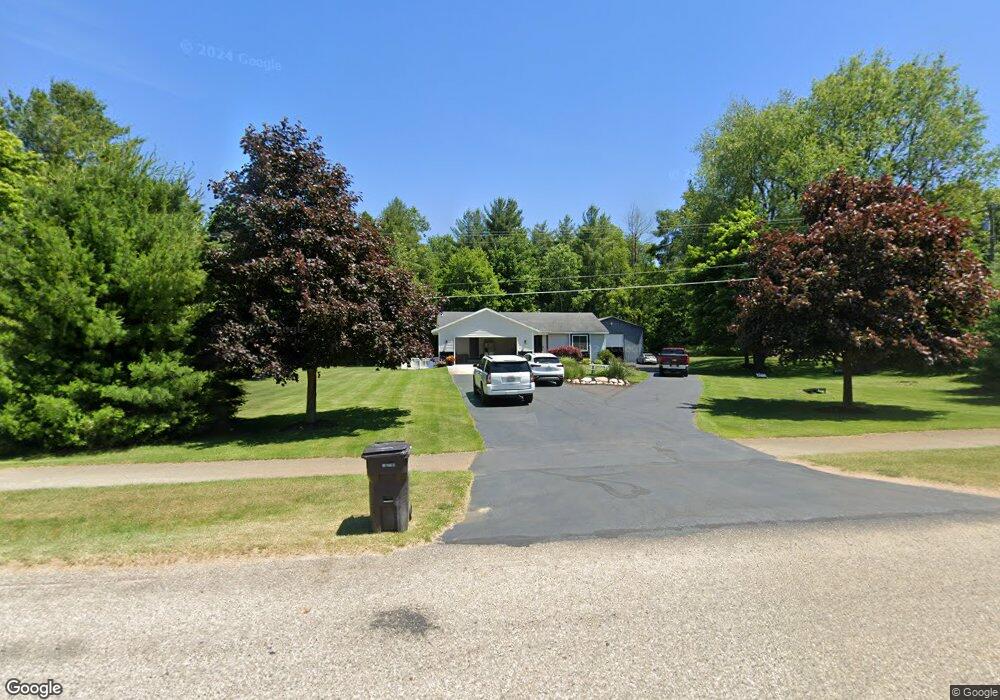
This home is located at 4229 20th St, Dorr, MI 49323 and is currently estimated at $449,963, approximately $316 per square foot. 4229 20th St is a home located in Allegan County with nearby schools including Wayland High School, St Marys Catholic Schools, and St. Stanislaus School.
Ownership History
Date
Name
Owned For
Owner Type
Purchase Details
Closed on
Dec 8, 2017
Sold by
Mergy Mark and Mergy Kathryn
Bought by
Calkins Keith and Calkins Kelli
Current Estimated Value
Home Financials for this Owner
Home Financials are based on the most recent Mortgage that was taken out on this home.
Original Mortgage
$220,000
Outstanding Balance
$183,474
Interest Rate
3.94%
Mortgage Type
New Conventional
Estimated Equity
$266,489
Purchase Details
Closed on
Oct 16, 2013
Sold by
Sevigny Steven E and Sevigny Holli
Bought by
Emery Mark and Emery Kathryn
Home Financials for this Owner
Home Financials are based on the most recent Mortgage that was taken out on this home.
Original Mortgage
$188,000
Interest Rate
4.59%
Mortgage Type
New Conventional
Purchase Details
Closed on
May 23, 2000
Sold by
Smith Donald W and Smith Terry R
Bought by
Sevigny Steven E
Purchase Details
Closed on
May 20, 2000
Sold by
Smith Donald W and Smith Terry R
Bought by
Sevingy Steve E
Create a Home Valuation Report for This Property
The Home Valuation Report is an in-depth analysis detailing your home's value as well as a comparison with similar homes in the area
Home Values in the Area
Average Home Value in this Area
Purchase History
| Date | Buyer | Sale Price | Title Company |
|---|---|---|---|
| Calkins Keith | $269,000 | Star Title Agency Lc | |
| Emery Mark | $235,000 | First American Title Ins Co | |
| Sevigny Steven E | -- | -- | |
| Sevingy Steve E | -- | -- |
Source: Public Records
Mortgage History
| Date | Status | Borrower | Loan Amount |
|---|---|---|---|
| Open | Calkins Keith | $220,000 | |
| Previous Owner | Emery Mark | $188,000 |
Source: Public Records
Tax History
| Year | Tax Paid | Tax Assessment Tax Assessment Total Assessment is a certain percentage of the fair market value that is determined by local assessors to be the total taxable value of land and additions on the property. | Land | Improvement |
|---|---|---|---|---|
| 2025 | $3,751 | $218,300 | $58,500 | $159,800 |
| 2024 | $3,384 | $197,100 | $43,900 | $153,200 |
| 2023 | $3,468 | $180,600 | $42,800 | $137,800 |
| 2022 | $3,384 | $146,500 | $30,000 | $116,500 |
| 2021 | $3,190 | $135,900 | $24,200 | $111,700 |
| 2020 | $3,044 | $124,800 | $23,000 | $101,800 |
| 2019 | $3,044 | $112,900 | $17,000 | $95,900 |
| 2018 | $2,976 | $97,400 | $17,000 | $80,400 |
| 2017 | $0 | $116,300 | $17,000 | $99,300 |
| 2016 | $0 | $95,500 | $18,000 | $77,500 |
| 2015 | -- | $95,500 | $18,000 | $77,500 |
| 2014 | -- | $87,200 | $18,000 | $69,200 |
| 2013 | -- | $81,600 | $16,500 | $65,100 |
Source: Public Records
Map
Nearby Homes
- 4221 Century Dr
- Lots A&B 142nd Ave
- 1341 142nd Ave
- 4162 Radstock Dr
- Lot A 142nd Ave
- Lot B 142nd Ave
- 4230 Fenwick Dr
- 10780 Windward Ave SW
- 10785 Windward Ave SW
- 10725 Windward Ave SW
- 10711 Windward Ave SW
- Lot 11 Walnut Dale Dr
- 2259 136th Ave
- 312 Ottogan Hills Ct
- 4365 Chappel St
- 1232 Rosewood Ave
- 136 100th St SW
- 737 100th St SW
- 1164 144th Ave
- 2729 138th Ave
- 4235 20th St
- 4223 20th St
- 4226 20th St
- 1981 Jansen Woods Ct Unit 10
- 4245 20th St
- 4248 Redwood Ln
- 4250 Redwood Ln
- 1979 Jansen Woods Ct Unit 11
- 1986 Jansen Woods Ct Unit 20
- 4252 Redwood Ln
- 1984 Red Pine Dr
- 1982 Jansen Woods Ct Unit 18
- 1973 Jansen Woods Ct
- 1973 Jansen Woods Ct Unit 12
- 1978 Jansen Woods Ct Unit 17
- 4254 Redwood Ln
- 1982 Red Pine Dr
- 1983 Red Pine Dr
- 4255 20th St
- 1974 Jansen Woods Ct Unit 16
Your Personal Tour Guide
Ask me questions while you tour the home.