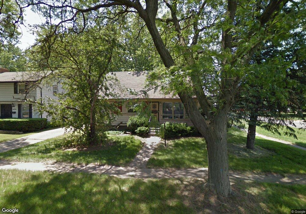
4235 Comstock Ave Flint, MI 48504
Merill NeighborhoodEstimated Value: $44,000 - $77,000
4
Beds
2
Baths
1,570
Sq Ft
$41/Sq Ft
Est. Value
About This Home
This home is located at 4235 Comstock Ave, Flint, MI 48504 and is currently estimated at $65,059, approximately $41 per square foot. 4235 Comstock Ave is a home located in Genesee County with nearby schools including Brownell STEM Academy, Eagle's Nest Academy, and Greater Heights Academy.
Ownership History
Date
Name
Owned For
Owner Type
Purchase Details
Closed on
Aug 7, 2018
Sold by
Gennesee County Land Bank Authority
Bought by
Adams Leo
Current Estimated Value
Purchase Details
Closed on
Oct 24, 2011
Sold by
Secretary Of Housing & Urban Development
Bought by
Adams Leo
Purchase Details
Closed on
Apr 16, 2010
Sold by
Fidelity Bank
Bought by
The Secretary Of Housing & Urban Develop
Purchase Details
Closed on
Oct 14, 2009
Sold by
Patrick James E
Bought by
Fidelity Bank
Purchase Details
Closed on
Apr 23, 1999
Sold by
Estate Of Gale J Kendrick
Bought by
Patrick James E
Create a Home Valuation Report for This Property
The Home Valuation Report is an in-depth analysis detailing your home's value as well as a comparison with similar homes in the area
Home Values in the Area
Average Home Value in this Area
Purchase History
| Date | Buyer | Sale Price | Title Company |
|---|---|---|---|
| Adams Leo | -- | None Available | |
| Adams Leo | -- | None Available | |
| The Secretary Of Housing & Urban Develop | -- | None Available | |
| Fidelity Bank | $80,048 | None Available | |
| Patrick James E | $62,300 | Sargents Title Company Llc |
Source: Public Records
Tax History
| Year | Tax Paid | Tax Assessment Tax Assessment Total Assessment is a certain percentage of the fair market value that is determined by local assessors to be the total taxable value of land and additions on the property. | Land | Improvement |
|---|---|---|---|---|
| 2025 | $1,233 | $23,900 | $0 | $0 |
| 2024 | $1,140 | $21,400 | $0 | $0 |
| 2023 | $1,113 | $16,300 | $0 | $0 |
| 2022 | $1,157 | $12,500 | $0 | $0 |
| 2021 | $1,129 | $11,900 | $0 | $0 |
| 2020 | $1,129 | $13,200 | $0 | $0 |
| 2019 | $0 | $12,900 | $0 | $0 |
Source: Public Records
Map
Nearby Homes
- 4110 Leerda St
- 4008 Winona St
- 2210 Canniff St
- 4539 Trumbull Dr
- 3808 Comstock Ave
- 1909 Cherrylawn Dr
- 4013 Sterling St
- 3617 Kellar Ave
- 3517 Leerda St
- 3506 Brownell Blvd
- 3505 Leerda St
- 1710 Shamrock Ln
- 3722 Sterling St
- 5106 Cloverlawn Dr
- 3143 Maywood Dr
- 3413 Leerda St
- 3095 Maywood Dr
- 3218 Trumbull Ave
- 4816 Glenn Ave
- 5413 Fleming Rd
- 4236 Brownell Blvd
- 4230 Brownell Blvd
- 4226 Brownell Blvd
- 4229 Comstock Ave
- 1918 W Stewart Ave
- 4222 Brownell Blvd
- 1922 W Stewart Ave
- 1914 W Stewart Ave
- 4217 Comstock Ave
- 1926 W Stewart Ave
- 1910 W Stewart Ave
- 4223 Comstock Ave
- 1930 W Stewart Ave
- 1906 W Stewart Ave
- 4211 Comstock Ave
- 2002 W Stewart Ave
- 4233 Brownell Blvd
- 4236 Comstock Ave
- 4229 Brownell Blvd
- 4301 Warrington Dr
Your Personal Tour Guide
Ask me questions while you tour the home.