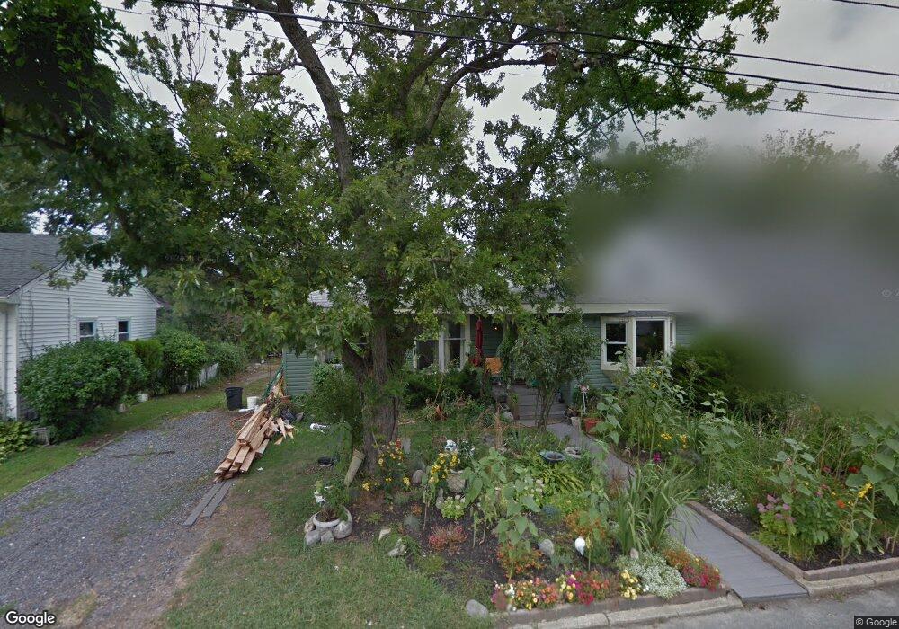
425 E Long Branch Ave Ocean Gate, NJ 08740
Estimated Value: $429,615 - $479,000
3
Beds
1
Bath
1,218
Sq Ft
$374/Sq Ft
Est. Value
About This Home
This home is located at 425 E Long Branch Ave, Ocean Gate, NJ 08740 and is currently estimated at $455,904, approximately $374 per square foot. 425 E Long Branch Ave is a home located in Ocean County with nearby schools including Ocean Gate Elementary School, Central Regional Middle School, and Central Regional High School.
Ownership History
Date
Name
Owned For
Owner Type
Purchase Details
Closed on
Jun 9, 2006
Sold by
Tibbs Sean L and Tibbs Margaret Marie
Bought by
Brown Peter
Current Estimated Value
Home Financials for this Owner
Home Financials are based on the most recent Mortgage that was taken out on this home.
Original Mortgage
$125,000
Interest Rate
6.67%
Mortgage Type
Purchase Money Mortgage
Purchase Details
Closed on
Aug 29, 2001
Sold by
Nice William
Bought by
Tibbs Sean
Home Financials for this Owner
Home Financials are based on the most recent Mortgage that was taken out on this home.
Original Mortgage
$100,000
Interest Rate
6.98%
Purchase Details
Closed on
Jan 30, 2001
Sold by
Federal National Mortgage Association
Bought by
Nice William
Create a Home Valuation Report for This Property
The Home Valuation Report is an in-depth analysis detailing your home's value as well as a comparison with similar homes in the area
Home Values in the Area
Average Home Value in this Area
Purchase History
We collect this data history from publicly available records. To have your information removed, we recommend requesting removal directly through your county’s website.
| Date | Buyer | Sale Price | Title Company |
|---|---|---|---|
| Brown Peter | -- | None Available | |
| Tibbs Sean | $125,000 | -- | |
| Nice William | $64,000 | -- | |
| Nice William | $64,000 | -- |
Source: Public Records
Mortgage History
We collect this data history from publicly available records. To have your information removed, we recommend requesting removal directly through your county’s website.
| Date | Status | Borrower | Loan Amount |
|---|---|---|---|
| Previous Owner | Brown Peter | $125,000 | |
| Previous Owner | Tibbs Sean | $100,000 |
Source: Public Records
Tax History
| Year | Tax Paid | Tax Assessment Tax Assessment Total Assessment is a certain percentage of the fair market value that is determined by local assessors to be the total taxable value of land and additions on the property. | Land | Improvement |
|---|---|---|---|---|
| 2025 | $6,392 | $351,000 | $180,000 | $171,000 |
| 2024 | $4,969 | $351,000 | $180,000 | $171,000 |
| 2023 | $4,578 | $164,600 | $70,000 | $94,600 |
| 2022 | $4,578 | $164,600 | $70,000 | $94,600 |
| 2021 | $4,382 | $164,600 | $70,000 | $94,600 |
| 2020 | $4,416 | $164,600 | $70,000 | $94,600 |
| 2019 | $4,309 | $164,600 | $70,000 | $94,600 |
| 2018 | $4,159 | $164,600 | $70,000 | $94,600 |
| 2017 | $4,128 | $164,600 | $70,000 | $94,600 |
| 2016 | $4,095 | $164,600 | $70,000 | $94,600 |
| 2015 | $4,200 | $206,100 | $115,000 | $91,100 |
| 2014 | $4,219 | $206,100 | $115,000 | $91,100 |
Source: Public Records
Map
Nearby Homes
- 521 E Long Branch Ave
- 319 Monmouth Ave
- 521 E Point Pleasant Ave
- 334 E Bayview Ave
- 334 E Cape May Ave
- 710 Newport Ave
- 318 E Cape May Ave
- 540 E Cape May Ave
- 409 Newport Ave
- 601 E Arverne Ave
- 723 E Long Branch Ave
- 129 E Long Branch Ave
- 37 E Lakewood Ave
- 32 E Long Branch Ave
- 207 Ocean Gate Ave
- 11 W Arverne Ave
- 15 W Arverne Ave
- 46 W Cape May Ave
- 707 Navesink Ave
- 553 Ocean Gate Dr
- 429 E Long Branch Ave
- 431 E Long Branch Ave
- 430 E Lakewood Ave
- 419 E Long Branch Ave
- 434 E Lakewood Ave
- 426 E Lakewood Ave
- 443 E Long Branch Ave
- 438 E Lakewood Ave
- 438 E Lakewood Ave Unit 1
- 420 E Lakewood Ave
- 418 E Long Branch Ave
- 415 E Long Branch Ave
- 440 E Long Branch Ave
- 414 E Lakewood Ave
- 414 E Long Branch Ave
- 448 E Lakewood Ave
- 442 E Long Branch Ave
- 518 Anglesea Ave
- 412 E Long Branch Ave
- 446 E Long Branch Ave
Your Personal Tour Guide
Ask me questions while you tour the home.