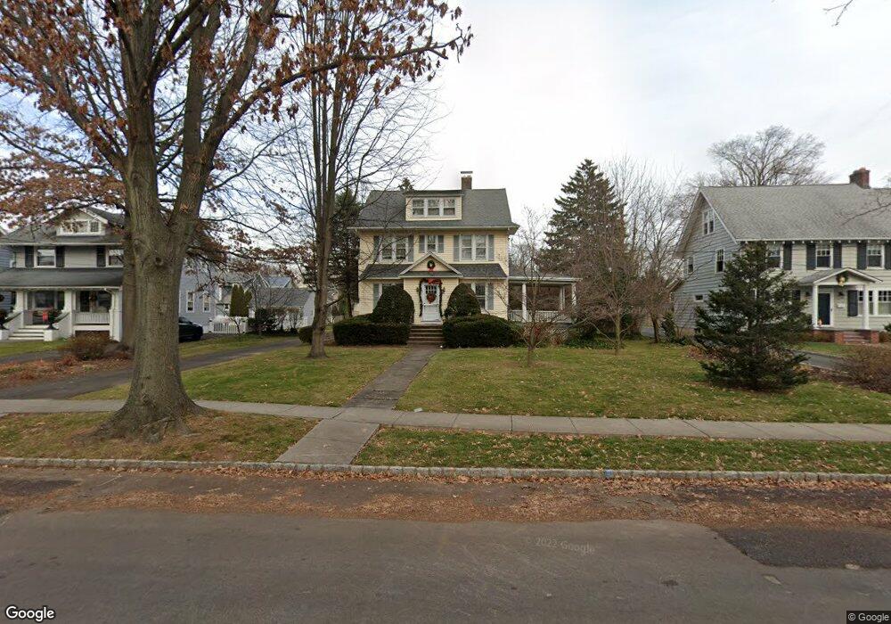
426 N Chestnut St Westfield, NJ 07090
Estimated Value: $1,154,773 - $1,414,000
Studio
--
Bath
2,352
Sq Ft
$550/Sq Ft
Est. Value
About This Home
This home is located at 426 N Chestnut St, Westfield, NJ 07090 and is currently estimated at $1,294,693, approximately $550 per square foot. 426 N Chestnut St is a home located in Union County with nearby schools including Wilson Elementary School, Roosevelt Intermediate School, and Westfield Senior High School.
Ownership History
Date
Name
Owned For
Owner Type
Purchase Details
Closed on
Jul 2, 1999
Sold by
Allen Marjorie B and Allen Marjorie Susan
Bought by
Schaaf Eric and Schaaf Susan
Current Estimated Value
Home Financials for this Owner
Home Financials are based on the most recent Mortgage that was taken out on this home.
Original Mortgage
$70,000
Outstanding Balance
$18,502
Interest Rate
6.62%
Mortgage Type
Unknown
Estimated Equity
$1,276,191
Create a Home Valuation Report for This Property
The Home Valuation Report is an in-depth analysis detailing your home's value as well as a comparison with similar homes in the area
Home Values in the Area
Average Home Value in this Area
Purchase History
| Date | Buyer | Sale Price | Title Company |
|---|---|---|---|
| Schaaf Eric | $395,000 | -- |
Source: Public Records
Mortgage History
| Date | Status | Borrower | Loan Amount |
|---|---|---|---|
| Open | Schaaf Eric | $70,000 | |
| Previous Owner | Schaaf Eric | $240,000 |
Source: Public Records
Tax History
| Year | Tax Paid | Tax Assessment Tax Assessment Total Assessment is a certain percentage of the fair market value that is determined by local assessors to be the total taxable value of land and additions on the property. | Land | Improvement |
|---|---|---|---|---|
| 2025 | $16,417 | $729,000 | $484,800 | $244,200 |
| 2024 | $16,082 | $729,000 | $484,800 | $244,200 |
| 2023 | $16,082 | $729,000 | $484,800 | $244,200 |
| 2022 | $15,746 | $729,000 | $484,800 | $244,200 |
| 2021 | $15,768 | $729,000 | $484,800 | $244,200 |
| 2020 | $15,732 | $729,000 | $484,800 | $244,200 |
| 2019 | $15,674 | $729,000 | $484,800 | $244,200 |
| 2018 | $14,234 | $153,100 | $97,300 | $55,800 |
| 2017 | $14,156 | $153,100 | $97,300 | $55,800 |
| 2016 | $13,823 | $153,100 | $97,300 | $55,800 |
| 2015 | $13,548 | $153,100 | $97,300 | $55,800 |
| 2014 | $13,101 | $153,100 | $97,300 | $55,800 |
Source: Public Records
Map
Nearby Homes
- 645 Kimball Ave
- 621 Kimball Ave
- 706 Mountain Ave
- 208 Jefferson Ave
- 582 Sherwood Pkwy
- 808 Grant Ave
- 611 Bradford Ave
- 418 Colonial Ave
- 910 Highland Ave
- 634 Lenox Ave
- 820 E Broad St
- 9 Settlers Ln
- 629 Tremont Ave
- 735 Castleman Dr
- 424 Saint Marks Ave
- 260 Prospect St Unit C12
- 312 Wells St
- 400 Salter Place
- 4 Cowperthwaite Square
- 170 New Providence Rd
- 432 N Chestnut St
- 420 N Chestnut St
- 438 N Chestnut St
- 712 Oak Ave
- 416 N Chestnut St
- 429 Baker Ave
- 425 Baker Ave
- 421 Baker Ave
- 716 Oak Ave
- 412 N Chestnut St
- 651 Raymond St
- 417 Baker Ave
- 720 Oak Ave
- 410 N Chestnut St
- 413 Baker Ave
- 654 Raymond St
- 645 Raymond St
- 515 N Chestnut St
- 409 Baker Ave
- 650 Raymond St
Your Personal Tour Guide
Ask me questions while you tour the home.