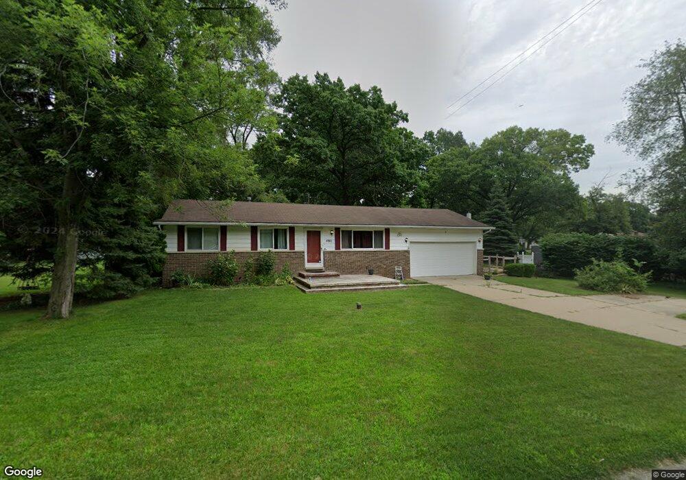
4265 Bunker Ave West Bloomfield, MI 48323
West Bloomfield Township NeighborhoodEstimated Value: $279,000 - $311,000
About This Home
This home is located at 4265 Bunker Ave, West Bloomfield, MI 48323 and is currently estimated at $293,993, approximately $302 per square foot. 4265 Bunker Ave is a home located in Oakland County with nearby schools including Walled Lake Central High School, Our Lady Of Refuge School, and St. Matthew Lutheran School.
Ownership History
We collect this data history from publicly available records. To have your information removed, we recommend requesting removal directly through your county’s website.
Purchase Details
Home Financials for this Owner
Home Financials are based on the most recent Mortgage that was taken out on this home.Purchase Details
Purchase Details
Home Financials for this Owner
Home Financials are based on the most recent Mortgage that was taken out on this home.Home Values in the Area
Average Home Value in this Area
Purchase History
We collect this data history from publicly available records. To have your information removed, we recommend requesting removal directly through your county’s website.
| Date | Buyer | Sale Price | Title Company |
|---|---|---|---|
| $182,000 | Devon Title Agency | ||
| $164,000 | -- | ||
| $134,000 | -- |
Mortgage History
We collect this data history from publicly available records. To have your information removed, we recommend requesting removal directly through your county’s website.
| Date | Status | Borrower | Loan Amount |
|---|---|---|---|
| Open | $27,300 | ||
| Open | $145,600 | ||
| Previous Owner | $107,200 |
Tax History
We collect this data history from publicly available records. To have your information removed, we recommend requesting removal directly through your county’s website.
| Year | Tax Paid | Tax Assessment Tax Assessment Total Assessment is a certain percentage of the fair market value that is determined by local assessors to be the total taxable value of land and additions on the property. | Land | Improvement |
|---|---|---|---|---|
| 2025 | $1,745 | $131,690 | $38,880 | $92,810 |
| 2024 | $1,735 | $124,370 | $0 | $0 |
| 2022 | $1,357 | $102,330 | $27,050 | $75,280 |
| 2021 | $2,232 | $98,620 | $0 | $0 |
| 2020 | $1,341 | $96,680 | $27,050 | $69,630 |
| 2018 | $2,173 | $85,420 | $22,550 | $62,870 |
| 2015 | -- | $69,760 | $0 | $0 |
| 2014 | -- | $63,920 | $0 | $0 |
| 2011 | -- | $54,980 | $0 | $0 |
Map
- 7085 Colony Dr
- 4383 Green Lake Rd
- 6930 Colony Dr
- 6912 Colony Dr
- 7386 Woodlore Dr
- 4575 Northridge Ct Unit 19
- 6920 Pontiac Trail
- 6790 Edwood Ave
- 3965 Carrick Ave
- 6777 Dandison Blvd
- 4442 Rolling Pine Dr
- 4663 Rosewood Ln
- 7806 Circle Blvd
- 6884 Aeroview St
- 7900 Detroit Blvd
- 7969 Richardson Rd
- 3575 Knollview Ave
- 6551 Duffield St
- 7545 Pontiac Trail
- 6835 High Ridge Rd
- 7175 Richardson Rd
- 4234 Crestdale Ave
- 4254 Crestdale Ave
- 4240 Crestdale Ave Unit Bldg-Unit
- 4240 Crestdale Ave
- 4220 Bunker Ave
- 7165 Richardson Rd
- 7231 Richardson Rd Unit Bldg-Unit
- 7231 Richardson Rd
- 4240 Bunker Ave
- 4260 Bunker Ave
- 4262 Crestdale Ave
- 4223 Forbush Ave
- 7241 Richardson Rd Unit Bldg-Unit
- 7121 Richardson Rd
- 7170 Crestmore St
- 4231 Crestdale Ave
- 4251 Crestdale Ave
- 4263 Forbush Ave
- 7220 Richardson Rd
Ask me questions while you tour the home.