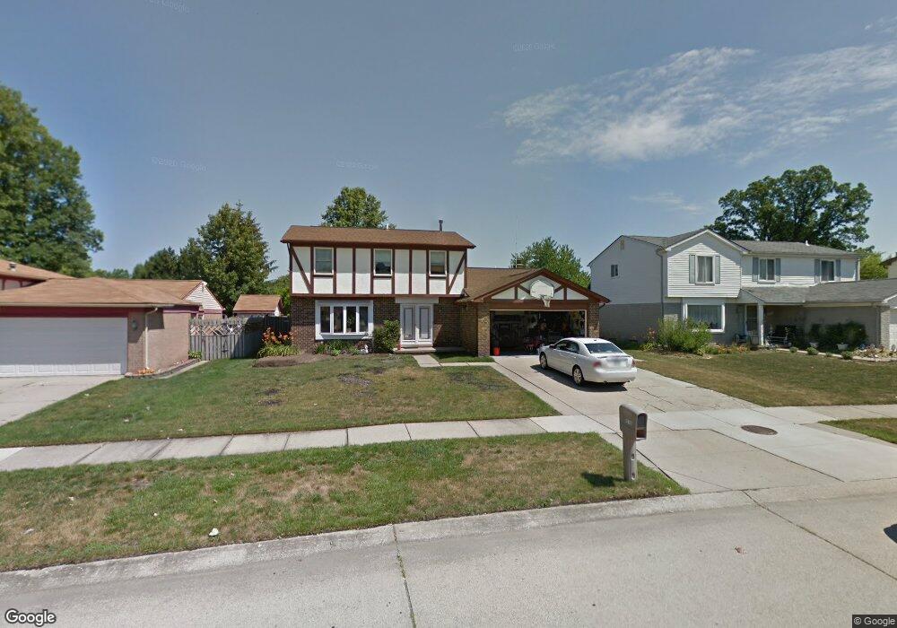
42766 Shadowlawn Dr Canton, MI 48187
Estimated Value: $371,000 - $414,329
3
Beds
4
Baths
1,897
Sq Ft
$204/Sq Ft
Est. Value
About This Home
This home is located at 42766 Shadowlawn Dr, Canton, MI 48187 and is currently estimated at $387,582, approximately $204 per square foot. 42766 Shadowlawn Dr is a home located in Wayne County with nearby schools including Canton High School, Discovery Middle School, and Salem High School.
Ownership History
Date
Name
Owned For
Owner Type
Purchase Details
Closed on
Jan 19, 2024
Sold by
Bragalone David R
Bought by
Bragalone David and Merlino Eugene Louis
Current Estimated Value
Home Financials for this Owner
Home Financials are based on the most recent Mortgage that was taken out on this home.
Original Mortgage
$256,000
Outstanding Balance
$249,946
Interest Rate
6.61%
Mortgage Type
New Conventional
Estimated Equity
$137,636
Purchase Details
Closed on
Oct 26, 2019
Sold by
Bragalone David R
Bought by
Bragalone David R and David R Bragalone Trust
Create a Home Valuation Report for This Property
The Home Valuation Report is an in-depth analysis detailing your home's value as well as a comparison with similar homes in the area
Home Values in the Area
Average Home Value in this Area
Purchase History
We collect this data history from publicly available records. To have your information removed, we recommend requesting removal directly through your county’s website.
| Date | Buyer | Sale Price | Title Company |
|---|---|---|---|
| Bragalone David | $320,000 | Title One | |
| Bragalone David | $320,000 | Title One | |
| Bragalone David R | -- | None Available |
Source: Public Records
Mortgage History
We collect this data history from publicly available records. To have your information removed, we recommend requesting removal directly through your county’s website.
| Date | Status | Borrower | Loan Amount |
|---|---|---|---|
| Open | Bragalone David | $256,000 | |
| Closed | Bragalone David | $256,000 |
Source: Public Records
Tax History
| Year | Tax Paid | Tax Assessment Tax Assessment Total Assessment is a certain percentage of the fair market value that is determined by local assessors to be the total taxable value of land and additions on the property. | Land | Improvement |
|---|---|---|---|---|
| 2025 | $2,929 | $162,600 | $0 | $0 |
| 2024 | $1,767 | $151,300 | $0 | $0 |
| 2023 | $1,685 | $145,300 | $0 | $0 |
| 2022 | $3,722 | $125,300 | $0 | $0 |
| 2021 | $3,612 | $119,800 | $0 | $0 |
| 2020 | $3,565 | $119,600 | $0 | $0 |
| 2019 | $3,503 | $109,960 | $0 | $0 |
| 2018 | $1,432 | $106,750 | $0 | $0 |
| 2017 | $3,599 | $101,300 | $0 | $0 |
| 2016 | $3,187 | $100,800 | $0 | $0 |
| 2015 | $7,868 | $92,930 | $0 | $0 |
| 2013 | $7,623 | $83,800 | $0 | $0 |
| 2010 | -- | $79,940 | $38,776 | $41,164 |
Source: Public Records
Map
Nearby Homes
- 42519 Addison Ave
- 42505 Saltz Rd
- 42195 Fairview Dr
- 43603 Emrick Dr
- 5855 Wedgewood Rd
- 42739 Lilley Pointe Dr Unit 119
- 5866 Willow Creek Dr
- 42764 Lilley Pointe Dr Unit 165
- 41772 Glade Rd Unit 41
- 5903 Beaufort Dr
- 42779 Lilley Pointe Dr Unit 152
- 42789 Lilley Pointe Dr Unit 146
- 1344 Saltz Ct
- 41682 Bedford Dr
- 58560 Stuart Dr
- 42317 Gloria Dr
- 41642 Haggerty Woods Ct Unit 20
- 41626 Bedford Dr Unit 123
- 41617 Bedford Dr
- 1567 Marlowe St
- 42715 Addison Ave
- 42727 Addison Ave
- 42703 Addison Ave
- 1788 Manton Blvd
- 42739 Addison Ave
- 1810 Manton Blvd
- 1766 Manton Blvd
- 42683 Addison Ave
- 1824 Manton Blvd
- 42668 Addison Ave
- 1744 Manton Blvd
- 42671 Addison Ave
- 42753 Addison Ave
- 1842 Manton Blvd
- 42654 Addison Ave
- 42747 Keystone Ln
- 42659 Addison Ave
- 42776 Shadowlawn Dr
- 42754 Shadowlawn Dr
- 42790 Shadowlawn Dr
Your Personal Tour Guide
Ask me questions while you tour the home.