Estimated Value: $189,000 - $229,000
Studio
--
Bath
1,470
Sq Ft
$142/Sq Ft
Est. Value
About This Home
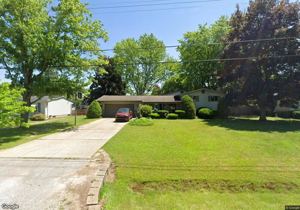
This home is located at 4294 Pheasant Dr, Flint, MI 48506 and is currently estimated at $208,681, approximately $141 per square foot. 4294 Pheasant Dr is a home located in Genesee County with nearby schools including Weston Elementary School, Leota Fiedler Elementary School, and Kate Dowdall Elementary School.
Ownership History
Date
Name
Owned For
Owner Type
Purchase Details
Closed on
Apr 23, 1999
Sold by
Craton Robert I and Craton Margaret L
Bought by
Cunningham John and Cunningham Tina
Current Estimated Value
Home Financials for this Owner
Home Financials are based on the most recent Mortgage that was taken out on this home.
Original Mortgage
$107,350
Outstanding Balance
$27,206
Interest Rate
7.05%
Mortgage Type
FHA
Estimated Equity
$181,475
Create a Home Valuation Report for This Property
The Home Valuation Report is an in-depth analysis detailing your home's value as well as a comparison with similar homes in the area
Home Values in the Area
Average Home Value in this Area
Purchase History
| Date | Buyer | Sale Price | Title Company |
|---|---|---|---|
| Cunningham John | $130,000 | First American Title |
Source: Public Records
Mortgage History
| Date | Status | Borrower | Loan Amount |
|---|---|---|---|
| Open | Cunningham John | $107,350 |
Source: Public Records
Tax History
| Year | Tax Paid | Tax Assessment Tax Assessment Total Assessment is a certain percentage of the fair market value that is determined by local assessors to be the total taxable value of land and additions on the property. | Land | Improvement |
|---|---|---|---|---|
| 2025 | $1,479 | $95,300 | $0 | $0 |
| 2024 | $382 | $88,300 | $0 | $0 |
| 2023 | $365 | $79,500 | $0 | $0 |
| 2022 | $1,221 | $74,200 | $0 | $0 |
| 2021 | $1,211 | $67,400 | $0 | $0 |
| 2020 | $334 | $62,200 | $0 | $0 |
| 2019 | $328 | $56,500 | $0 | $0 |
| 2018 | $1,149 | $49,800 | $0 | $0 |
| 2017 | $1,128 | $48,200 | $0 | $0 |
| 2016 | $1,104 | $46,500 | $0 | $0 |
| 2015 | $907 | $45,100 | $0 | $0 |
| 2014 | $303 | $42,000 | $0 | $0 |
| 2012 | -- | $25,300 | $25,300 | $0 |
Source: Public Records
Map
Nearby Homes
- 7045 Normandy Ct
- 6443 Richfield Rd
- 4126 N Belsay Rd
- 6076 E Carpenter Rd
- 5165 N Irish Rd
- 5177 N Irish Rd
- 5411 Squire Ln
- 1240 N Irish Rd
- 3424 N Irish Rd
- 6490 E Coldwater Rd
- 0 Whisper Ridge Ct
- 7200 E Potter Rd
- 2401 Mcclellan Blvd
- 4044 N Genesee Rd
- 5131 E Carpenter Rd
- 5113 Richfield Rd
- 4489 Home Town Dr Unit 32
- 4465 Market Place
- 6099 Brookwood Dr
- 4459 Market Place
- 4304 Pheasant Dr
- 4286 Pheasant Dr
- 4314 Pheasant Dr
- 4266 Pheasant Dr
- 6479 Nightingale Dr
- 4295 Pheasant Dr
- 4303 Pheasant Dr
- 4285 Pheasant Dr
- 4324 Pheasant Dr
- 0 Pheasant Dr
- 4265 Pheasant Dr
- 4313 Pheasant Dr
- VL Pheasant
- 4259 Pheasant Dr
- 4323 Pheasant Dr
- 4277 N Vassar Rd
- 4295 N Vassar Rd
- 6456 Nightingale Dr
- 6501 Nightingale Dr Unit Bldg-Unit
- 6501 Nightingale Dr
Your Personal Tour Guide
Ask me questions while you tour the home.