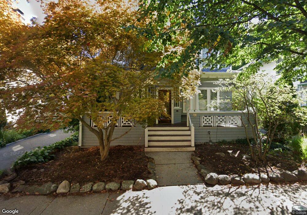
43 Stetson St Brookline, MA 02446
Coolidge Corner NeighborhoodEstimated Value: $2,038,422 - $2,703,000
About This Home
This home is located at 43 Stetson St, Brookline, MA 02446 and is currently estimated at $2,278,856, approximately $1,150 per square foot. 43 Stetson St is a home located in Norfolk County with nearby schools including Florida Ruffin Ridley, Brookline High School, and Match Charter Public School.
Ownership History
We collect this data history from publicly available records. To have your information removed, we recommend requesting removal directly through your county’s website.
Purchase Details
Home Financials for this Owner
Home Financials are based on the most recent Mortgage that was taken out on this home.Home Values in the Area
Average Home Value in this Area
Purchase History
We collect this data history from publicly available records. To have your information removed, we recommend requesting removal directly through your county’s website.
| Date | Buyer | Sale Price | Title Company |
|---|---|---|---|
| $850,000 | -- |
Mortgage History
We collect this data history from publicly available records. To have your information removed, we recommend requesting removal directly through your county’s website.
| Date | Status | Borrower | Loan Amount |
|---|---|---|---|
| Open | $300,700 |
Tax History
We collect this data history from publicly available records. To have your information removed, we recommend requesting removal directly through your county’s website.
| Year | Tax Paid | Tax Assessment Tax Assessment Total Assessment is a certain percentage of the fair market value that is determined by local assessors to be the total taxable value of land and additions on the property. | Land | Improvement |
|---|---|---|---|---|
| 2025 | $17,009 | $1,723,300 | $1,214,400 | $508,900 |
| 2024 | $16,163 | $1,654,400 | $1,167,600 | $486,800 |
| 2023 | $15,806 | $1,585,400 | $1,070,500 | $514,900 |
| 2022 | $15,385 | $1,509,800 | $1,019,400 | $490,400 |
| 2021 | $14,228 | $1,451,800 | $980,200 | $471,600 |
| 2020 | $12,812 | $1,355,800 | $891,100 | $464,700 |
| 2019 | $12,099 | $1,291,300 | $848,700 | $442,600 |
| 2018 | $10,805 | $1,142,200 | $707,300 | $434,900 |
| 2017 | $10,647 | $1,077,600 | $667,200 | $410,400 |
| 2016 | $11,691 | $1,122,000 | $623,600 | $498,400 |
| 2015 | $11,199 | $1,048,600 | $582,800 | $465,800 |
| 2014 | $10,793 | $947,600 | $485,600 | $462,000 |
Map
- 201 Freeman St Unit A7
- 7 Stetson St
- 95 Babcock St
- 134 Pleasant St Unit 1
- 157 Babcock St Unit 2
- 99 Crowninshield Rd Unit 99
- 80 Browne St Unit 2
- 100 Beals St
- 71 Green St Unit 1
- 77 Parkman St Unit 4
- 58 Pleasant St Unit 2
- 216 Saint Paul St Unit 502
- 40 Stedman St
- 53 Winslow Rd
- 123 Fuller St Unit B
- 21 Crowninshield Rd Unit 21
- 7 Parkman St Unit 1
- 18 Naples Rd
- 1 Egmont Ave
- 1253 Beacon St Unit C3
- 47 Stetson St
- 47 Stetson St
- 39 Stetson St
- 222 Freeman St Unit 3
- 222 Freeman St Unit 1
- 222 Freeman St
- 222 Freeman St Unit 2
- 230 Freeman St Unit 2
- 230 Freeman St Unit 5
- 230 Freeman St Unit 4
- 230 Freeman St
- 51 Stetson St Unit 1
- 35 Stetson St
- 35 Stetson St Unit 2B
- 218 Freeman St Unit 3
- 218 Freeman St Unit 2
- 218 Freeman St Unit 1
- 218 Freeman St Unit 218
- 218 Freeman St
- 218 Freeman St Unit P9
Ask me questions while you tour the home.