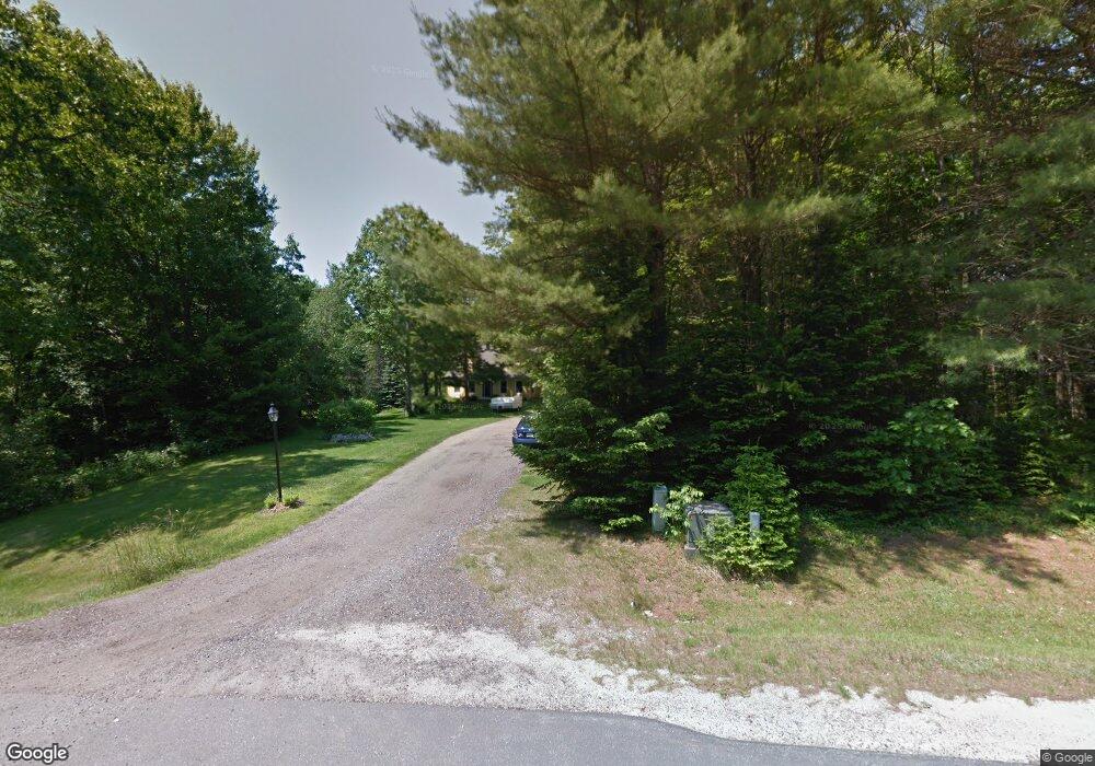
43 Todd Brook Rd Freeport, ME 04032
Estimated Value: $700,000 - $1,000,499
4
Beds
2
Baths
2,196
Sq Ft
$399/Sq Ft
Est. Value
About This Home
This home is located at 43 Todd Brook Rd, Freeport, ME 04032 and is currently estimated at $875,125, approximately $398 per square foot. 43 Todd Brook Rd is a home located in Cumberland County with nearby schools including Morse Street School, Mast Landing School, and Freeport Middle School.
Ownership History
Date
Name
Owned For
Owner Type
Purchase Details
Closed on
Jun 26, 2007
Sold by
Tayman Robert E and Tayman Marcia M
Bought by
Bassett-Willard Lynette and Willard Jesse
Current Estimated Value
Home Financials for this Owner
Home Financials are based on the most recent Mortgage that was taken out on this home.
Original Mortgage
$440,000
Outstanding Balance
$263,248
Interest Rate
6.14%
Mortgage Type
Purchase Money Mortgage
Estimated Equity
$611,877
Purchase Details
Closed on
May 2, 2005
Sold by
Dupree Thomas J and Organek Melissa L
Bought by
Tayman Robert E and Tayman Marcia M
Home Financials for this Owner
Home Financials are based on the most recent Mortgage that was taken out on this home.
Original Mortgage
$300,000
Interest Rate
5.95%
Mortgage Type
Purchase Money Mortgage
Create a Home Valuation Report for This Property
The Home Valuation Report is an in-depth analysis detailing your home's value as well as a comparison with similar homes in the area
Home Values in the Area
Average Home Value in this Area
Purchase History
| Date | Buyer | Sale Price | Title Company |
|---|---|---|---|
| Bassett-Willard Lynette | -- | -- | |
| Tayman Robert E | -- | -- |
Source: Public Records
Mortgage History
| Date | Status | Borrower | Loan Amount |
|---|---|---|---|
| Open | Bassett-Willard Lynette | $105,000 | |
| Open | Bassett-Willard Lynette | $440,000 | |
| Previous Owner | Tayman Robert E | $300,000 |
Source: Public Records
Tax History
| Year | Tax Paid | Tax Assessment Tax Assessment Total Assessment is a certain percentage of the fair market value that is determined by local assessors to be the total taxable value of land and additions on the property. | Land | Improvement |
|---|---|---|---|---|
| 2025 | $9,568 | $690,800 | $256,900 | $433,900 |
| 2024 | $9,059 | $678,600 | $244,700 | $433,900 |
| 2023 | $8,242 | $599,400 | $222,400 | $377,000 |
| 2022 | $7,921 | $580,300 | $203,300 | $377,000 |
| 2021 | $7,747 | $580,300 | $203,300 | $377,000 |
| 2020 | $7,559 | $539,900 | $188,400 | $351,500 |
| 2019 | $7,273 | $508,600 | $177,700 | $330,900 |
| 2018 | $7,162 | $475,900 | $169,600 | $306,300 |
| 2017 | $6,850 | $458,200 | $165,700 | $292,500 |
| 2016 | $6,713 | $424,900 | $153,500 | $271,400 |
| 2015 | $6,688 | $398,100 | $140,600 | $257,500 |
| 2014 | $6,290 | $398,100 | $140,600 | $257,500 |
| 2013 | $6,128 | $386,600 | $135,600 | $251,000 |
Source: Public Records
Map
Nearby Homes
- 2 Tidal Brook Rd
- 17 Youngs Ln Unit 17
- 27 Youngs Ln Unit 27
- 15 Harvey Brook Dr
- 177 Bluff Rd Unit 20
- 0 Redding Ln Unit 1657670
- 31 John Howland Dr
- 26 Harvest Ridge Rd Unit 24
- 9 Gables Dr Unit 9
- 0 Bayview St
- 15 Linwood Rd Unit 15
- 166 E Main St
- 823 North Rd
- 111 Concord Cir
- 61 Yankee Dr
- 15 Blueberry Cove
- 51 Old Field Rd
- 20 Island Park
- 29 S Freeport Rd
- 52 Blueberry Cove Rd Unit 52
- 45 Todd Brook Rd
- 29 Todd Brook Rd
- 36 Todd Brook Rd
- 21 Todd Brook Rd
- 55 Todd Brook Rd
- 61 Todd Brook Rd
- 17 Todd Brook Rd
- 14 Todd Brook Rd
- 9 Todd Brook Rd
- 7 Todd Brook Rd
- 11 Miles Way
- 12 Tidal Brook Rd
- 6 Beck's Ln
- 60 Old County Rd
- 15 Miles Way
- 4 Becks Ln
- 6 Tidal Brook Rd
- 6 Becks Ln
- 1 Tidal Brook Rd
- 4 Tidal Brook Road Extension
Your Personal Tour Guide
Ask me questions while you tour the home.