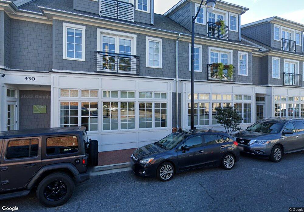
430 Fourth St Annapolis, MD 21403
Eastport NeighborhoodEstimated Value: $2,630,000
Studio
--
Bath
9,043
Sq Ft
$291/Sq Ft
Est. Value
About This Home
This home is located at 430 Fourth St, Annapolis, MD 21403 and is currently estimated at $2,630,000, approximately $290 per square foot. 430 Fourth St is a home located in Anne Arundel County with nearby schools including Eastport Elementary School, Annapolis Middle School, and Annapolis High School.
Ownership History
Date
Name
Owned For
Owner Type
Purchase Details
Closed on
Jul 2, 2019
Sold by
Eastport Sail Loft Llc
Bought by
430 Fourth Street Llc
Current Estimated Value
Home Financials for this Owner
Home Financials are based on the most recent Mortgage that was taken out on this home.
Original Mortgage
$2,240,000
Outstanding Balance
$1,969,643
Interest Rate
4%
Mortgage Type
Commercial
Estimated Equity
$660,357
Create a Home Valuation Report for This Property
The Home Valuation Report is an in-depth analysis detailing your home's value as well as a comparison with similar homes in the area
Home Values in the Area
Average Home Value in this Area
Purchase History
| Date | Buyer | Sale Price | Title Company |
|---|---|---|---|
| 430 Fourth Street Llc | $1,700,000 | None Available |
Source: Public Records
Mortgage History
| Date | Status | Borrower | Loan Amount |
|---|---|---|---|
| Open | 430 Fourth Street Llc | $2,240,000 |
Source: Public Records
Tax History
| Year | Tax Paid | Tax Assessment Tax Assessment Total Assessment is a certain percentage of the fair market value that is determined by local assessors to be the total taxable value of land and additions on the property. | Land | Improvement |
|---|---|---|---|---|
| 2025 | $24,215 | $1,751,500 | -- | -- |
| 2024 | $24,215 | $1,718,900 | $0 | $0 |
Source: Public Records
Map
Nearby Homes
- 400 Chesapeake Ave Unit 2-101
- 509 Chesapeake Ave
- 312 Severn Ave
- 312 Severn Ave Unit W-401
- 200 Chesapeake Ave
- 120 Chesapeake Ave
- 517 Burnside St
- 301 Burnside St
- 316 Burnside St Unit 203
- 289 State St Unit 4
- 513 Horn Point Dr
- 287 State St Unit 2
- 98 Duke of Gloucester St
- 9 Shipwright St
- 1 Shipwright Harbor
- 3 Klakring Ct
- 148 Jefferson St
- 936 Bay Ridge Ave Unit 306
- 400 Jefferson St
- 179 Green St
- 406 Chesapeake Ave
- 400 Chesapeake Ave
- 400 Chesapeake Ave Unit 105
- 414 Chesapeake Ave
- 429 Fourth St
- 424 Fourth St
- 445 Fourth St
- 416 Chesapeake Ave
- 425 Fourth St
- 433 Fourth St
- 403 Chesapeake Ave
- 405 Chesapeake Ave
- 401 Chesapeake Ave
- 423 Fourth St
- 418 Chesapeake Ave
- 318 Chesapeake Ave
- 407 Chesapeake Ave
- 427 Fourth St
- 420 Chesapeake Ave
- 418 Fourth St
Your Personal Tour Guide
Ask me questions while you tour the home.