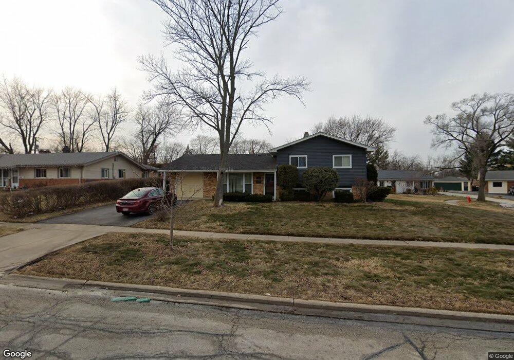
430 Westview St Hoffman Estates, IL 60169
South Hoffman Estates NeighborhoodEstimated Value: $306,000 - $383,000
3
Beds
2
Baths
1,388
Sq Ft
$249/Sq Ft
Est. Value
About This Home
This home is located at 430 Westview St, Hoffman Estates, IL 60169 and is currently estimated at $345,127, approximately $248 per square foot. 430 Westview St is a home located in Cook County with nearby schools including Enders-Salk Elementary School, Helen Keller Junior High School, and Schaumburg High School.
Ownership History
Date
Name
Owned For
Owner Type
Purchase Details
Closed on
Jun 23, 2010
Sold by
Rasmussen Donald P
Bought by
Powell Dalton A and Plett Caroline
Current Estimated Value
Home Financials for this Owner
Home Financials are based on the most recent Mortgage that was taken out on this home.
Original Mortgage
$212,143
Outstanding Balance
$141,584
Interest Rate
5.12%
Mortgage Type
FHA
Estimated Equity
$203,543
Create a Home Valuation Report for This Property
The Home Valuation Report is an in-depth analysis detailing your home's value as well as a comparison with similar homes in the area
Home Values in the Area
Average Home Value in this Area
Purchase History
We collect this data history from publicly available records. To have your information removed, we recommend requesting removal directly through your county’s website.
| Date | Buyer | Sale Price | Title Company |
|---|---|---|---|
| Powell Dalton A | $215,000 | Pntn |
Source: Public Records
Mortgage History
We collect this data history from publicly available records. To have your information removed, we recommend requesting removal directly through your county’s website.
| Date | Status | Borrower | Loan Amount |
|---|---|---|---|
| Open | Powell Dalton A | $212,143 |
Source: Public Records
Tax History
| Year | Tax Paid | Tax Assessment Tax Assessment Total Assessment is a certain percentage of the fair market value that is determined by local assessors to be the total taxable value of land and additions on the property. | Land | Improvement |
|---|---|---|---|---|
| 2025 | $3,933 | $19,190 | $3,245 | $15,945 |
| 2024 | $3,933 | $14,476 | $2,782 | $11,694 |
| 2023 | $3,791 | $14,476 | $2,782 | $11,694 |
| 2022 | $3,791 | $14,476 | $2,782 | $11,694 |
| 2021 | $2,995 | $10,605 | $1,970 | $8,635 |
| 2020 | $2,962 | $10,605 | $1,970 | $8,635 |
| 2019 | $3,006 | $11,981 | $1,970 | $10,011 |
| 2018 | $3,292 | $11,812 | $1,738 | $10,074 |
| 2017 | $3,242 | $11,812 | $1,738 | $10,074 |
| 2016 | $3,147 | $11,812 | $1,738 | $10,074 |
| 2015 | $3,742 | $12,964 | $1,506 | $11,458 |
| 2014 | $4,090 | $12,964 | $1,506 | $11,458 |
| 2013 | $2,593 | $12,964 | $1,506 | $11,458 |
Source: Public Records
Map
Nearby Homes
- 828 Harwich Ln
- 508 Bristol Ln
- 520 Morgan Ln
- 203 Barcliffe Ln Unit 1063
- 670 Lakeview Ln
- 575 Olive St
- 135 Nauset Ln Unit 1224
- 520 Glendale Ln
- 1024 Parker Dr
- 770 Woodlawn St
- 616 Claridge Cir Unit 79
- 600 Flagstaff Ln
- 705 Ascot Ct
- 310 Maricopa Ln
- 712 Scarbrough Cir Unit 126
- 6 Stone Bridge Ct
- 1133 Perth Dr
- 849 Colony Lake Dr Unit 2
- 11 Stone Bridge Ct
- 923 Daniels Ct Unit 2
- 430 Westview St
- 420 Westview St
- 440 Westview St
- 425 Westview St
- 455 Western St
- 425 Western St
- 435 Westview St
- 415 Westview St
- 405 Western St
- 465 Western St
- 445 Westview St
- 460 Westview St
- 450 Westview St
- 395 Westview St
- 455 Westview St
- 455 Westview St
- 370 Washington Blvd
- 475 Western St
- 360 Washington Blvd
- 385 Westview St
Your Personal Tour Guide
Ask me questions while you tour the home.