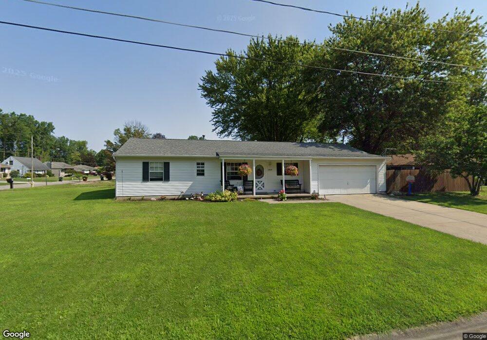
43020 Emerald Dr Elyria, OH 44035
Estimated Value: $192,000 - $208,000
3
Beds
2
Baths
1,341
Sq Ft
$150/Sq Ft
Est. Value
About This Home
This home is located at 43020 Emerald Dr, Elyria, OH 44035 and is currently estimated at $201,579, approximately $150 per square foot. 43020 Emerald Dr is a home located in Lorain County with nearby schools including Crestwood Elementary School, Westwood Middle School, and Elyria High School.
Ownership History
Date
Name
Owned For
Owner Type
Purchase Details
Closed on
Oct 25, 2016
Sold by
Hozalski Joann M
Bought by
Day Julie M
Current Estimated Value
Purchase Details
Closed on
Jun 9, 2016
Sold by
Day Julie M
Bought by
Hozalski Joann M and Day Julie M
Purchase Details
Closed on
May 21, 2002
Sold by
Richard Bailey
Bought by
Day Matthew K and Hozalski Julie M
Home Financials for this Owner
Home Financials are based on the most recent Mortgage that was taken out on this home.
Original Mortgage
$113,400
Interest Rate
7.07%
Purchase Details
Closed on
Nov 20, 1998
Sold by
Kramer Virgil F
Bought by
Bailey Richard
Home Financials for this Owner
Home Financials are based on the most recent Mortgage that was taken out on this home.
Original Mortgage
$73,000
Interest Rate
7.01%
Create a Home Valuation Report for This Property
The Home Valuation Report is an in-depth analysis detailing your home's value as well as a comparison with similar homes in the area
Home Values in the Area
Average Home Value in this Area
Purchase History
| Date | Buyer | Sale Price | Title Company |
|---|---|---|---|
| Day Julie M | -- | -- | |
| Hozalski Joann M | $100,000 | -- | |
| Day Matthew K | $126,000 | Midland Title | |
| Bailey Richard | $98,000 | Midland Title |
Source: Public Records
Mortgage History
| Date | Status | Borrower | Loan Amount |
|---|---|---|---|
| Previous Owner | Day Matthew K | $113,400 | |
| Previous Owner | Bailey Richard | $73,000 |
Source: Public Records
Tax History
| Year | Tax Paid | Tax Assessment Tax Assessment Total Assessment is a certain percentage of the fair market value that is determined by local assessors to be the total taxable value of land and additions on the property. | Land | Improvement |
|---|---|---|---|---|
| 2024 | $2,586 | $46,001 | $6,391 | $39,610 |
| 2023 | $2,606 | $39,841 | $3,752 | $36,089 |
| 2022 | $2,597 | $39,841 | $3,752 | $36,089 |
| 2021 | $2,444 | $39,841 | $3,752 | $36,089 |
| 2020 | $2,148 | $31,000 | $2,920 | $28,080 |
| 2019 | $2,150 | $31,000 | $2,920 | $28,080 |
| 2018 | $2,128 | $31,000 | $2,920 | $28,080 |
| 2017 | $2,103 | $28,960 | $4,830 | $24,130 |
| 2016 | $1,984 | $28,960 | $4,830 | $24,130 |
| 2015 | $1,868 | $28,960 | $4,830 | $24,130 |
| 2014 | $2,066 | $29,960 | $5,000 | $24,960 |
| 2013 | $2,066 | $29,960 | $5,000 | $24,960 |
Source: Public Records
Map
Nearby Homes
- 6832 Murray Ridge Rd
- 1267 Bell Ct
- 6445 Lake Ave
- 6635 Lake Ave
- 975 N Ridge Rd E
- 77 King St
- 142 Parmely Ave
- 348 Robin Dr
- 42190 Helen St
- V/L N Ridge Rd
- 44565 Stang Rd
- 411 Oaknoll Dr
- 807 Woodland Ave
- 5211 Hecock Ave
- 370 North Dr
- 1693 Elfleda St
- 211 Brace Ave
- 45002 Middle Ridge Rd
- 161 High St
- 129 Hidden Tree Ln
- 7075 Freeland Dr
- 7055 Freeland Dr
- 43019 Emerald Dr
- 42967 Emerald Dr
- 42965 Emerald Dr
- 7133 Freeland Dr
- 7110 Freeland Dr
- 7102 Freeland Dr
- 43008 Emerald Dr
- 43008 Emerald Dr
- 43008 Emerald Dr
- 7088 Freeland Dr
- 42961 Emerald Dr
- 7035 Freeland Dr
- 7118 Freeland Dr
- 7143 Freeland Dr
- 7084 Freeland Dr
- 42957 Emerald Dr
- 7122 Freeland Dr
- 43000 Galaxy Dr
Your Personal Tour Guide
Ask me questions while you tour the home.