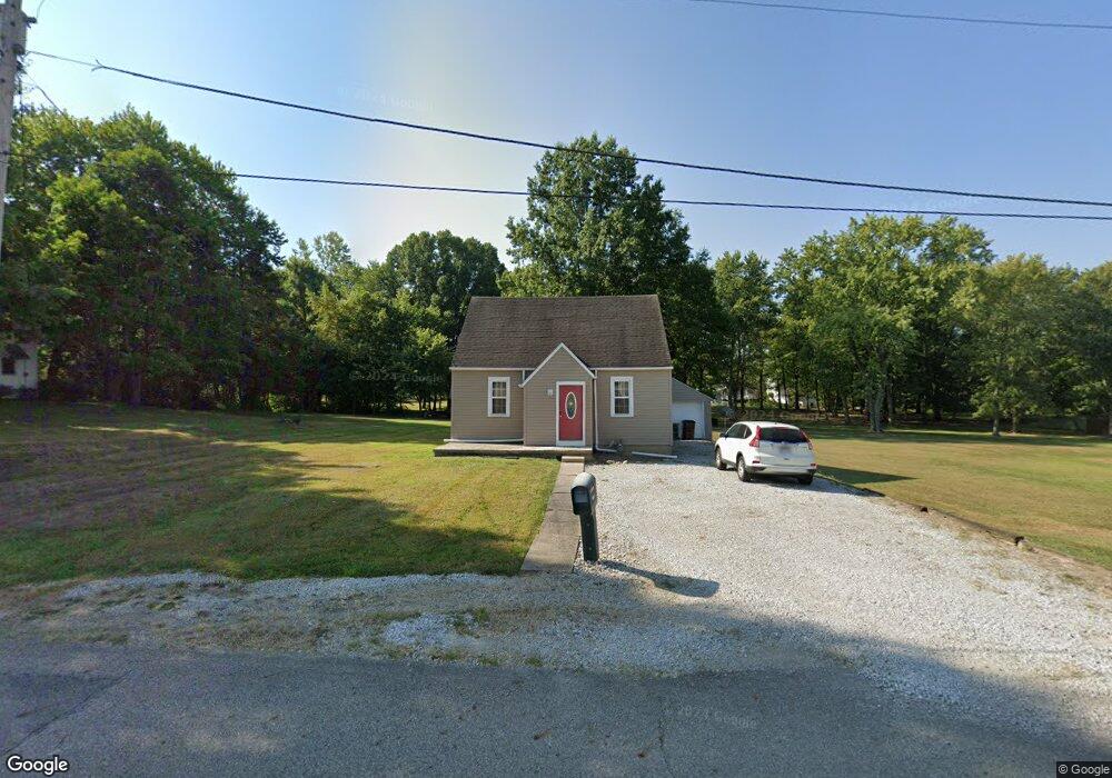
431 E Cliff St Baltimore, OH 43105
Estimated Value: $181,000 - $225,000
3
Beds
2
Baths
1,151
Sq Ft
$183/Sq Ft
Est. Value
About This Home
This home is located at 431 E Cliff St, Baltimore, OH 43105 and is currently estimated at $211,139, approximately $183 per square foot. 431 E Cliff St is a home located in Fairfield County with nearby schools including Liberty Union Elementary School, Liberty Union Middle School, and Liberty Union High School.
Ownership History
Date
Name
Owned For
Owner Type
Purchase Details
Closed on
Jul 22, 2009
Sold by
Hsbc Bank Usa Na
Bought by
Underwood James A and Underwood Sandra L
Current Estimated Value
Purchase Details
Closed on
May 8, 2009
Sold by
Evans Donna and Evans Gary
Bought by
Hsbc Bank Usa Na
Purchase Details
Closed on
Sep 12, 2006
Sold by
Stein Dendra Ann and Stein Wiley
Bought by
Evans Gary and Evans Donna
Home Financials for this Owner
Home Financials are based on the most recent Mortgage that was taken out on this home.
Original Mortgage
$72,000
Interest Rate
9.5%
Mortgage Type
Purchase Money Mortgage
Create a Home Valuation Report for This Property
The Home Valuation Report is an in-depth analysis detailing your home's value as well as a comparison with similar homes in the area
Home Values in the Area
Average Home Value in this Area
Purchase History
| Date | Buyer | Sale Price | Title Company |
|---|---|---|---|
| Underwood James A | $65,000 | Titlequest Agency | |
| Hsbc Bank Usa Na | $67,000 | None Available | |
| Evans Gary | -- | None Available |
Source: Public Records
Mortgage History
| Date | Status | Borrower | Loan Amount |
|---|---|---|---|
| Previous Owner | Evans Gary | $72,000 |
Source: Public Records
Tax History
| Year | Tax Paid | Tax Assessment Tax Assessment Total Assessment is a certain percentage of the fair market value that is determined by local assessors to be the total taxable value of land and additions on the property. | Land | Improvement |
|---|---|---|---|---|
| 2025 | $3,719 | $63,380 | $17,750 | $45,630 |
| 2024 | $3,719 | $49,540 | $12,880 | $36,660 |
| 2023 | $1,948 | $49,540 | $12,880 | $36,660 |
| 2022 | $1,932 | $49,540 | $12,880 | $36,660 |
| 2021 | $1,622 | $37,730 | $11,670 | $26,060 |
| 2020 | $1,631 | $37,730 | $11,670 | $26,060 |
| 2019 | $1,687 | $37,730 | $11,670 | $26,060 |
| 2018 | $1,464 | $29,520 | $11,670 | $17,850 |
| 2017 | $1,471 | $30,010 | $11,670 | $18,340 |
| 2016 | $1,451 | $30,010 | $11,670 | $18,340 |
| 2015 | $1,351 | $29,210 | $11,670 | $17,540 |
| 2014 | $1,297 | $29,210 | $11,670 | $17,540 |
| 2013 | $1,297 | $29,210 | $11,670 | $17,540 |
Source: Public Records
Map
Nearby Homes
- 220 N Wagner Ave
- 113 S Park Dr
- 407 S Main St
- 403 S Walnut St
- 201 E Dorchester Dr
- 601 S Main St
- 727 W Washington St
- 112 N Creekview Ct
- 445 Baltimore Somerset Rd NE
- 570 Baltimore Somerset Rd NE Unit Lot 1
- 0 Basil Rd NW Unit 226003110
- 7836 Basil Rd NW
- 116 S High St
- 0 Cherry Ln Unit 226008720
- 201 N Liberty St
- 0 S Company St Unit Lot 2 225029545
- 0 S Company St Unit Lot 1 225029543
- 0 Lancaster-Newark Rd NE Unit Lot A
- 0 Lancaster-Newark Rd NE
- 1455 Giesy Rd NW
- 435 E Cliff St
- 408 E Cliff St
- 425 E Cliff St
- 410 E Cliff St
- 406 E Cliff St
- 439 E Cliff St
- 412 E Cliff St
- 419 E Cliff St
- 415 E Cliff St
- 219 N Wagner Ave
- 459 E Cliff St
- 215 N Wagner Ave
- 413 E Cliff St
- 211 N Wagner Ave
- 404 E Cliff St
- 207 N Wagner Ave
- 416 E Cliff St
- 402 E Cliff St
- 410 E Market St
- 414 E Market St
Your Personal Tour Guide
Ask me questions while you tour the home.