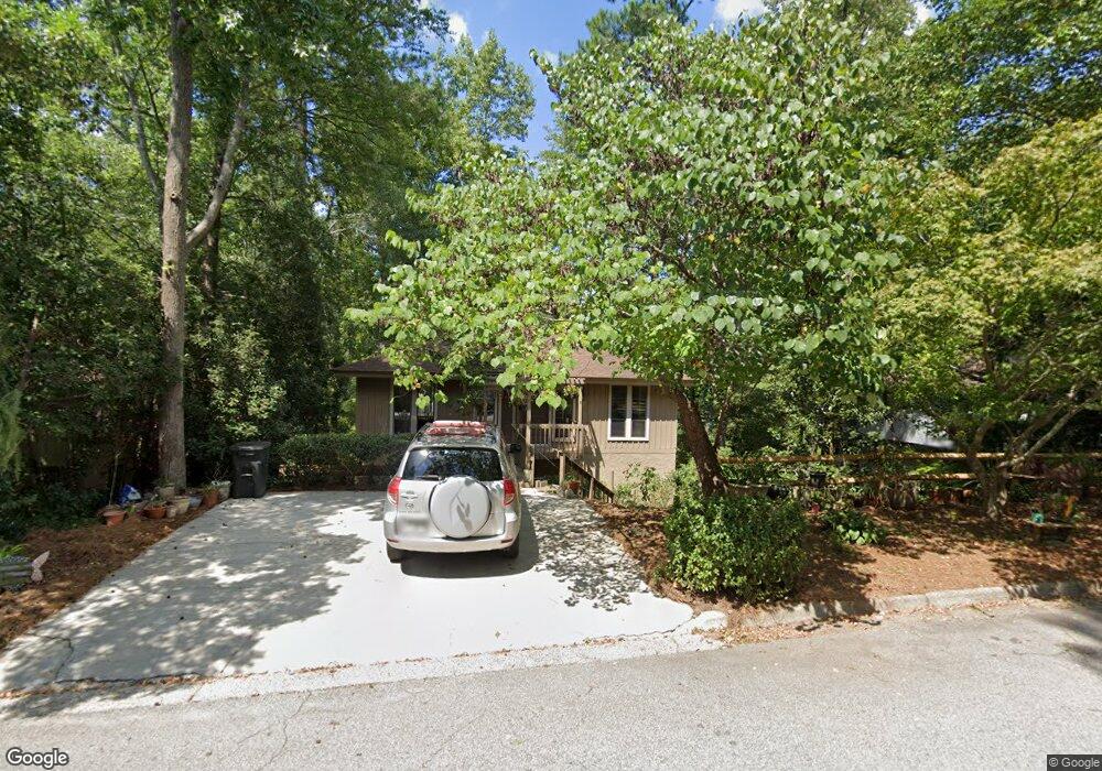
432 Bristol Rd Augusta, GA 30907
Estimated Value: $262,000 - $292,000
3
Beds
3
Baths
2,304
Sq Ft
$120/Sq Ft
Est. Value
About This Home
This home is located at 432 Bristol Rd, Augusta, GA 30907 and is currently estimated at $277,471, approximately $120 per square foot. 432 Bristol Rd is a home located in Columbia County with nearby schools including Blue Ridge Elementary School, Lakeside Middle School, and Lakeside High School.
Ownership History
Date
Name
Owned For
Owner Type
Purchase Details
Closed on
Aug 31, 2005
Sold by
Palco Matthew
Bought by
Handy Ann R
Current Estimated Value
Home Financials for this Owner
Home Financials are based on the most recent Mortgage that was taken out on this home.
Original Mortgage
$116,350
Outstanding Balance
$61,552
Interest Rate
5.77%
Mortgage Type
New Conventional
Estimated Equity
$215,919
Purchase Details
Closed on
Aug 29, 2003
Sold by
Palco Melissa M
Bought by
Palco Matthew
Create a Home Valuation Report for This Property
The Home Valuation Report is an in-depth analysis detailing your home's value as well as a comparison with similar homes in the area
Home Values in the Area
Average Home Value in this Area
Purchase History
We collect this data history from publicly available records. To have your information removed, we recommend requesting removal directly through your county’s website.
| Date | Buyer | Sale Price | Title Company |
|---|---|---|---|
| Handy Ann R | $136,900 | -- | |
| Palco Matthew | -- | -- |
Source: Public Records
Mortgage History
We collect this data history from publicly available records. To have your information removed, we recommend requesting removal directly through your county’s website.
| Date | Status | Borrower | Loan Amount |
|---|---|---|---|
| Open | Handy Ann R | $116,350 |
Source: Public Records
Tax History
| Year | Tax Paid | Tax Assessment Tax Assessment Total Assessment is a certain percentage of the fair market value that is determined by local assessors to be the total taxable value of land and additions on the property. | Land | Improvement |
|---|---|---|---|---|
| 2025 | $2,529 | $105,558 | $14,074 | $91,484 |
| 2024 | $2,601 | $103,702 | $16,654 | $87,048 |
| 2023 | $2,601 | $90,548 | $15,548 | $75,000 |
| 2022 | $2,323 | $89,084 | $12,968 | $76,116 |
| 2021 | $2,072 | $75,992 | $11,770 | $64,222 |
| 2020 | $1,896 | $68,114 | $11,032 | $57,082 |
| 2019 | $1,670 | $59,973 | $9,190 | $50,783 |
| 2018 | $1,708 | $61,101 | $10,203 | $50,898 |
| 2017 | $1,553 | $55,342 | $9,374 | $45,968 |
| 2016 | $1,570 | $58,054 | $9,166 | $48,888 |
| 2015 | $1,536 | $56,698 | $9,166 | $47,532 |
| 2014 | $1,483 | $54,071 | $8,981 | $45,090 |
Source: Public Records
Map
Nearby Homes
- 4083 Amherst Way
- 4098 Amherst Way
- 366 Sumac Trail
- 356 Sumac Trail
- 148 Canton Park Ave
- 4209 Fairfield Cir
- 4071 Danielle Dr
- 410 Shortleaf Trail
- 0 Commons Dr Unit 98211676
- 4035 Oregon Trail
- 4067 Briarwood Dr
- 536 Blue Ridge Crossing
- 4061 Briarwood Dr
- 702 Bradford Ln
- 723 Bradford Ln
- 279 High Chaparral Dr
- 3779 Winchester Trail
- 4019 Danielle Dr
- 386 Connor Cir
- 350 Connor Cir
- 430 Bristol Rd
- 434 Bristol Rd
- 436 Bristol Rd
- 428 Bristol Rd
- 502 Fairfield Ct
- 425 Bristol Rd
- 423 Bristol Rd
- 438 Bristol Rd
- 426 Bristol Rd
- 4081 Amherst Way
- 504 Fairfield Ct
- 419 Bristol Rd
- 498 Fairfield Ct
- 440 Bristol Rd
- 4091 Amherst Ct
- 4089 Amherst Ct
- 424 Bristol Rd
- 417 Bristol Rd
- 506 Fairfield Ct
- 442 Bristol Rd
Your Personal Tour Guide
Ask me questions while you tour the home.