Estimated Value: $217,082 - $411,000
3
Beds
2
Baths
1,456
Sq Ft
$191/Sq Ft
Est. Value
About This Home
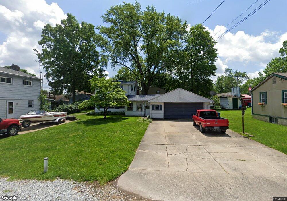
This home is located at 432 Rawlins Ave, Akron, OH 44319 and is currently estimated at $277,771, approximately $190 per square foot. 432 Rawlins Ave is a home located in Summit County with nearby schools including Nolley Elementary School, Manchester Middle School, and Manchester High School.
Ownership History
Date
Name
Owned For
Owner Type
Purchase Details
Closed on
Apr 11, 2000
Sold by
Mccartt Michael
Bought by
Wilson Robert M and Weaver Wendy M
Current Estimated Value
Home Financials for this Owner
Home Financials are based on the most recent Mortgage that was taken out on this home.
Original Mortgage
$105,150
Interest Rate
8.29%
Create a Home Valuation Report for This Property
The Home Valuation Report is an in-depth analysis detailing your home's value as well as a comparison with similar homes in the area
Home Values in the Area
Average Home Value in this Area
Purchase History
| Date | Buyer | Sale Price | Title Company |
|---|---|---|---|
| Wilson Robert M | $83,000 | Northeast Title Agency Inc |
Source: Public Records
Mortgage History
| Date | Status | Borrower | Loan Amount |
|---|---|---|---|
| Closed | Wilson Robert M | $105,150 |
Source: Public Records
Tax History
| Year | Tax Paid | Tax Assessment Tax Assessment Total Assessment is a certain percentage of the fair market value that is determined by local assessors to be the total taxable value of land and additions on the property. | Land | Improvement |
|---|---|---|---|---|
| 2025 | $2,707 | $53,169 | $9,034 | $44,135 |
| 2024 | $2,707 | $53,169 | $9,034 | $44,135 |
| 2023 | $2,707 | $53,169 | $9,034 | $44,135 |
| 2022 | $2,627 | $40,279 | $6,843 | $33,436 |
| 2021 | $2,636 | $40,279 | $6,843 | $33,436 |
| 2020 | $2,591 | $40,280 | $6,840 | $33,440 |
| 2019 | $2,218 | $30,830 | $5,230 | $25,600 |
| 2018 | $1,925 | $30,830 | $5,230 | $25,600 |
| 2017 | $2,005 | $30,830 | $5,230 | $25,600 |
| 2016 | $1,981 | $29,090 | $5,230 | $23,860 |
| 2015 | $2,005 | $29,090 | $5,230 | $23,860 |
| 2014 | $1,990 | $29,090 | $5,230 | $23,860 |
| 2013 | $1,979 | $29,090 | $5,230 | $23,860 |
Source: Public Records
Map
Nearby Homes
- 5008 Laddie Dr
- 4786 Bickford Ave
- 5042 Laddie Dr
- lot 8 Whyem Dr
- 7 Shrakes Hotel Dr
- 3 Shrakes Hotel Dr
- 4885 Will Dr
- 6 Shrakes Hotel Dr
- 692 Zeletta Dr
- 4 Shrakes Hotel Dr
- 4387 Point Comfort Dr
- 4742 Cherimoya Ave
- 4298 S Main St Unit 4302
- 4138 S Main St
- 4385 Rex Lake Dr
- 68 Starboard Cir
- 45 Forest Cove Dr Unit 24
- 4698 Manchester Rd
- 781 Leeman Dr
- 752 Leeman Dr
- 428 Rawlins Ave
- 440 Rawlins Ave
- 407 Fayette Ave
- 413 Fayette Ave
- 4851 Barrymore Ave
- 437 Rawlins Ave
- 437 Rawlins Ave
- 412 Rawlins Ave
- 399 Fayette Ave
- 441 Rawlins Ave
- 4815 Sandra Ave
- 4820 Coleman Dr
- 4813 Sandra Ave
- 4825 Durbin Ave
- 4809 Sandra Ave
- 404 Fayette Ave
- 4850 Barrymore Ave
- 402 Fayette Ave
- 4828 Coleman Dr
- 4828 Coleman Dr
Your Personal Tour Guide
Ask me questions while you tour the home.