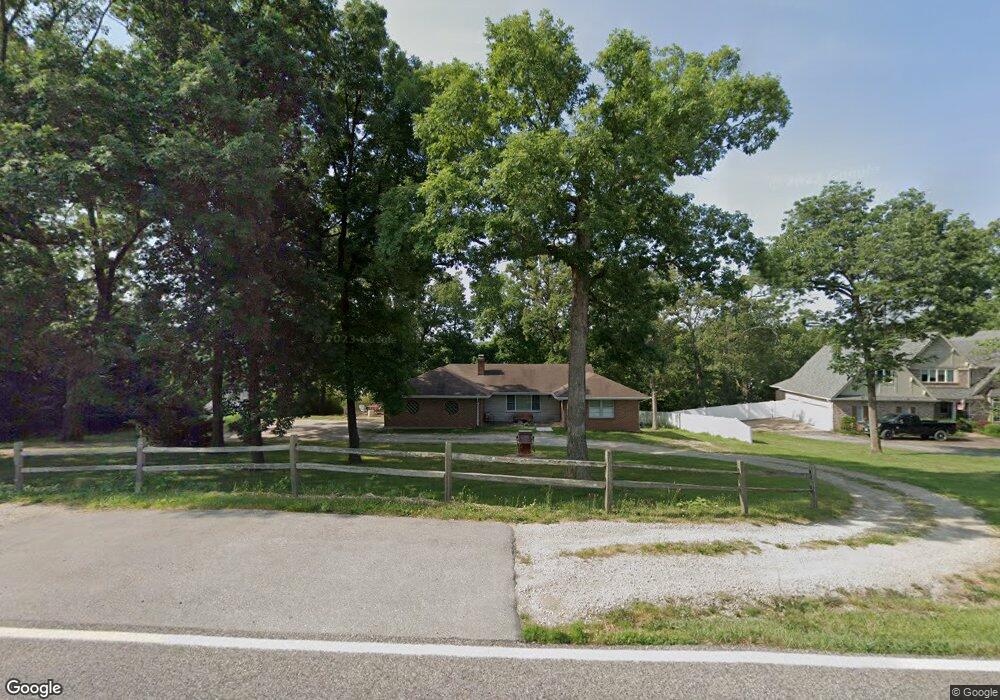
433 Summit Rd Fenton, MO 63026
Estimated Value: $328,198 - $411,000
3
Beds
4
Baths
1,386
Sq Ft
$264/Sq Ft
Est. Value
About This Home
This home is located at 433 Summit Rd, Fenton, MO 63026 and is currently estimated at $365,550, approximately $263 per square foot. 433 Summit Rd is a home located in St. Louis County with nearby schools including Bowles Elementary School, Rockwood South Middle School, and Rockwood Summit Senior High School.
Ownership History
Date
Name
Owned For
Owner Type
Purchase Details
Closed on
Mar 15, 2011
Sold by
Stuedeman William L and Steudeman Andrea J
Bought by
Stuedeman William
Current Estimated Value
Home Financials for this Owner
Home Financials are based on the most recent Mortgage that was taken out on this home.
Original Mortgage
$146,000
Outstanding Balance
$6,853
Interest Rate
5.06%
Mortgage Type
New Conventional
Estimated Equity
$358,697
Purchase Details
Closed on
Nov 8, 2002
Sold by
Raineri Mary A
Bought by
Stuedeman William L
Home Financials for this Owner
Home Financials are based on the most recent Mortgage that was taken out on this home.
Original Mortgage
$172,900
Interest Rate
5.89%
Purchase Details
Closed on
Aug 4, 2000
Sold by
Weil Mary A
Bought by
Raineri Mary A
Home Financials for this Owner
Home Financials are based on the most recent Mortgage that was taken out on this home.
Original Mortgage
$55,000
Interest Rate
8.12%
Create a Home Valuation Report for This Property
The Home Valuation Report is an in-depth analysis detailing your home's value as well as a comparison with similar homes in the area
Purchase History
| Date | Buyer | Sale Price | Title Company |
|---|---|---|---|
| Stuedeman William | $146,000 | Ctc | |
| Stuedeman William L | $182,000 | -- | |
| Raineri Mary A | $135,000 | -- |
Source: Public Records
Mortgage History
| Date | Status | Borrower | Loan Amount |
|---|---|---|---|
| Open | Stuedeman William | $146,000 | |
| Closed | Stuedeman William L | $172,900 | |
| Previous Owner | Raineri Mary A | $55,000 |
Source: Public Records
Tax History
| Year | Tax Paid | Tax Assessment Tax Assessment Total Assessment is a certain percentage of the fair market value that is determined by local assessors to be the total taxable value of land and additions on the property. | Land | Improvement |
|---|---|---|---|---|
| 2025 | $3,642 | $62,700 | $40,910 | $21,790 |
| 2024 | $3,642 | $48,800 | $27,270 | $21,530 |
| 2023 | $3,639 | $48,800 | $27,270 | $21,530 |
| 2022 | $3,352 | $41,860 | $27,270 | $14,590 |
| 2021 | $3,326 | $41,860 | $27,270 | $14,590 |
| 2020 | $2,763 | $33,380 | $17,630 | $15,750 |
| 2019 | $2,771 | $33,380 | $17,630 | $15,750 |
| 2018 | $2,489 | $28,730 | $13,570 | $15,160 |
| 2017 | $2,469 | $28,730 | $13,570 | $15,160 |
| 2016 | $2,910 | $34,260 | $11,860 | $22,400 |
Source: Public Records
Map
Nearby Homes
- 425 Roosevelt Woods Ct
- 975 Arlington Glen Dr
- 000 Gravois Summit
- 520 May Valley Dr
- 87 Fall Meadow Ct
- 1230 Summit Meadows Dr
- 818 Mary Lee Ct
- 711 Mosely Ct
- 78 Poppy Dr Unit 78
- 740 Spring Crest Ct
- 811 Mary Lee Ct
- 800 Mary Lee Ct
- 687 Green Forest Dr
- 919 Oak Dr
- 564 Oakwood Dr
- 907 Oak Dr
- 1273 Green Falls Dr
- 831 Oak Dr
- 68 Rainbow Dr
- 484 Summit Tree Ct
- 499 Summit Rd
- 414 Lincoln Terrace Ct
- 410 Lincoln Terrace Ct
- 418 Lincoln Terrace Ct
- 406 Lincoln Terrace Ct
- 494 Churchill Downs Manor Ct
- 422 Lincoln Terrace Ct
- 498 Churchill Downs Manor Ct
- 505 Summit Rd
- 490 Churchill Downs Manor Ct
- 505& 511 Summit Dr
- 911 Arlington Glen Dr
- 907 Arlington Glen Dr
- 402 Lincoln Terrace Ct
- 486 Churchill Downs Manor Ct
- 1 Fairview Place
- 411 Lincoln Terrace Ct
- 426 Lincoln Terrace Ct
- 915 Arlington Glen Dr
- 419 Lincoln Terrace Ct
Your Personal Tour Guide
Ask me questions while you tour the home.