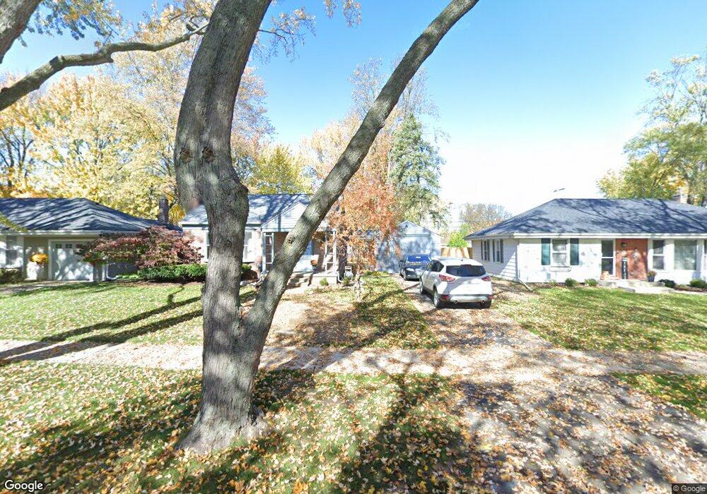
4330 Samoset Rd Unit Bldg-Unit Royal Oak, MI 48073
Estimated Value: $366,000 - $449,000
3
Beds
2
Baths
1,092
Sq Ft
$357/Sq Ft
Est. Value
About This Home
This home is located at 4330 Samoset Rd Unit Bldg-Unit, Royal Oak, MI 48073 and is currently estimated at $390,279, approximately $357 per square foot. 4330 Samoset Rd Unit Bldg-Unit is a home located in Oakland County with nearby schools including Alfred E. Upton Elementary School, Royal Oak Middle School, and Royal Oak High School.
Ownership History
Date
Name
Owned For
Owner Type
Purchase Details
Closed on
Jul 12, 2018
Sold by
Myziuk Nicholas and Myziuk Samantha
Bought by
Raiskin Steven M
Current Estimated Value
Purchase Details
Closed on
Jan 5, 2016
Sold by
Herrmann Robin Luce and Luce Robin K
Bought by
Myziuk Nicholas and Myziuk Samantha
Home Financials for this Owner
Home Financials are based on the most recent Mortgage that was taken out on this home.
Original Mortgage
$178,698
Interest Rate
3.37%
Mortgage Type
FHA
Purchase Details
Closed on
Mar 30, 1998
Sold by
Dilaura Lenard J
Bought by
Luce Robin K
Home Financials for this Owner
Home Financials are based on the most recent Mortgage that was taken out on this home.
Original Mortgage
$166,250
Interest Rate
7.19%
Create a Home Valuation Report for This Property
The Home Valuation Report is an in-depth analysis detailing your home's value as well as a comparison with similar homes in the area
Home Values in the Area
Average Home Value in this Area
Purchase History
| Date | Buyer | Sale Price | Title Company |
|---|---|---|---|
| Raiskin Steven M | $230,000 | None Available | |
| Myziuk Nicholas | $182,000 | Attorney | |
| Luce Robin K | $175,000 | -- |
Source: Public Records
Mortgage History
| Date | Status | Borrower | Loan Amount |
|---|---|---|---|
| Previous Owner | Myziuk Nicholas | $178,698 | |
| Previous Owner | Luce Robin K | $166,250 |
Source: Public Records
Tax History
| Year | Tax Paid | Tax Assessment Tax Assessment Total Assessment is a certain percentage of the fair market value that is determined by local assessors to be the total taxable value of land and additions on the property. | Land | Improvement |
|---|---|---|---|---|
| 2025 | $4,771 | $144,190 | $0 | $0 |
| 2024 | $3,631 | $132,650 | $0 | $0 |
| 2022 | $4,291 | $119,450 | $0 | $0 |
| 2020 | $3,529 | $111,700 | $0 | $0 |
| 2018 | $4,291 | $102,960 | $0 | $0 |
| 2017 | $4,226 | $102,960 | $0 | $0 |
| 2015 | -- | $85,800 | $0 | $0 |
| 2014 | -- | $79,210 | $0 | $0 |
| 2011 | -- | $63,970 | $0 | $0 |
Source: Public Records
Map
Nearby Homes
- 4312 Samoset Rd
- 4313 Berkshire Rd
- 4240 Sheridan Dr
- 1544 Sheffield Rd
- 1723 E 14 Mile Rd Unit B
- 1717 E 14 Mile Rd Unit C
- 1389 Bird Ave
- 1205 E 14 Mile Rd
- 4311 Arlington Dr
- 1653 Taunton Rd
- 15636 Kirkshire Ave
- 4109 Berkshire Rd
- 1268 Davis Ave
- 15751 W 14 Mile Rd
- 4725 Elmwood Ave
- 870 Davis Ave
- 1588 Bennaville Ave
- 1368 Bennaville Ave
- 1323 Bennaville Ave
- 4414 Robinwood Ave
- 4330 Samoset Rd
- 4324 Samoset Rd
- 4338 Samoset Rd
- 4318 Samoset Rd
- 4342 Samoset Rd
- 4333 Berkshire Rd
- 4327 Berkshire Rd
- 4339 Berkshire Rd
- 4319 Berkshire Rd
- 4404 Samoset Rd
- 4333 Samoset Rd
- 4349 Berkshire Rd
- 4327 Samoset Rd
- 4339 Samoset Rd
- 4306 Samoset Rd
- 4321 Samoset Rd
- 4345 Samoset Rd
- 4403 Berkshire Rd
- 4315 Samoset Rd
- 4408 Samoset Rd
Your Personal Tour Guide
Ask me questions while you tour the home.