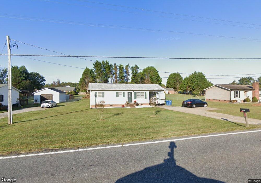
4359 Startown Rd Newton, NC 28658
Estimated Value: $188,000 - $207,000
3
Beds
1
Bath
950
Sq Ft
$210/Sq Ft
Est. Value
About This Home
This home is located at 4359 Startown Rd, Newton, NC 28658 and is currently estimated at $199,701, approximately $210 per square foot. 4359 Startown Rd is a home located in Catawba County with nearby schools including Startown Elementary School, Maiden Middle School, and Maiden High School.
Ownership History
Date
Name
Owned For
Owner Type
Purchase Details
Closed on
Nov 30, 2017
Sold by
Bradley Michael W
Bought by
Blackburn Penny
Current Estimated Value
Home Financials for this Owner
Home Financials are based on the most recent Mortgage that was taken out on this home.
Original Mortgage
$82,478
Outstanding Balance
$69,988
Interest Rate
4.25%
Mortgage Type
FHA
Estimated Equity
$129,713
Purchase Details
Closed on
Aug 18, 2000
Bought by
Winstead Lora Kistler
Purchase Details
Closed on
Dec 1, 1992
Create a Home Valuation Report for This Property
The Home Valuation Report is an in-depth analysis detailing your home's value as well as a comparison with similar homes in the area
Home Values in the Area
Average Home Value in this Area
Purchase History
| Date | Buyer | Sale Price | Title Company |
|---|---|---|---|
| Blackburn Penny | $84,000 | None Available | |
| Winstead Lora Kistler | $77,000 | -- | |
| -- | $50,500 | -- |
Source: Public Records
Mortgage History
| Date | Status | Borrower | Loan Amount |
|---|---|---|---|
| Open | Blackburn Penny | $82,478 |
Source: Public Records
Tax History
| Year | Tax Paid | Tax Assessment Tax Assessment Total Assessment is a certain percentage of the fair market value that is determined by local assessors to be the total taxable value of land and additions on the property. | Land | Improvement |
|---|---|---|---|---|
| 2025 | $788 | $157,800 | $9,600 | $148,200 |
| 2024 | $788 | $157,800 | $9,600 | $148,200 |
| 2023 | $788 | $89,800 | $9,600 | $80,200 |
| 2022 | $651 | $89,800 | $9,600 | $80,200 |
| 2021 | $633 | $89,800 | $9,600 | $80,200 |
| 2020 | $633 | $89,800 | $9,600 | $80,200 |
| 2019 | $624 | $89,800 | $0 | $0 |
| 2018 | $521 | $74,900 | $9,900 | $65,000 |
| 2017 | $498 | $0 | $0 | $0 |
| 2016 | $498 | $0 | $0 | $0 |
| 2015 | $484 | $74,870 | $9,900 | $64,970 |
| 2014 | $484 | $80,600 | $11,100 | $69,500 |
Source: Public Records
Map
Nearby Homes
- 1322 Kensington Cir
- 1181 Kensington Cir
- 2625 Glenn St
- 1704 Knightbridge Dr
- 1954 Villa Dr
- 2301 Willow Creek Dr
- 1221 Willow Creek Dr
- 2919 Teton Dr
- 3007 Michelle Dr
- 2025 Picnic Dr
- 2235 Picnic Dr
- 2953 Ninth Tee Dr
- 3651 W Nc 10 Hwy
- 1148 Fye Dr
- 1043 Rolling Green Dr
- 000 Long Dr
- 226 Oak Cir
- 1511 Old Carriage Dr
- 1326 Brentwood Dr
- 1050 Quail Hill Ave
- 4369 Startown Rd
- 4349 Startown Rd
- 2024 Whitegate Ln
- 2044 Whitegate Ln
- 4339 Startown Rd
- 4379 Startown Rd
- 2054 Whitegate Ln
- 2014 Whitegate Ln
- 4329 Startown Rd
- 4389 Startown Rd
- 2002 Whitegate Ln
- 2064 Whitegate Ln
- 2037 Whitegate Ln
- 2025 Whitegate Ln
- 2049 Whitegate Ln
- 4319 Startown Rd
- 4399 Startown Rd
- 2015 Whitegate Ln
- 2074 Whitegate Ln
- 1992 Whitegate Ln
Your Personal Tour Guide
Ask me questions while you tour the home.