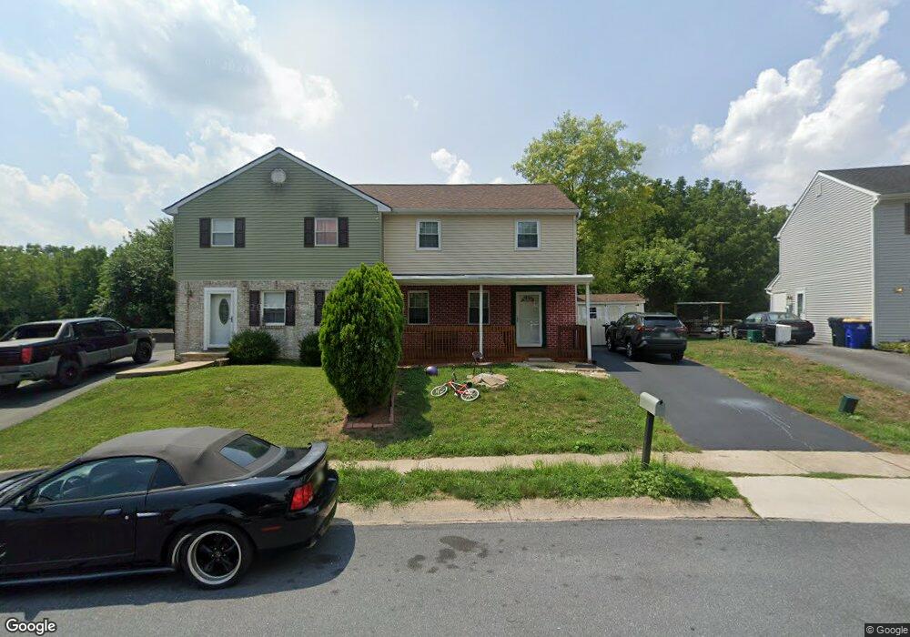
436 Larkspur Loop Lancaster, PA 17602
Fertility NeighborhoodEstimated Value: $269,000 - $314,000
3
Beds
3
Baths
1,756
Sq Ft
$169/Sq Ft
Est. Value
About This Home
This home is located at 436 Larkspur Loop, Lancaster, PA 17602 and is currently estimated at $296,285, approximately $168 per square foot. 436 Larkspur Loop is a home located in Lancaster County with nearby schools including Smoketown Elementary School, Gerald G. Huesken Middle School, and Conestoga Valley High School.
Ownership History
Date
Name
Owned For
Owner Type
Purchase Details
Closed on
Sep 30, 2009
Sold by
Mackey James A
Bought by
Dessu Tsehaye K
Current Estimated Value
Home Financials for this Owner
Home Financials are based on the most recent Mortgage that was taken out on this home.
Original Mortgage
$132,554
Outstanding Balance
$86,732
Interest Rate
5.12%
Mortgage Type
FHA
Estimated Equity
$209,553
Purchase Details
Closed on
Nov 27, 2007
Sold by
Linder N Eric and Linder Laura S
Bought by
Mackey James A
Create a Home Valuation Report for This Property
The Home Valuation Report is an in-depth analysis detailing your home's value as well as a comparison with similar homes in the area
Home Values in the Area
Average Home Value in this Area
Purchase History
| Date | Buyer | Sale Price | Title Company |
|---|---|---|---|
| Dessu Tsehaye K | $135,000 | Conestoga Title Insurance Co | |
| Mackey James A | $154,900 | None Available |
Source: Public Records
Mortgage History
| Date | Status | Borrower | Loan Amount |
|---|---|---|---|
| Open | Dessu Tsehaye K | $132,554 |
Source: Public Records
Tax History
| Year | Tax Paid | Tax Assessment Tax Assessment Total Assessment is a certain percentage of the fair market value that is determined by local assessors to be the total taxable value of land and additions on the property. | Land | Improvement |
|---|---|---|---|---|
| 2025 | $2,838 | $140,200 | $35,900 | $104,300 |
| 2024 | $2,838 | $140,200 | $35,900 | $104,300 |
| 2023 | $2,773 | $140,200 | $35,900 | $104,300 |
| 2022 | $2,704 | $140,200 | $35,900 | $104,300 |
| 2021 | $2,608 | $140,200 | $35,900 | $104,300 |
| 2020 | $2,608 | $140,200 | $35,900 | $104,300 |
| 2019 | $2,552 | $140,200 | $35,900 | $104,300 |
| 2018 | $3,756 | $140,200 | $35,900 | $104,300 |
| 2017 | $2,345 | $108,300 | $22,600 | $85,700 |
| 2016 | $2,316 | $108,300 | $22,600 | $85,700 |
| 2015 | $592 | $108,300 | $22,600 | $85,700 |
| 2014 | $1,606 | $108,300 | $22,600 | $85,700 |
Source: Public Records
Map
Nearby Homes
- 450 Daisy Ln
- 452 Daisy Ln
- 352 Dohner Dr Unit 69
- 305 Greenland Dr Unit 385
- 2009 Millstream Rd
- 2187 Lincoln Hwy E
- 314 Country Meadows Dr
- 225 Black Oak Dr
- 6 Thicket Ln
- 104 Nordick Dr
- 1973 Drexel Ave
- 26 Midway Farms Ln
- 1829 Krystle Dr
- 32 Greenfield Rd
- 77 Highland Dr
- 68 Linda Ave
- 36 Creekside Dr
- 105 Plumeria Place
- 157 Jimanna Rd
- 89 Greenfield Rd
- 434 Larkspur Loop
- 432 Larkspur Loop
- 311 Dohner Dr
- 313 Dohner Dr
- 430 Larkspur Loop
- 307 Dohner Dr
- 315 Dohner Dr
- 433 Larkspur Loop
- 428 Larkspur Loop
- 317 Dohner Dr
- 305 Dohner Dr
- 431 Larkspur Loop
- 426 Larkspur Loop
- 435 Daisy Ln
- 433 Daisy Ln
- 303 Dohner Dr
- 441 Garland Cir
- 429 Larkspur Loop
- 431 Daisy Ln
- 437 Daisy Ln
Your Personal Tour Guide
Ask me questions while you tour the home.