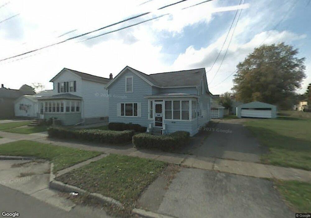
437 S Roberts Rd Dunkirk, NY 14048
Estimated Value: $91,000 - $121,000
4
Beds
1
Bath
1,407
Sq Ft
$72/Sq Ft
Est. Value
About This Home
This home is located at 437 S Roberts Rd, Dunkirk, NY 14048 and is currently estimated at $100,822, approximately $71 per square foot. 437 S Roberts Rd is a home located in Chautauqua County with nearby schools including Dunkirk Intermediate School, Northern Chautauqua Catholic School, and Central Christian Academy.
Ownership History
Date
Name
Owned For
Owner Type
Purchase Details
Closed on
Jun 7, 2022
Sold by
Chautauqua County Land Bank Corporation
Bought by
Cambria William G
Current Estimated Value
Purchase Details
Closed on
Oct 24, 2012
Sold by
County Of Chautauqua
Bought by
Cambria William
Purchase Details
Closed on
Dec 24, 2008
Sold by
Michalak Darleen
Bought by
Goetz Angela
Home Financials for this Owner
Home Financials are based on the most recent Mortgage that was taken out on this home.
Original Mortgage
$32,000
Interest Rate
6.17%
Mortgage Type
Purchase Money Mortgage
Purchase Details
Closed on
Jul 17, 2002
Sold by
Michalak Darleen A
Bought by
Murphy Theodore E
Create a Home Valuation Report for This Property
The Home Valuation Report is an in-depth analysis detailing your home's value as well as a comparison with similar homes in the area
Home Values in the Area
Average Home Value in this Area
Purchase History
We collect this data history from publicly available records. To have your information removed, we recommend requesting removal directly through your county’s website.
| Date | Buyer | Sale Price | Title Company |
|---|---|---|---|
| Cambria William G | $300 | None Listed On Document | |
| Cambria William | $1,500 | -- | |
| County Of Chautauqua | $5,652 | -- | |
| Goetz Angela | $33,000 | -- | |
| Murphy Theodore E | $27,000 | -- | |
| Murphy Theodore E | $27,000 | -- |
Source: Public Records
Mortgage History
We collect this data history from publicly available records. To have your information removed, we recommend requesting removal directly through your county’s website.
| Date | Status | Borrower | Loan Amount |
|---|---|---|---|
| Previous Owner | Goetz Angela | $32,000 |
Source: Public Records
Tax History
| Year | Tax Paid | Tax Assessment Tax Assessment Total Assessment is a certain percentage of the fair market value that is determined by local assessors to be the total taxable value of land and additions on the property. | Land | Improvement |
|---|---|---|---|---|
| 2025 | $1,433 | $35,600 | $2,400 | $33,200 |
| 2024 | $1,433 | $35,600 | $2,400 | $33,200 |
| 2023 | $1,400 | $35,600 | $2,400 | $33,200 |
| 2022 | $1,154 | $35,600 | $2,400 | $33,200 |
| 2021 | $984 | $28,300 | $2,400 | $25,900 |
| 2020 | $976 | $28,300 | $2,400 | $25,900 |
| 2019 | $989 | $28,300 | $2,400 | $25,900 |
| 2018 | $989 | $28,300 | $2,400 | $25,900 |
| 2017 | $969 | $28,300 | $2,400 | $25,900 |
| 2016 | $943 | $28,300 | $2,400 | $25,900 |
| 2015 | -- | $28,300 | $2,400 | $25,900 |
| 2014 | -- | $28,300 | $2,400 | $25,900 |
Source: Public Records
Map
Nearby Homes
- 49 E Courtney St
- 146 Hoyt St
- 250 Townsend St
- 55 Kosciuszko Ave
- 241 Lord St
- 306 Lord St
- 59 E Front St
- 316 Lord St
- 142 Ruggles St
- 0 W Benton & Ruggles St Unit R1631836
- 58 Ruggles St
- 172 S Margay St
- 67 Ruggles St
- 267 Lake Shore Dr E
- 113 S Martin St
- 23 Leming St
- 152 Maple Ave
- 154 Maple Ave
- 423 Bucknor St
- 427 Bucknor St
- 445 S Roberts Rd
- 447 S Roberts Rd
- 441 S Roberts Rd
- 449 S Roberts Rd
- 453 S Roberts Rd
- 134 Townsend St
- 136 Townsend St
- 140 Townsend St
- 130 Townsend St
- 132 Townsend St
- 128 Townsend St
- 461 S Roberts Rd
- 64 E Courtney St
- 62 E Courtney St
- 60 E Courtney St
- 120 Townsend St
- 118 Townsend St
- 129 Townsend St
- 421 S Roberts Rd
- 139 Townsend St
Your Personal Tour Guide
Ask me questions while you tour the home.