Estimated Value: $214,000 - $234,744
Studio
--
Bath
1,682
Sq Ft
$133/Sq Ft
Est. Value
About This Home
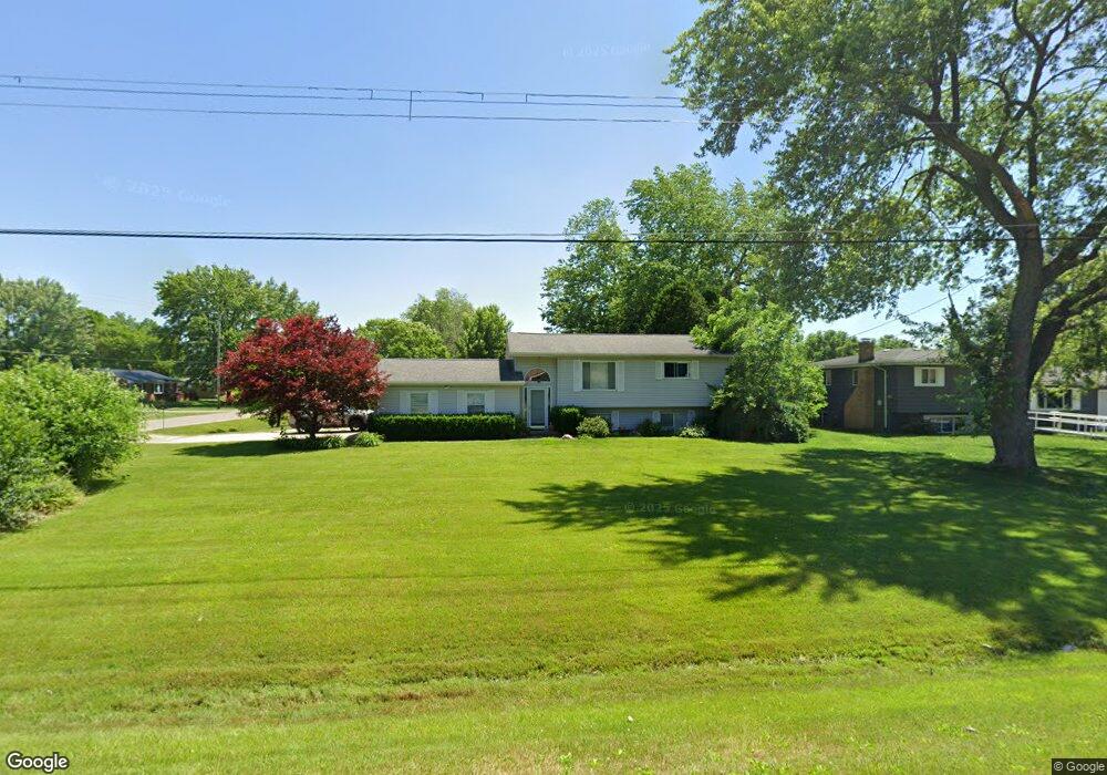
This home is located at 4372 Pheasant Dr, Flint, MI 48506 and is currently estimated at $223,186, approximately $132 per square foot. 4372 Pheasant Dr is a home located in Genesee County with nearby schools including Weston Elementary School, Leota Fiedler Elementary School, and Kate Dowdall Elementary School.
Ownership History
Date
Name
Owned For
Owner Type
Purchase Details
Closed on
Jul 22, 2020
Sold by
Roberts Ricky and Roberts Cheri
Bought by
Ginn Randal and Ginn Donna
Current Estimated Value
Home Financials for this Owner
Home Financials are based on the most recent Mortgage that was taken out on this home.
Original Mortgage
$159,035
Outstanding Balance
$141,022
Interest Rate
3.1%
Mortgage Type
FHA
Estimated Equity
$82,164
Purchase Details
Closed on
May 21, 2004
Sold by
Clifford Louise and Clifford Howell Louise
Bought by
Roberts Ricky and Roberts Cheri
Home Financials for this Owner
Home Financials are based on the most recent Mortgage that was taken out on this home.
Original Mortgage
$139,000
Interest Rate
5.91%
Mortgage Type
Purchase Money Mortgage
Purchase Details
Closed on
Jul 11, 2000
Sold by
Pratt Eugene and Pratt Sue A H
Bought by
Clifford Louise
Create a Home Valuation Report for This Property
The Home Valuation Report is an in-depth analysis detailing your home's value as well as a comparison with similar homes in the area
Home Values in the Area
Average Home Value in this Area
Purchase History
| Date | Buyer | Sale Price | Title Company |
|---|---|---|---|
| Ginn Randal | $162,000 | None Available | |
| Roberts Ricky | $139,000 | Lawyers Title | |
| Clifford Louise | $126,000 | Lawyers Title Insurance Corp |
Source: Public Records
Mortgage History
| Date | Status | Borrower | Loan Amount |
|---|---|---|---|
| Open | Ginn Randal | $159,035 | |
| Previous Owner | Roberts Ricky | $139,000 |
Source: Public Records
Tax History
| Year | Tax Paid | Tax Assessment Tax Assessment Total Assessment is a certain percentage of the fair market value that is determined by local assessors to be the total taxable value of land and additions on the property. | Land | Improvement |
|---|---|---|---|---|
| 2025 | $3,709 | $118,200 | $0 | $0 |
| 2024 | $1,073 | $108,700 | $0 | $0 |
| 2023 | $1,023 | $97,000 | $0 | $0 |
| 2022 | $3,057 | $90,800 | $0 | $0 |
| 2021 | $3,029 | $82,000 | $0 | $0 |
| 2020 | $549 | $76,600 | $0 | $0 |
| 2019 | $540 | $68,200 | $0 | $0 |
| 2018 | $1,848 | $61,600 | $0 | $0 |
| 2017 | $1,670 | $59,300 | $0 | $0 |
| 2016 | $1,641 | $57,000 | $0 | $0 |
| 2015 | $1,324 | $48,500 | $0 | $0 |
| 2014 | $442 | $44,800 | $0 | $0 |
| 2012 | -- | $36,900 | $36,900 | $0 |
Source: Public Records
Map
Nearby Homes
- 7045 Normandy Ct
- 6312 Tamara Dr
- 6367 E Pierson Rd
- 6443 Richfield Rd
- 4126 N Belsay Rd
- 6076 E Carpenter Rd
- 6054 E Pierson Rd
- 5165 N Irish Rd
- 5177 N Irish Rd
- 1240 N Irish Rd
- 3424 N Irish Rd
- 3179 Gehring Dr
- 5131 E Carpenter Rd
- 3267 Mills Acres St
- 0 Whisper Ridge Ct
- 4455 N Genesee Rd
- 2411 Briar Creek Ln
- 4044 N Genesee Rd
- 4465 Market Place
- 4489 Home Town Dr Unit 32
- 4372 Pheasant Dr
- 4364 Pheasant Dr
- 6474 Bluejay Dr
- 4371 Pheasant Dr
- 6463 Bluejay Dr
- 6463 Bluejay Dr
- 4342 Pheasant Dr
- 6443 Bluejay Dr
- 6473 Bluejay Dr
- 6484 Bluejay Dr
- 6433 Bluejay Dr
- 4353 Pheasant Dr
- 6483 Bluejay Dr
- 6424 Bluejay Dr
- 4343 Pheasant Dr
- 6423 Bluejay Dr
- 6494 Bluejay Dr
- VL Pheasant
- 6414 Bluejay Dr
- 6493 Bluejay Dr
Your Personal Tour Guide
Ask me questions while you tour the home.