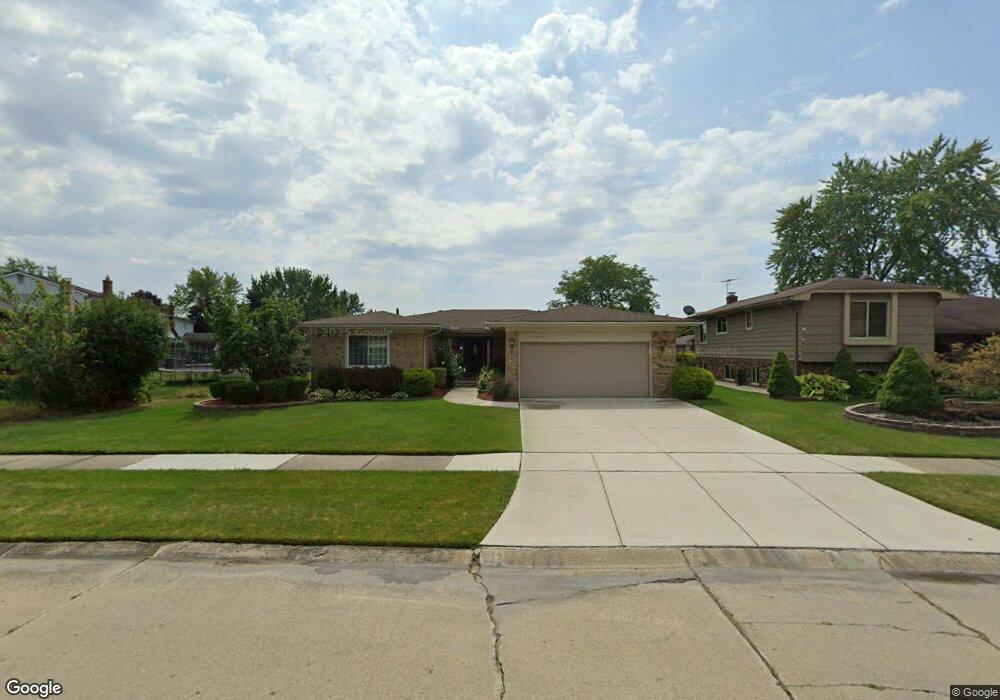
43735 Cranford Ave Canton, MI 48187
Estimated Value: $333,000 - $413,000
About This Home
This home is located at 43735 Cranford Ave, Canton, MI 48187 and is currently estimated at $370,730, approximately $240 per square foot. 43735 Cranford Ave is a home located in Wayne County with nearby schools including Canton High School, Discovery Middle School, and Salem High School.
Ownership History
We collect this data history from publicly available records. To have your information removed, we recommend requesting removal directly through your county’s website.
Purchase Details
Purchase Details
Purchase Details
Home Financials for this Owner
Home Financials are based on the most recent Mortgage that was taken out on this home.Purchase Details
Home Values in the Area
Average Home Value in this Area
Purchase History
We collect this data history from publicly available records. To have your information removed, we recommend requesting removal directly through your county’s website.
| Date | Buyer | Sale Price | Title Company |
|---|---|---|---|
| -- | None Listed On Document | ||
| -- | First American Title Ins Co | ||
| $189,900 | -- | ||
| $182,000 | -- |
Mortgage History
We collect this data history from publicly available records. To have your information removed, we recommend requesting removal directly through your county’s website.
| Date | Status | Borrower | Loan Amount |
|---|---|---|---|
| Previous Owner | $180,400 |
Tax History
We collect this data history from publicly available records. To have your information removed, we recommend requesting removal directly through your county’s website.
| Year | Tax Paid | Tax Assessment Tax Assessment Total Assessment is a certain percentage of the fair market value that is determined by local assessors to be the total taxable value of land and additions on the property. | Land | Improvement |
|---|---|---|---|---|
| 2025 | $1,547 | $167,700 | $0 | $0 |
| 2024 | $1,502 | $153,400 | $0 | $0 |
| 2023 | $1,953 | $136,200 | $0 | $0 |
| 2022 | $3,200 | $119,600 | $0 | $0 |
| 2021 | $1,782 | $118,100 | $0 | $0 |
| 2020 | $3,064 | $112,900 | $0 | $0 |
| 2019 | $3,009 | $103,280 | $0 | $0 |
| 2018 | $1,217 | $95,210 | $0 | $0 |
| 2017 | $3,125 | $94,200 | $0 | $0 |
| 2016 | $2,744 | $96,400 | $0 | $0 |
| 2015 | $6,690 | $86,380 | $0 | $0 |
| 2013 | $6,481 | $67,340 | $0 | $0 |
| 2010 | -- | $74,700 | $42,945 | $31,755 |
Map
- 379 Cherry Orchard Rd Unit 105
- 531 Cherry Grove Rd Unit 169
- 44220 Saltz Rd
- 1129 Whittier Dr
- 43060 Providence Ln
- 1567 Marlowe St
- 42779 Lilley Pointe Dr Unit 152
- 43694 Emrick Dr
- 42739 Lilley Pointe Dr Unit 119
- 42764 Lilley Pointe Dr Unit 165
- 222 Edington Cir
- 1660 N Sheldon Rd
- 44062 Proctor Rd
- 1822 N Sheldon Rd
- 58560 Stuart Dr
- 245 Roseland Dr
- 6121 Braemore Ct
- 1028 Knightsbridge Rd
- 45209 Saltz Rd
- 45095 Turnberry Ct
- 43775 Cranford Ave
- 43801 Cranford Ave
- 43759 Cranford Ave
- 43813 Cranford Ave
- 43747 Cranford Ave
- 43770 Palisades Dr
- 43758 Palisades Dr
- 43806 Palisades Dr
- 43825 Cranford Ave
- 43776 Cranford Ave
- 43764 Cranford Ave
- 43800 Cranford Ave
- 43818 Palisades Dr Unit Bldg-Unit
- 43746 Palisades Dr
- 43752 Cranford Ave
- 43812 Cranford Ave
- 43830 Palisades Dr
- 43837 Cranford Ave
- 43740 Cranford Ave
- 43824 Cranford Ave
Ask me questions while you tour the home.