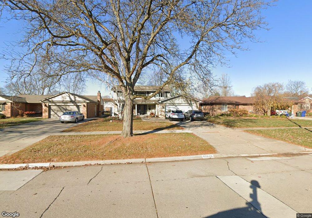
43818 Hanford Rd Canton, MI 48187
Estimated Value: $388,535 - $476,000
4
Beds
4
Baths
2,182
Sq Ft
$198/Sq Ft
Est. Value
About This Home
This home is located at 43818 Hanford Rd, Canton, MI 48187 and is currently estimated at $432,884, approximately $198 per square foot. 43818 Hanford Rd is a home located in Wayne County with nearby schools including Canton High School, Discovery Middle School, and Salem High School.
Ownership History
Date
Name
Owned For
Owner Type
Purchase Details
Closed on
May 1, 2019
Sold by
Mancuso Michael and Mancuso Jennifer
Bought by
Elias Vicky J
Current Estimated Value
Home Financials for this Owner
Home Financials are based on the most recent Mortgage that was taken out on this home.
Original Mortgage
$268,850
Outstanding Balance
$235,408
Interest Rate
4%
Mortgage Type
New Conventional
Estimated Equity
$197,476
Purchase Details
Closed on
Dec 31, 2009
Sold by
Worth Jeffry Adam and Spencer Worth Michelle Elizabeth
Bought by
Mancuso Michael and Mancuso Jennifer
Purchase Details
Closed on
Jul 11, 1994
Sold by
Palk Richard M
Bought by
Palk Richard
Home Financials for this Owner
Home Financials are based on the most recent Mortgage that was taken out on this home.
Original Mortgage
$100,400
Interest Rate
8.72%
Mortgage Type
New Conventional
Create a Home Valuation Report for This Property
The Home Valuation Report is an in-depth analysis detailing your home's value as well as a comparison with similar homes in the area
Home Values in the Area
Average Home Value in this Area
Purchase History
| Date | Buyer | Sale Price | Title Company |
|---|---|---|---|
| Elias Vicky J | $283,000 | None Available | |
| Mancuso Michael | $189,900 | None Available | |
| Palk Richard | $125,500 | -- |
Source: Public Records
Mortgage History
| Date | Status | Borrower | Loan Amount |
|---|---|---|---|
| Open | Elias Vicky J | $268,850 | |
| Previous Owner | Palk Richard | $100,400 |
Source: Public Records
Tax History
| Year | Tax Paid | Tax Assessment Tax Assessment Total Assessment is a certain percentage of the fair market value that is determined by local assessors to be the total taxable value of land and additions on the property. | Land | Improvement |
|---|---|---|---|---|
| 2025 | $2,538 | $171,300 | $0 | $0 |
| 2024 | $2,465 | $163,300 | $0 | $0 |
| 2023 | $2,350 | $138,600 | $0 | $0 |
| 2022 | $5,208 | $128,100 | $0 | $0 |
| 2021 | $5,048 | $124,200 | $0 | $0 |
| 2020 | $4,976 | $118,300 | $0 | $0 |
| 2019 | $3,663 | $112,730 | $0 | $0 |
| 2018 | $1,474 | $104,700 | $0 | $0 |
| 2017 | $3,863 | $102,700 | $0 | $0 |
| 2016 | $3,359 | $99,500 | $0 | $0 |
| 2015 | $8,098 | $92,460 | $0 | $0 |
| 2013 | $7,845 | $84,370 | $0 | $0 |
| 2010 | -- | $81,560 | $31,381 | $50,179 |
Source: Public Records
Map
Nearby Homes
- 835 Coldrose Way
- 47527 Ellery Ln
- 49772 Shoreline Dr
- 6852 New Providence Way Unit 104
- 5806 Wedgewood Rd
- 6962 Harvard Ln Unit 120
- 43800 Simsbury St
- 44652 Nantucket Dr
- 44418 Newburyport Dr
- 44432 Newburyport Dr
- 7264 Irongate Rd
- 58560 Stuart Dr
- 7125 N Lilley Rd
- 42542 Saratoga Rd Unit 26
- 1822 N Sheldon Rd
- 7533 Hillsboro Dr
- 48590 Ford Rd
- 1567 Marlowe St
- 0000 Ford
- 43086 Versailles Rd
- 43832 Hanford Rd
- 43804 Hanford Rd
- 868 Bellwood Ln
- 880 Bellwood Ln
- 896 Bellwood Ln
- 43846 Hanford Rd
- 43909 Bannockburn Dr
- 43923 Bannockburn Dr
- 43877 Bannockburn Dr
- 43937 Bannockburn Dr
- 43860 Hanford Rd
- 43763 Bannockburn Dr
- 43750 Hanford Rd
- 847 Coldrose Way
- 829 Coldrose Way
- 43819 Hanford Rd
- 43833 Hanford Rd
- 43805 Hanford Rd
- 43749 Bannockburn Dr
- 44012 Hanford Rd
Your Personal Tour Guide
Ask me questions while you tour the home.