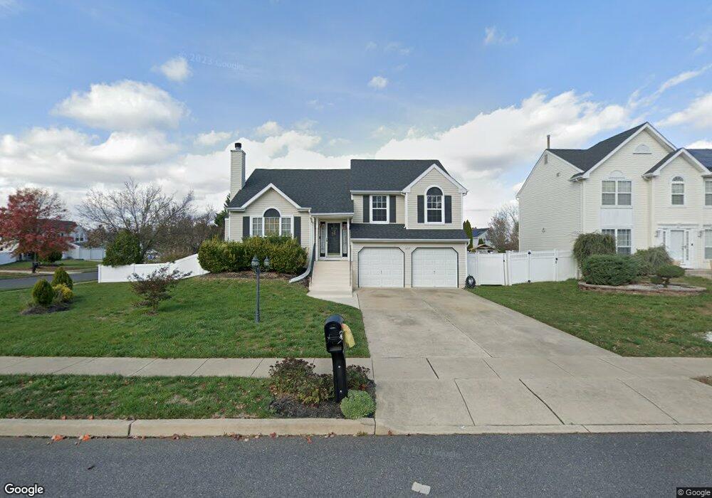
439 Moore Blvd Clayton, NJ 08312
Estimated Value: $387,700 - $426,000
Studio
--
Bath
1,925
Sq Ft
$214/Sq Ft
Est. Value
About This Home
This home is located at 439 Moore Blvd, Clayton, NJ 08312 and is currently estimated at $411,425, approximately $213 per square foot. 439 Moore Blvd is a home located in Gloucester County with nearby schools including Herma S. Simmons Elementary School, Clayton Middle School, and Clayton High School.
Ownership History
Date
Name
Owned For
Owner Type
Purchase Details
Closed on
Sep 12, 1999
Sold by
Quinones Wilfredo and Valentin Awilda
Bought by
Joynes Roger and Joynes Eugenia
Current Estimated Value
Home Financials for this Owner
Home Financials are based on the most recent Mortgage that was taken out on this home.
Original Mortgage
$121,380
Outstanding Balance
$36,759
Interest Rate
8.1%
Mortgage Type
VA
Estimated Equity
$374,666
Create a Home Valuation Report for This Property
The Home Valuation Report is an in-depth analysis detailing your home's value as well as a comparison with similar homes in the area
Home Values in the Area
Average Home Value in this Area
Purchase History
| Date | Buyer | Sale Price | Title Company |
|---|---|---|---|
| Joynes Roger | $121,000 | United Title & Abstract |
Source: Public Records
Mortgage History
| Date | Status | Borrower | Loan Amount |
|---|---|---|---|
| Open | Joynes Roger | $121,380 |
Source: Public Records
Tax History
| Year | Tax Paid | Tax Assessment Tax Assessment Total Assessment is a certain percentage of the fair market value that is determined by local assessors to be the total taxable value of land and additions on the property. | Land | Improvement |
|---|---|---|---|---|
| 2025 | $9,427 | $355,200 | $85,600 | $269,600 |
| 2024 | $6,854 | $380,900 | $85,600 | $295,300 |
| 2023 | $6,854 | $169,600 | $41,400 | $128,200 |
| 2022 | $6,779 | $169,600 | $41,400 | $128,200 |
| 2021 | $6,698 | $169,600 | $41,400 | $128,200 |
| 2020 | $6,711 | $169,600 | $41,400 | $128,200 |
| 2019 | $6,597 | $169,600 | $41,400 | $128,200 |
| 2018 | $6,504 | $169,600 | $41,400 | $128,200 |
| 2017 | $6,394 | $169,600 | $41,400 | $128,200 |
| 2016 | $6,326 | $169,600 | $41,400 | $128,200 |
| 2015 | $6,140 | $169,600 | $41,400 | $128,200 |
| 2014 | $5,926 | $169,600 | $41,400 | $128,200 |
Source: Public Records
Map
Nearby Homes
- 60 Roberts Ave
- 554 Bellview Ave
- 580 Sunhaven Dr
- 237 S Delsea Dr
- 212 N Vine St
- 231 N Main St
- 171 Morrow Ln
- 104 Maple St
- 520 Coleman Dr
- 26 W Center St
- 000 N Pearl St
- 0 N Pearl St
- 691 East Ave
- 238 W Center St
- 29 Downs St
- 760 Roosevelt Blvd
- 132 W Clinton St
- 100 Aura Rd Unit 206
- 100 Aura Rd Unit 311
- 100 Aura Rd Unit 212
- 441 Moore Blvd
- 1 Wheatsheaf Cir
- 6 Wheatsheaf Cir
- 443 Moore Blvd
- 438 Moore Blvd
- 2 Wheatsheaf Cir
- 440 Moore Blvd
- 4 Hawthorn Way
- 436 Moore Blvd
- 5 Wheatsheaf Cir
- 442 Moore Blvd
- 445 Moore Blvd
- 429 Moore Blvd
- 3 Hawthorn Way
- 434 Moore Blvd
- 444 Moore Blvd
- 3 Wheatsheaf Cir
- 4 Wheatsheaf Cir
- 2 Hawthorn Way
- 427 Moore Blvd
Your Personal Tour Guide
Ask me questions while you tour the home.