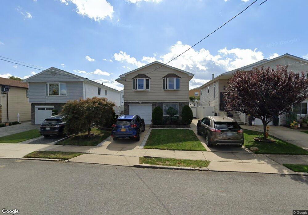
44 E Scranton Ave Staten Island, NY 10308
Great Kills NeighborhoodEstimated Value: $785,000 - $934,000
4
Beds
3
Baths
1,296
Sq Ft
$662/Sq Ft
Est. Value
About This Home
This home is located at 44 E Scranton Ave, Staten Island, NY 10308 and is currently estimated at $857,841, approximately $661 per square foot. 44 E Scranton Ave is a home located in Richmond County with nearby schools including P.S. 32 The Gifford School, Myra S. Barnes Intermediate School 24, and Susan E Wagner High School.
Ownership History
Date
Name
Owned For
Owner Type
Purchase Details
Closed on
Dec 20, 2000
Sold by
Gontarz Michael and Gontarz Devora
Bought by
Insalaco Peter and Insalaco Jennifer
Current Estimated Value
Home Financials for this Owner
Home Financials are based on the most recent Mortgage that was taken out on this home.
Original Mortgage
$200,000
Outstanding Balance
$72,056
Interest Rate
7.39%
Estimated Equity
$785,785
Create a Home Valuation Report for This Property
The Home Valuation Report is an in-depth analysis detailing your home's value as well as a comparison with similar homes in the area
Home Values in the Area
Average Home Value in this Area
Purchase History
| Date | Buyer | Sale Price | Title Company |
|---|---|---|---|
| Insalaco Peter | $291,000 | -- |
Source: Public Records
Mortgage History
| Date | Status | Borrower | Loan Amount |
|---|---|---|---|
| Open | Insalaco Peter | $200,000 |
Source: Public Records
Tax History
| Year | Tax Paid | Tax Assessment Tax Assessment Total Assessment is a certain percentage of the fair market value that is determined by local assessors to be the total taxable value of land and additions on the property. | Land | Improvement |
|---|---|---|---|---|
| 2025 | $7,715 | $45,780 | $11,836 | $33,944 |
| 2024 | $7,727 | $44,520 | $11,482 | $33,038 |
| 2023 | $7,781 | $39,712 | $11,241 | $28,471 |
| 2022 | $7,601 | $41,160 | $12,840 | $28,320 |
| 2021 | $7,542 | $38,040 | $12,840 | $25,200 |
| 2020 | $7,148 | $37,260 | $12,840 | $24,420 |
| 2019 | $6,647 | $38,760 | $12,840 | $25,920 |
| 2018 | $6,448 | $33,093 | $9,596 | $23,497 |
| 2017 | $6,412 | $32,926 | $12,560 | $20,366 |
| 2016 | $5,900 | $31,063 | $12,356 | $18,707 |
| 2015 | $5,001 | $29,306 | $9,589 | $19,717 |
| 2014 | $5,001 | $27,648 | $10,382 | $17,266 |
Source: Public Records
Map
Nearby Homes
- 67 Genesee Ave
- 47 E Figurea Ave
- 478 Leverett Ave
- 193 Brookfield Ave
- 287 Abingdon Ave
- 890 Armstrong Ave Unit 2-3
- 892 Armstrong Ave Unit 23
- 526 Leverett Ave
- 309 Abingdon Ave
- 115 Abingdon Ave
- 538 Leverett Ave
- 307 Leverett Ave
- 28 Fenway Cir Unit 2-2
- 360 Barlow Ave Unit 1
- 360 Barlow Ave Unit 40A
- 360 Barlow Ave Unit 29
- 360 Barlow Ave Unit 32
- 360 Barlow Ave Unit 24
- 147 Cortelyou Ave Unit 2-3
- 275 Katan Ave
- 48 E Scranton Ave
- 40 E Scranton Ave
- 52 E Scranton Ave
- 36 E Scranton Ave
- 99 Genesee Ave
- 103 Genesee Ave
- 95 Genesee Ave
- 56 E Scranton Ave
- 32 E Scranton Ave
- 107 Genesee Ave
- 91 Genesee Ave
- 111 Genesee Ave
- 28 E Scranton Ave
- 41 E Scranton Ave
- 87 Genesee Ave
- 47 E Scranton Ave
- 37 E Scranton Ave
- 51 E Scranton Ave
- 33 E Scranton Ave
- 805 Armstrong Ave
Your Personal Tour Guide
Ask me questions while you tour the home.