Estimated Value: $702,681 - $957,000
About This Home
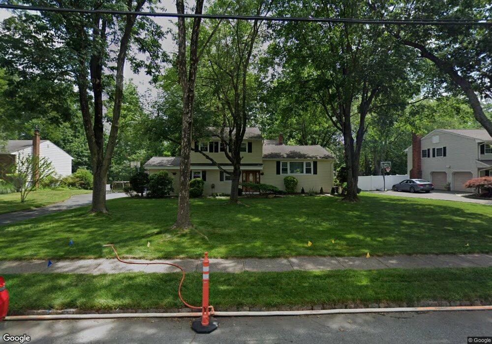
This home is located at 44 Wheatsheaf Rd, Clark, NJ 07066 and is currently estimated at $780,170, approximately $390 per square foot. 44 Wheatsheaf Rd is a home located in Union County with nearby schools including Frank K. Hehnly Elementary School, Carl H. Kumpf Middle School, and Arthur L. Johnson High School.
Ownership History
We collect this data history from publicly available records. To have your information removed, we recommend requesting removal directly through your county’s website.
Purchase Details
Home Financials for this Owner
Home Financials are based on the most recent Mortgage that was taken out on this home.Home Values in the Area
Average Home Value in this Area
Purchase History
We collect this data history from publicly available records. To have your information removed, we recommend requesting removal directly through your county’s website.
| Date | Buyer | Sale Price | Title Company |
|---|---|---|---|
| $283,000 | First American Title Ins Co |
Mortgage History
We collect this data history from publicly available records. To have your information removed, we recommend requesting removal directly through your county’s website.
| Date | Status | Borrower | Loan Amount |
|---|---|---|---|
| Open | $178,000 |
Tax History
We collect this data history from publicly available records. To have your information removed, we recommend requesting removal directly through your county’s website.
| Year | Tax Paid | Tax Assessment Tax Assessment Total Assessment is a certain percentage of the fair market value that is determined by local assessors to be the total taxable value of land and additions on the property. | Land | Improvement |
|---|---|---|---|---|
| 2025 | $10,222 | $461,700 | $240,000 | $221,700 |
| 2024 | $10,070 | $461,700 | $240,000 | $221,700 |
| 2023 | $10,070 | $461,700 | $240,000 | $221,700 |
| 2022 | $9,779 | $461,700 | $240,000 | $221,700 |
| 2021 | $12,037 | $135,400 | $52,000 | $83,400 |
| 2020 | $11,841 | $135,400 | $52,000 | $83,400 |
| 2019 | $11,722 | $135,400 | $52,000 | $83,400 |
| 2018 | $11,581 | $135,400 | $52,000 | $83,400 |
| 2017 | $11,395 | $135,400 | $52,000 | $83,400 |
| 2016 | $10,976 | $135,400 | $52,000 | $83,400 |
| 2015 | $10,865 | $135,400 | $52,000 | $83,400 |
| 2014 | $10,636 | $135,400 | $52,000 | $83,400 |
Map
- 372 Willow Way
- 212 Oxford Rd
- 110 Normandy Rd
- 70 Oxford Rd
- 196 W Grant Ave
- 213 Normandy Rd
- 184 Stonehenge Terrace
- 17 Schwinn Dr
- 1168 Lake Ave Unit 6
- 3 Harvey Ct Unit 3
- 41 Harvey Ct
- 248 W Prescott Ave
- 4 Visco Dr
- 37 Hall Dr
- 232 W Shirley Ave
- 61 Cypress Dr
- 236 W Shirley Ave
- 49 Hall Dr
- 48 Morningside Rd
- 75 Lancaster Rd
- 52 Wheatsheaf Rd
- 36 Wheatsheaf Rd
- 51 Brookside Terrace
- 45 Brookside Terrace
- 244 Laurel Ln
- 28 Wheatsheaf Rd
- 243 Laurel Ln
- 57 Brookside Terrace
- 39 Brookside Terrace
- 250 Laurel Ln
- 33 Brookside Terrace
- 68 Wheatsheaf Rd
- 22 Wheatsheaf Rd
- 249 Laurel Ln
- 21 Wheatsheaf Rd
- 65 Wheatsheaf Rd
- 27 Brookside Terrace
- 258 Laurel Ln
- 76 Wheatsheaf Rd
- 257 Laurel Ln
Ask me questions while you tour the home.