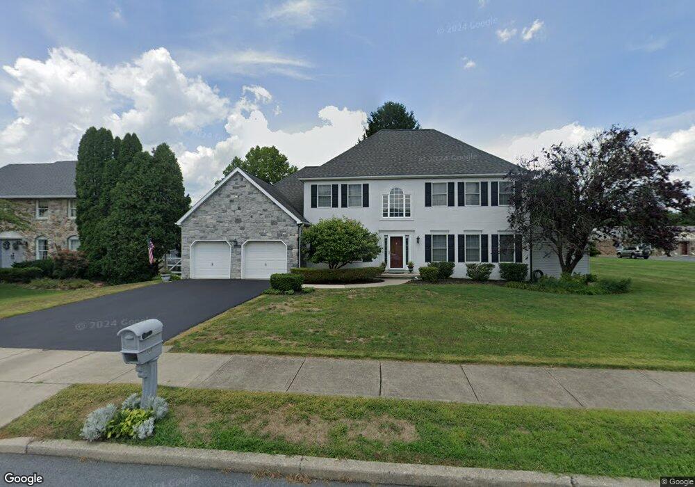
440 Bridle Path Rd Bethlehem, PA 18017
Estimated Value: $657,998 - $799,000
4
Beds
3
Baths
3,057
Sq Ft
$234/Sq Ft
Est. Value
About This Home
This home is located at 440 Bridle Path Rd, Bethlehem, PA 18017 and is currently estimated at $715,750, approximately $234 per square foot. 440 Bridle Path Rd is a home located in Northampton County with nearby schools including Asa Packer Elementary School, Nitschmann Middle School, and Liberty High School.
Ownership History
Date
Name
Owned For
Owner Type
Purchase Details
Closed on
Aug 25, 2008
Sold by
Gallo Carmen M and Gallo Shelly R
Bought by
Scaff David W and Strockoz Scaff Laurie L
Current Estimated Value
Purchase Details
Closed on
Mar 25, 2003
Sold by
Amato Robert
Bought by
Gallo Carmen
Home Financials for this Owner
Home Financials are based on the most recent Mortgage that was taken out on this home.
Original Mortgage
$272,000
Interest Rate
5.9%
Mortgage Type
New Conventional
Create a Home Valuation Report for This Property
The Home Valuation Report is an in-depth analysis detailing your home's value as well as a comparison with similar homes in the area
Home Values in the Area
Average Home Value in this Area
Purchase History
We collect this data history from publicly available records. To have your information removed, we recommend requesting removal directly through your county’s website.
| Date | Buyer | Sale Price | Title Company |
|---|---|---|---|
| Scaff David W | $385,000 | None Available | |
| Gallo Carmen | $340,000 | -- |
Source: Public Records
Mortgage History
We collect this data history from publicly available records. To have your information removed, we recommend requesting removal directly through your county’s website.
| Date | Status | Borrower | Loan Amount |
|---|---|---|---|
| Previous Owner | Gallo Carmen | $272,000 |
Source: Public Records
Tax History
| Year | Tax Paid | Tax Assessment Tax Assessment Total Assessment is a certain percentage of the fair market value that is determined by local assessors to be the total taxable value of land and additions on the property. | Land | Improvement |
|---|---|---|---|---|
| 2026 | $1,432 | $132,600 | $40,600 | $92,000 |
| 2025 | $1,432 | $132,600 | $40,600 | $92,000 |
| 2024 | $9,667 | $132,600 | $40,600 | $92,000 |
| 2023 | $9,700 | $132,600 | $40,600 | $92,000 |
| 2022 | $9,608 | $132,600 | $40,600 | $92,000 |
| 2021 | $9,530 | $132,600 | $40,600 | $92,000 |
| 2020 | $9,542 | $132,600 | $40,600 | $92,000 |
| 2019 | $9,503 | $132,600 | $40,600 | $92,000 |
| 2018 | $9,315 | $132,600 | $40,600 | $92,000 |
| 2017 | $9,249 | $132,600 | $40,600 | $92,000 |
| 2016 | -- | $132,600 | $40,600 | $92,000 |
| 2015 | -- | $132,600 | $40,600 | $92,000 |
| 2014 | -- | $132,600 | $40,600 | $92,000 |
Source: Public Records
Map
Nearby Homes
- 801 Yorkshire Rd
- 2713 Center St
- 2821 Center St
- 2618 Ambassador Dr
- 951 W MacAda Rd
- 3032 Center St
- 1045 Resolution Dr
- 200 Bella Vista Dr
- 2277 Main St
- 2840 Jacksonville Rd
- 1220 Oakwood Dr
- 2708 Bridle Path Place
- 0 Rosewood Dr Unit 766427
- 2630 Jacksonville Rd
- 706 Overlook Dr
- 2640 Belaire Rd
- 1205 Alyssa Place Unit lot 7
- 1860 Rosewood Dr
- 1535 Ciara Dr
- 1455 Wynnewood Dr
- 450 Bridle Path Rd
- 452 Sugar Maple Ct
- 430 Bridle Path Rd
- 440 Sugar Maple Ct
- 462 Sugar Maple Ct
- 470 Bridle Path Rd
- 472 Sugar Maple Ct
- 453 Sugar Maple Ct
- 2820 Cross Creek Rd
- 463 Sugar Maple Ct
- 492 Sugar Maple Ct
- 473 Sugar Maple Ct
- 473 Sugar Maple Ct
- 483 Sugar Maple Ct
- 2825 Cross Creek Rd
- 2835 Cross Creek Rd
- 2855 Cross Creek Rd
- 234 Wedgewood Rd
- 224 Wedgewood Rd
- 540 Bridle Path Rd
Your Personal Tour Guide
Ask me questions while you tour the home.