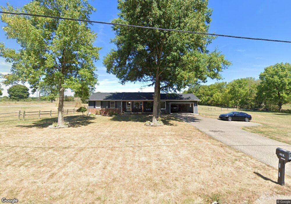
440 Coonpath Rd NE Lancaster, OH 43130
Estimated Value: $352,000 - $405,000
3
Beds
3
Baths
1,400
Sq Ft
$268/Sq Ft
Est. Value
About This Home
This home is located at 440 Coonpath Rd NE, Lancaster, OH 43130 and is currently estimated at $375,867, approximately $268 per square foot. 440 Coonpath Rd NE is a home located in Fairfield County.
Ownership History
Date
Name
Owned For
Owner Type
Purchase Details
Closed on
Jul 10, 2025
Sold by
Rawn Eric E
Bought by
Rawn Holden L and Davis Beth E
Current Estimated Value
Home Financials for this Owner
Home Financials are based on the most recent Mortgage that was taken out on this home.
Original Mortgage
$315,000
Outstanding Balance
$314,471
Interest Rate
6.89%
Mortgage Type
New Conventional
Estimated Equity
$61,396
Purchase Details
Closed on
Oct 27, 2022
Sold by
Ralph P Rawn Trust and Jennie A Rawn Trust
Bought by
Rawn Eric E
Home Financials for this Owner
Home Financials are based on the most recent Mortgage that was taken out on this home.
Original Mortgage
$265,000
Interest Rate
6.7%
Mortgage Type
New Conventional
Purchase Details
Closed on
May 15, 2007
Sold by
Rawn Ralph P and Rawn Jennie A
Bought by
Rawn Ralph P and Rawn Jennie A
Create a Home Valuation Report for This Property
The Home Valuation Report is an in-depth analysis detailing your home's value as well as a comparison with similar homes in the area
Purchase History
| Date | Buyer | Sale Price | Title Company |
|---|---|---|---|
| Rawn Holden L | $350,000 | None Listed On Document | |
| Rawn Eric E | $275,000 | Hocking Valley Title | |
| Rawn Ralph P | -- | Attorney |
Source: Public Records
Mortgage History
| Date | Status | Borrower | Loan Amount |
|---|---|---|---|
| Open | Rawn Holden L | $315,000 | |
| Previous Owner | Rawn Eric E | $265,000 |
Source: Public Records
Tax History
| Year | Tax Paid | Tax Assessment Tax Assessment Total Assessment is a certain percentage of the fair market value that is determined by local assessors to be the total taxable value of land and additions on the property. | Land | Improvement |
|---|---|---|---|---|
| 2025 | $8,578 | $143,670 | $50,600 | $93,070 |
| 2024 | $8,578 | $106,300 | $32,300 | $74,000 |
| 2023 | $4,736 | $106,300 | $32,300 | $74,000 |
| 2022 | $4,303 | $106,300 | $32,300 | $74,000 |
| 2021 | $3,323 | $82,610 | $26,920 | $55,690 |
| 2020 | $3,363 | $82,610 | $26,920 | $55,690 |
| 2019 | $3,377 | $82,610 | $26,920 | $55,690 |
| 2018 | $2,451 | $64,350 | $21,530 | $42,820 |
| 2017 | $2,300 | $63,770 | $21,530 | $42,240 |
| 2016 | $2,232 | $63,770 | $21,530 | $42,240 |
| 2015 | $2,149 | $60,330 | $21,530 | $38,800 |
| 2014 | $2,055 | $60,330 | $21,530 | $38,800 |
| 2013 | $2,055 | $60,330 | $21,530 | $38,800 |
Source: Public Records
Map
Nearby Homes
- 0 Tschopp Rd NE Unit Lot 17 225027320
- 0 Tschopp Rd NE Unit Lot 33 225027324
- 0 Fremar Rd NE Unit Lot1 225007256
- 245 Rainbow Dr NE
- 850 Marquette Dr NE
- 0 Marquette Dr NE Unit Lot 16 225027323
- 0 Marquette Dr NE Unit Lot 5
- 0 Marquette Dr NE Unit Lot 4 225007276
- 2370 Scenic Dr NE
- 4070 Tschopp Rd NE
- 1826 Pleasantview Dr NE
- 0 Old Millersport Rd NE Unit 225010386
- 2927 Lancaster-Kirkersville Rd NW
- 1916 Country Place
- 0 Stringtown Rd NW
- 1908 Branch Place
- 3485 Lancaster-Kirkersville Rd NW
- 2065 N Glenn Dr NE
- 1101 Beechwood Dr NE
- 1295 Ginder Rd NW
- 440 Coonpath Rd NE
- 394 Coonpath Rd NE
- 505 Coonpath Rd NE
- 596 Coonpath Rd NE
- 595 Coonpath Rd NE
- 640 Coonpath Rd NE
- 637 Coonpath Rd NE
- 270 Coonpath Rd NE
- 260 Coonpath Rd NE
- 180 Coonpath Rd NE
- 228 Coonpath Rd NE
- 664 Coonpath Rd NE
- 334 Fremar Rd NE
- 665 Coonpath Rd NE
- 685 Coonpath Rd NE
- 174 Coonpath Rd NE
- 713 Coonpath Rd NE
- 734 Coonpath Rd NE
- 182 Coonpath Rd NE
- 772 Coonpath Rd NE
Your Personal Tour Guide
Ask me questions while you tour the home.