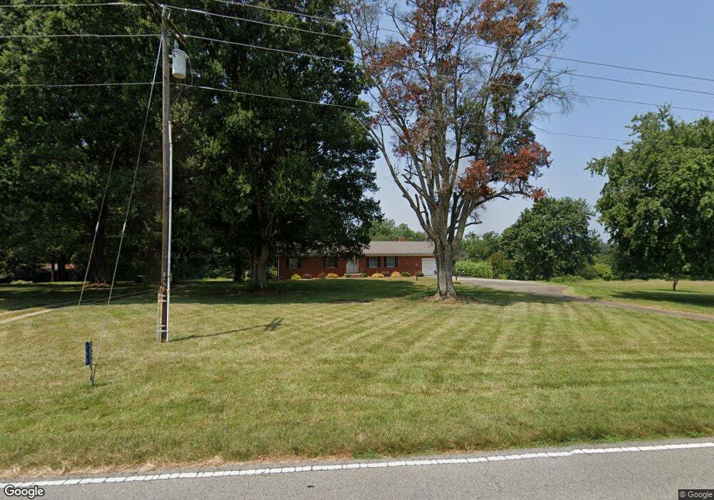
440 White Rd Mount Ulla, NC 28125
Estimated Value: $364,000 - $546,000
Studio
3
Baths
2,033
Sq Ft
$223/Sq Ft
Est. Value
About This Home
This home is located at 440 White Rd, Mount Ulla, NC 28125 and is currently estimated at $454,326, approximately $223 per square foot. 440 White Rd is a home located in Rowan County with nearby schools including Mount Ulla Elementary School, West Rowan Middle School, and West Rowan High School.
Ownership History
Date
Name
Owned For
Owner Type
Purchase Details
Closed on
Jul 11, 2013
Sold by
Hall Mary H
Bought by
Hall Edward L
Current Estimated Value
Home Financials for this Owner
Home Financials are based on the most recent Mortgage that was taken out on this home.
Original Mortgage
$170,000
Interest Rate
3.91%
Mortgage Type
New Conventional
Create a Home Valuation Report for This Property
The Home Valuation Report is an in-depth analysis detailing your home's value as well as a comparison with similar homes in the area
Purchase History
We collect this data history from publicly available records. To have your information removed, we recommend requesting removal directly through your county’s website.
| Date | Buyer | Sale Price | Title Company |
|---|---|---|---|
| Hall Edward L | -- | None Available |
Source: Public Records
Mortgage History
We collect this data history from publicly available records. To have your information removed, we recommend requesting removal directly through your county’s website.
| Date | Status | Borrower | Loan Amount |
|---|---|---|---|
| Closed | Hall Edward L | $170,000 |
Source: Public Records
Tax History
| Year | Tax Paid | Tax Assessment Tax Assessment Total Assessment is a certain percentage of the fair market value that is determined by local assessors to be the total taxable value of land and additions on the property. | Land | Improvement |
|---|---|---|---|---|
| 2025 | $2,126 | $313,775 | $91,318 | $222,457 |
| 2024 | $2,126 | $313,775 | $91,318 | $222,457 |
| 2023 | $2,126 | $313,775 | $91,318 | $222,457 |
| 2022 | $1,634 | $216,438 | $75,061 | $141,377 |
| 2021 | $1,618 | $216,438 | $75,061 | $141,377 |
| 2020 | $1,618 | $216,438 | $75,061 | $141,377 |
| 2019 | $1,618 | $216,438 | $75,061 | $141,377 |
| 2018 | $1,508 | $203,437 | $75,060 | $128,377 |
| 2017 | $1,508 | $203,437 | $75,060 | $128,377 |
| 2016 | $1,508 | $203,437 | $75,060 | $128,377 |
| 2015 | $1,526 | $203,437 | $75,060 | $128,377 |
| 2014 | $1,495 | $209,159 | $75,060 | $134,099 |
Source: Public Records
Map
Nearby Homes
- 0 White Rd
- 250 Goldenrod Cir
- 1015 Coppergate Dr
- 1070 Castle Mill Ln
- 1055 Coppergate Dr
- 1155 Coppergate Dr
- 185 Goldenrod Cir
- 109 Beechwood Dr
- 7195 Mooresville Rd
- 1033 Stonegate Dr
- 0 Trinity Ct
- 1225 Coppergate Dr
- 153 Trinity Ct
- 1063 Stonegate Dr
- 1075 Stonegate Dr
- 1105 Coppergate Dr
- 1115 Stonegate Dr
- 170 Saint James Way
- 152 Old Bailey Ct
- 194 Trinity Ct Unit 164
- 445 White Rd
- 830 White Rd Unit BOB
- 220 White Rd
- 300 Sloan Rd
- 8612 Mooresville Rd
- 180 White Rd
- 160 White Rd
- 240 Sloan Rd
- 130 White Rd
- 220 Sloan Rd
- 180 Sloan Rd
- 8706 Mooresville Rd
- 260 Sloan Rd
- 120 White Rd
- 8712 Mooresville Rd
- 8609 Mooresville Rd
- 8711 Mooresville Rd
- 8811 Mooresville Rd
- 655 Kerr Mill Rd
- 9006 Mooresville Rd
Your Personal Tour Guide
Ask me questions while you tour the home.