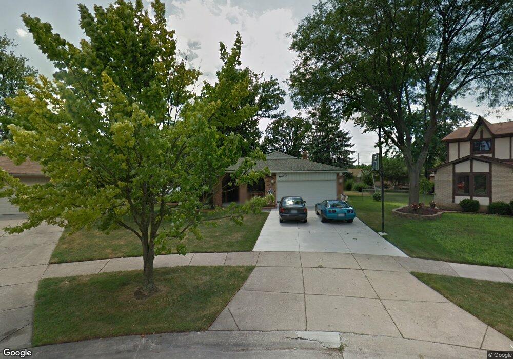
44133 Yorkshire Dr Canton, MI 48187
Estimated Value: $349,315 - $387,000
Studio
2
Baths
1,710
Sq Ft
$216/Sq Ft
Est. Value
About This Home
This home is located at 44133 Yorkshire Dr, Canton, MI 48187 and is currently estimated at $369,579, approximately $216 per square foot. 44133 Yorkshire Dr is a home located in Wayne County with nearby schools including Canton High School, Discovery Middle School, and Salem High School.
Ownership History
Date
Name
Owned For
Owner Type
Purchase Details
Closed on
Mar 18, 2010
Sold by
Rauch Donald and Rauch Elaine
Bought by
Rauch Donald W and Donald W Rauch Trust
Current Estimated Value
Purchase Details
Closed on
Jun 23, 1994
Sold by
Arcenal Edgardo C
Bought by
Arcenal Edgardo
Home Financials for this Owner
Home Financials are based on the most recent Mortgage that was taken out on this home.
Original Mortgage
$70,000
Interest Rate
8.6%
Mortgage Type
New Conventional
Create a Home Valuation Report for This Property
The Home Valuation Report is an in-depth analysis detailing your home's value as well as a comparison with similar homes in the area
Home Values in the Area
Average Home Value in this Area
Purchase History
| Date | Buyer | Sale Price | Title Company |
|---|---|---|---|
| Rauch Donald W | -- | None Available | |
| Arcenal Edgardo | $125,000 | -- |
Source: Public Records
Mortgage History
| Date | Status | Borrower | Loan Amount |
|---|---|---|---|
| Closed | Arcenal Edgardo | $70,000 |
Source: Public Records
Tax History
| Year | Tax Paid | Tax Assessment Tax Assessment Total Assessment is a certain percentage of the fair market value that is determined by local assessors to be the total taxable value of land and additions on the property. | Land | Improvement |
|---|---|---|---|---|
| 2025 | $2,162 | $198,300 | $0 | $0 |
| 2024 | $2,101 | $188,500 | $0 | $0 |
| 2023 | $2,003 | $165,200 | $0 | $0 |
| 2022 | $4,475 | $152,800 | $0 | $0 |
| 2021 | $4,337 | $148,300 | $0 | $0 |
| 2020 | $4,272 | $140,200 | $0 | $0 |
| 2019 | $4,197 | $131,150 | $0 | $0 |
| 2018 | $1,702 | $123,460 | $0 | $0 |
| 2017 | $4,389 | $121,800 | $0 | $0 |
| 2016 | $3,843 | $117,500 | $0 | $0 |
| 2015 | $9,353 | $105,510 | $0 | $0 |
| 2013 | $9,061 | $94,580 | $0 | $0 |
| 2010 | -- | $91,820 | $48,819 | $43,001 |
Source: Public Records
Map
Nearby Homes
- 44035 Westminister Way
- 47527 Ellery Ln
- 49772 Shoreline Dr
- 835 Coldrose Way
- 44652 Nantucket Dr
- 6852 New Providence Way Unit 104
- 6907 Harvard Ln
- 1987 E Franklin Dr Unit 65
- 44447 Savery Dr Unit 126
- 58560 Stuart Dr
- 48590 Ford Rd
- Ottawa Drive
- 1822 N Sheldon Rd
- 44528 Whitman Ave
- 44432 Newburyport Dr
- 5806 Wedgewood Rd
- 1567 Marlowe St
- 0000 Ford
- 45193 Quaker Hill Dr
- 7264 Irongate Rd
- 6205 Guilford Dr
- 44119 Yorkshire Dr
- 44150 Westminister Way
- 44136 Westminister Way
- 6140 Gloucester Dr
- 44122 Westminister Way
- 6217 Guilford Dr
- 6152 Gloucester Dr
- 6124 Gloucester Dr
- 44170 Westminister Way
- 44105 Yorkshire Dr
- 6164 Gloucester Dr
- 44108 Westminister Way
- 6231 Guilford Dr
- 44097 Yorkshire Dr
- 6176 Gloucester Dr
- 44094 Westminister Way
- 44110 Yorkshire Dr
- 6245 Guilford Dr
- 6232 Guilford Dr
Your Personal Tour Guide
Ask me questions while you tour the home.