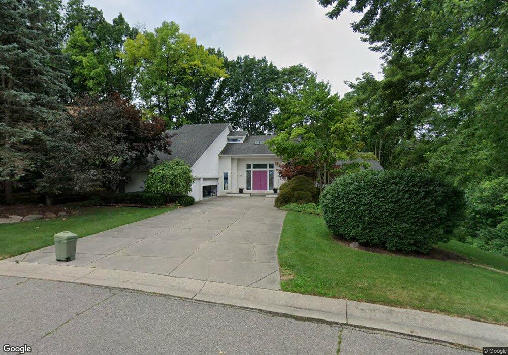
4415 Rolling Pine Dr West Bloomfield, MI 48323
West Bloomfield Township NeighborhoodEstimated Value: $561,000 - $782,000
4
Beds
5
Baths
3,291
Sq Ft
$205/Sq Ft
Est. Value
About This Home
This home is located at 4415 Rolling Pine Dr, West Bloomfield, MI 48323 and is currently estimated at $674,122, approximately $204 per square foot. 4415 Rolling Pine Dr is a home located in Oakland County with nearby schools including Walled Lake Central High School, The Susan And Rabbi Harold Loss Ecc, and Brookfield Academy - West Bloomfield.
Ownership History
Date
Name
Owned For
Owner Type
Purchase Details
Closed on
Apr 12, 2018
Sold by
Clark J Curtis and Clark Carolyn A
Bought by
Clark J Curtis and Clark Carolyn A
Current Estimated Value
Purchase Details
Closed on
May 16, 2005
Sold by
Berman Sam and Berman Minnie
Bought by
Clark J Curtis and Clark Carolyn A
Create a Home Valuation Report for This Property
The Home Valuation Report is an in-depth analysis detailing your home's value as well as a comparison with similar homes in the area
Home Values in the Area
Average Home Value in this Area
Purchase History
We collect this data history from publicly available records. To have your information removed, we recommend requesting removal directly through your county’s website.
| Date | Buyer | Sale Price | Title Company |
|---|---|---|---|
| Clark J Curtis | -- | None Available | |
| Clark J Curtis | -- | Metropolitan Title Company |
Source: Public Records
Tax History
| Year | Tax Paid | Tax Assessment Tax Assessment Total Assessment is a certain percentage of the fair market value that is determined by local assessors to be the total taxable value of land and additions on the property. | Land | Improvement |
|---|---|---|---|---|
| 2025 | $8,855 | $344,860 | $26,750 | $318,110 |
| 2024 | $5,113 | $340,890 | $0 | $0 |
| 2022 | $4,821 | $313,990 | $26,750 | $287,240 |
| 2021 | $7,933 | $323,990 | $0 | $0 |
| 2020 | $4,764 | $317,640 | $26,750 | $290,890 |
| 2018 | $7,730 | $274,400 | $26,450 | $247,950 |
| 2015 | -- | $230,720 | $0 | $0 |
| 2014 | -- | $216,140 | $0 | $0 |
| 2011 | -- | $204,500 | $0 | $0 |
Source: Public Records
Map
Nearby Homes
- 4442 Rolling Pine Dr
- 4383 Green Lake Rd
- 0000 Kress Rd
- 6426 Country Shire Ln
- 4860 Pelican Way
- 6390 Country Shire Ln
- 6912 Colony Dr
- 4769 Halsted Rd
- 6978 Colony Dr
- 3991 Fieldview Ave
- 7080 Colony Dr
- 3965 Carrick Ave
- 6903 Dandison Blvd
- 4212 Greendale Ave
- 5146 Lagoons Cir Unit 22
- 6100 Pontiac Trail
- 6140 Pontiac Trail
- 3705 Sancroft Ave
- 4502 Forest Edge Ln
- 5140 Woodrun Ct
- 4409 Rolling Pine Dr
- 4461 Borland St
- 4481 Borland St
- 4418 Rolling Pine Dr
- 4403 Rolling Pine Dr
- 4437 Borland St
- 4406 Rolling Pine Dr
- 0000 Renshaw St
- 0000 Renshaw St
- 0 Renshaw Unit 4913859
- 0 Renshaw Unit 4913858
- 0 Renshaw Unit 4921592
- 0 Renshaw Unit 4922453
- 0 Renshaw Unit 214066630
- 0 Renshaw Unit 214066595
- 0 Renshaw Unit 214105189
- 0 Renshaw Unit 214105177
- 4495 Borland St
- 4454 Borland St
- 4425 Borland St
Your Personal Tour Guide
Ask me questions while you tour the home.