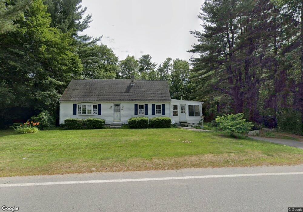
442 Dunstable Rd Tyngsboro, MA 01879
Estimated Value: $534,000 - $627,000
About This Home
This home is located at 442 Dunstable Rd, Tyngsboro, MA 01879 and is currently estimated at $594,247, approximately $347 per square foot. 442 Dunstable Rd is a home located in Middlesex County with nearby schools including Tyngsborough Elementary School, Tyngsborough Middle School, and Tyngsborough High School.
Ownership History
We collect this data history from publicly available records. To have your information removed, we recommend requesting removal directly through your county’s website.
Purchase Details
Home Financials for this Owner
Home Financials are based on the most recent Mortgage that was taken out on this home.Purchase Details
Home Financials for this Owner
Home Financials are based on the most recent Mortgage that was taken out on this home.Purchase Details
Purchase Details
Home Financials for this Owner
Home Financials are based on the most recent Mortgage that was taken out on this home.Purchase Details
Purchase Details
Home Values in the Area
Average Home Value in this Area
Purchase History
We collect this data history from publicly available records. To have your information removed, we recommend requesting removal directly through your county’s website.
| Date | Buyer | Sale Price | Title Company |
|---|---|---|---|
| $288,000 | -- | ||
| $225,000 | -- | ||
| -- | -- | ||
| -- | -- | ||
| -- | -- | ||
| $128,000 | -- |
Mortgage History
We collect this data history from publicly available records. To have your information removed, we recommend requesting removal directly through your county’s website.
| Date | Status | Borrower | Loan Amount |
|---|---|---|---|
| Open | $288,000 | ||
| Previous Owner | $225,000 | ||
| Previous Owner | $276,000 | ||
| Previous Owner | $159,000 | ||
| Previous Owner | $30,000 | ||
| Previous Owner | $112,000 |
Tax History
We collect this data history from publicly available records. To have your information removed, we recommend requesting removal directly through your county’s website.
| Year | Tax Paid | Tax Assessment Tax Assessment Total Assessment is a certain percentage of the fair market value that is determined by local assessors to be the total taxable value of land and additions on the property. | Land | Improvement |
|---|---|---|---|---|
| 2025 | $5,992 | $485,600 | $209,300 | $276,300 |
| 2024 | $5,705 | $448,500 | $199,400 | $249,100 |
| 2023 | $5,499 | $388,900 | $165,900 | $223,000 |
| 2022 | $5,225 | $349,700 | $144,100 | $205,600 |
| 2021 | $0 | $317,200 | $130,300 | $186,900 |
| 2020 | $10,124 | $314,800 | $130,300 | $184,500 |
| 2019 | $4,954 | $292,600 | $124,400 | $168,200 |
| 2018 | $9,319 | $273,900 | $124,400 | $149,500 |
| 2017 | $9,388 | $267,800 | $124,400 | $143,400 |
| 2016 | $4,167 | $237,300 | $104,700 | $132,600 |
| 2015 | $4,025 | $237,300 | $104,700 | $132,600 |
Map
- 20 Constantine Dr
- 15 Cannongate Rd Unit 34
- 17 Cannongate Rd Unit 92
- 20 Emerald St
- 160 Westford Rd
- 0 Dunstable Rd
- 43 Flint Rd
- 3 Poe Cir
- 41 Chestnut Rd
- 0 Lowell St
- 21 Sandstone Rd
- 46 Pawtucket Blvd Unit 32
- 91 Riley Rd Unit 91
- 87 Riley Rd Unit 87
- 22 Merrimac Way Unit B
- 27 Riley Rd Unit 27
- 49 Riley Rd Unit 25
- 40 Sherburne Ave
- 26 Worden Rd
- 506 Cardinal Ln Unit 506F
- 438 Dunstable Rd
- 447 Dunstable Rd
- 446 Dunstable Rd
- 441 Dunstable Rd
- 436 Dunstable Rd
- 451 Dunstable Rd
- 435 Dunstable Rd
- 450 Dunstable Rd
- 448 Dunstable Rd
- 434 Dunstable Rd
- 4 Kristen Way
- 452 Dunstable Rd
- 56 Constatine Dr
- 0LOT3 Mackie Dr
- 453 Dunstable Rd
- 56 Constantine Dr
- 56 Constantine Dr
- 4 Mackey Dr
- 3 Mackey Dr
- 52 Constantine Dr
Ask me questions while you tour the home.