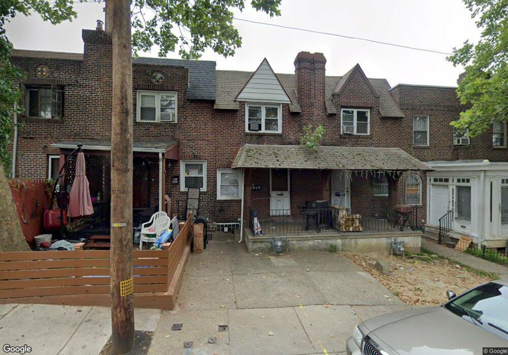
442 Glendale Rd Upper Darby, PA 19082
Estimated Value: $114,000 - $160,442
About This Home
This home is located at 442 Glendale Rd, Upper Darby, PA 19082 and is currently estimated at $137,861, approximately $126 per square foot. 442 Glendale Rd is a home located in Delaware County with nearby schools including Upper Darby Kdg Center, Upper Darby High School, and KIPP West Philadelphia Preparatory Chart.
Ownership History
We collect this data history from publicly available records. To have your information removed, we recommend requesting removal directly through your county’s website.
Purchase Details
Home Financials for this Owner
Home Financials are based on the most recent Mortgage that was taken out on this home.Purchase Details
Home Financials for this Owner
Home Financials are based on the most recent Mortgage that was taken out on this home.Purchase Details
Purchase Details
Purchase Details
Home Values in the Area
Average Home Value in this Area
Purchase History
We collect this data history from publicly available records. To have your information removed, we recommend requesting removal directly through your county’s website.
| Date | Buyer | Sale Price | Title Company |
|---|---|---|---|
| $115,000 | Choice One Abstract | ||
| $105,000 | None Listed On Document | ||
| -- | Attorney | ||
| $70,500 | None Available | ||
| -- | -- |
Mortgage History
We collect this data history from publicly available records. To have your information removed, we recommend requesting removal directly through your county’s website.
| Date | Status | Borrower | Loan Amount |
|---|---|---|---|
| Open | $125,000 | ||
| Previous Owner | $110,000 |
Tax History
We collect this data history from publicly available records. To have your information removed, we recommend requesting removal directly through your county’s website.
| Year | Tax Paid | Tax Assessment Tax Assessment Total Assessment is a certain percentage of the fair market value that is determined by local assessors to be the total taxable value of land and additions on the property. | Land | Improvement |
|---|---|---|---|---|
| 2026 | $3,002 | $67,580 | $13,460 | $54,120 |
| 2025 | $2,858 | $67,580 | $13,460 | $54,120 |
| 2024 | $2,858 | $67,580 | $13,460 | $54,120 |
| 2023 | $2,831 | $67,580 | $13,460 | $54,120 |
| 2022 | $2,755 | $67,580 | $13,460 | $54,120 |
| 2021 | $3,715 | $67,580 | $13,460 | $54,120 |
| 2020 | $2,313 | $35,750 | $12,240 | $23,510 |
| 2019 | $2,272 | $35,750 | $12,240 | $23,510 |
| 2018 | $2,246 | $35,750 | $0 | $0 |
| 2017 | $2,187 | $35,750 | $0 | $0 |
| 2016 | $196 | $42,330 | $0 | $0 |
| 2015 | $232 | $42,330 | $0 | $0 |
| 2014 | $232 | $42,330 | $0 | $0 |
Map
- 438 Glendale Rd
- 434 Hampden Rd
- 418 Littlecroft Rd Unit 6A
- 309 Hampden Rd
- 313 Hampden Rd
- 411 Millbank Rd
- 431 Millbank Rd
- 519 Littlecroft Rd
- 7206 Spruce St
- 510 Millbank Rd
- 402 Long Ln
- 501 Millbank Rd
- 7143 Guilford Rd
- 58 Gilpin Rd
- 212 Copley Rd
- 75 Lamport Rd
- 246 Wiltshire Rd
- 7243 Calvin Rd
- 419 Gilpin Rd
- 46 Lamport Rd
Ask me questions while you tour the home.