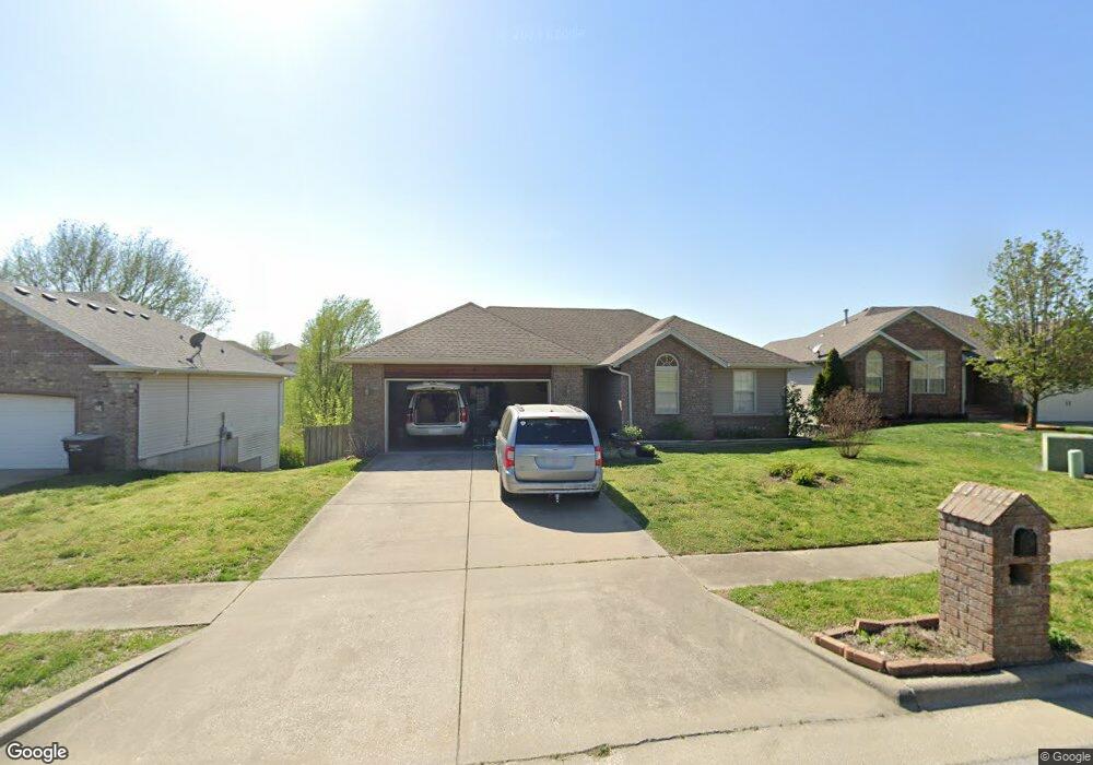
4425 N Branavy Ave Springfield, MO 65803
Estimated Value: $316,000 - $344,000
About This Home
This home is located at 4425 N Branavy Ave, Springfield, MO 65803 and is currently estimated at $331,339, approximately $122 per square foot. 4425 N Branavy Ave is a home located in Greene County with nearby schools including Truman Elementary School, Pleasant View K-8 School, and Hillcrest High School.
Ownership History
We collect this data history from publicly available records. To have your information removed, we recommend requesting removal directly through your county’s website.
Purchase Details
Purchase Details
Home Financials for this Owner
Home Financials are based on the most recent Mortgage that was taken out on this home.Purchase Details
Home Financials for this Owner
Home Financials are based on the most recent Mortgage that was taken out on this home.Purchase History
We collect this data history from publicly available records. To have your information removed, we recommend requesting removal directly through your county’s website.
| Date | Buyer | Sale Price | Title Company |
|---|---|---|---|
| -- | None Available | ||
| -- | None Available | ||
| -- | None Available |
Mortgage History
We collect this data history from publicly available records. To have your information removed, we recommend requesting removal directly through your county’s website.
| Date | Status | Borrower | Loan Amount |
|---|---|---|---|
| Closed | $38,500 | ||
| Previous Owner | $162,710 |
Tax History
We collect this data history from publicly available records. To have your information removed, we recommend requesting removal directly through your county’s website.
| Year | Tax Paid | Tax Assessment Tax Assessment Total Assessment is a certain percentage of the fair market value that is determined by local assessors to be the total taxable value of land and additions on the property. | Land | Improvement |
|---|---|---|---|---|
| 2025 | $2,451 | $45,330 | $5,700 | $39,630 |
| 2024 | $2,180 | $37,660 | $3,420 | $34,240 |
| 2023 | $2,169 | $37,660 | $3,420 | $34,240 |
| 2022 | $1,996 | $33,970 | $3,420 | $30,550 |
| 2021 | $1,909 | $33,970 | $3,420 | $30,550 |
| 2020 | $1,943 | $32,810 | $3,420 | $29,390 |
| 2019 | $1,888 | $32,810 | $3,420 | $29,390 |
| 2018 | $1,778 | $30,740 | $3,420 | $27,320 |
| 2017 | $1,762 | $30,170 | $3,420 | $26,750 |
| 2016 | $1,726 | $30,170 | $3,420 | $26,750 |
| 2015 | $1,713 | $30,170 | $3,420 | $26,750 |
| 2014 | $1,707 | $29,890 | $3,420 | $26,470 |
Map
- 4377 N Toby Ave
- 923 E Bluff Dr
- 441 W Farm Road 96
- 440 E Farm Road 84
- 555 E Farm Road 84
- 621 Meadowgate Dr
- 3746 N Croswell Ave
- 3983 N Courtney Cir
- 3713 N Croswell Ave
- 1348 E Arlington St
- 3630 N Thistlewood Ct
- 3669 N Oak Point Ave
- 1050 E Camorene St
- 3751 N Pauls Place
- 3879 N Williams Ct
- 856 874 E Farm Road 80
- 4260 N State Highway H
- 3304 N National Ave
- 1113 E Smith St
- 1115 E Smith St
- 4437 N Branavy Ave
- 4401 N Branavy Ave
- 4438 N Shirley Ave
- 4449 N Branavy Ave
- 4461 N Branavy Ave
- 0 Ashcroft Estates 2nd Unit 11100129
- 0 Ashcroft Estates 2nd Unit 11100130
- 0 Ashcroft Estates 2nd Unit 11100119
- 0 Ashcroft Estates 2nd Unit 11100117
- 0 Ashcroft Estates 2nd Unit 11100118
- 0 Ashcroft Estates 2nd Unit 11100116
- 0 Ashcroft Estates 2nd Unit 11100123
- 0 Ashcroft Estates 2nd Unit 11100134
- 0 Ashcroft Estates 2nd Unit 10811986
- 0 Ashcroft Estates 2nd Unit 10811999
- 0 Ashcroft Estates 2nd Unit 10811998
- 0 Ashcroft Estates 2nd Unit 10811995
- 0 Ashcroft Estates 2nd Unit 10811992
- 0 Ashcroft Estates 2nd Unit 10811994
- 0 Ashcroft Estates 2nd Unit 10811990
Ask me questions while you tour the home.