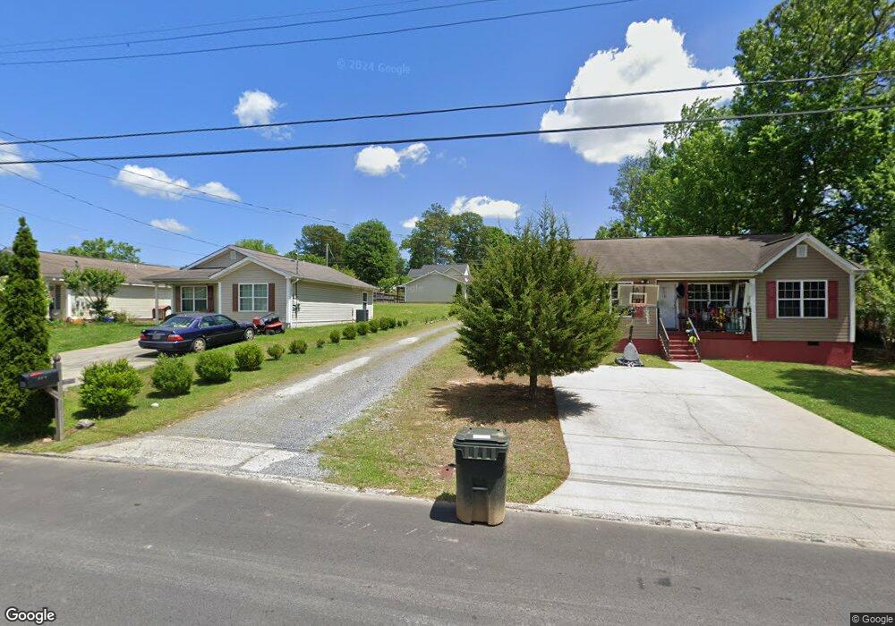
443 11th Ave Dalton, GA 30721
Estimated Value: $208,434 - $224,000
3
Beds
2
Baths
1,067
Sq Ft
$203/Sq Ft
Est. Value
About This Home
This home is located at 443 11th Ave, Dalton, GA 30721 and is currently estimated at $216,109, approximately $202 per square foot. 443 11th Ave is a home located in Whitfield County with nearby schools including Blue Ridge Elementary School, Dalton High School, and Rock Hill School.
Ownership History
Date
Name
Owned For
Owner Type
Purchase Details
Closed on
Feb 9, 2007
Sold by
Not Provided
Bought by
Serrano Jose and Martha Elba
Current Estimated Value
Home Financials for this Owner
Home Financials are based on the most recent Mortgage that was taken out on this home.
Original Mortgage
$90,500
Interest Rate
6.17%
Mortgage Type
New Conventional
Create a Home Valuation Report for This Property
The Home Valuation Report is an in-depth analysis detailing your home's value as well as a comparison with similar homes in the area
Purchase History
We collect this data history from publicly available records. To have your information removed, we recommend requesting removal directly through your county’s website.
| Date | Buyer | Sale Price | Title Company |
|---|---|---|---|
| Serrano Jose | $109,900 | -- |
Source: Public Records
Mortgage History
We collect this data history from publicly available records. To have your information removed, we recommend requesting removal directly through your county’s website.
| Date | Status | Borrower | Loan Amount |
|---|---|---|---|
| Closed | Serrano Jose | $90,500 |
Source: Public Records
Tax History
| Year | Tax Paid | Tax Assessment Tax Assessment Total Assessment is a certain percentage of the fair market value that is determined by local assessors to be the total taxable value of land and additions on the property. | Land | Improvement |
|---|---|---|---|---|
| 2025 | $1,673 | $61,511 | $8,400 | $53,111 |
| 2024 | $1,673 | $61,511 | $8,400 | $53,111 |
| 2023 | $1,132 | $36,641 | $4,000 | $32,641 |
| 2022 | $716 | $28,184 | $4,000 | $24,184 |
| 2021 | $717 | $28,184 | $4,000 | $24,184 |
| 2020 | $734 | $28,184 | $4,000 | $24,184 |
| 2019 | $752 | $28,184 | $4,000 | $24,184 |
| 2018 | $758 | $28,184 | $4,000 | $24,184 |
| 2017 | $724 | $28,184 | $4,000 | $24,184 |
| 2016 | $646 | $25,995 | $4,000 | $21,995 |
| 2014 | $952 | $35,784 | $10,080 | $25,704 |
| 2013 | -- | $35,783 | $10,080 | $25,703 |
Source: Public Records
Map
Nearby Homes
- 514 Sheridan Ave
- 1300 Ludie St
- 406 Lester Ave
- 306 Robinwood Dr
- 1104 May St
- 1007 Locke Dr
- 626 Fifth Ave
- 1902 Bartenfield Dr
- 902 Mattie Dr
- 303 Janice St
- 432 4th Ave
- 1317 Coker Dr
- 171 Keith St
- 204 N Bogle St
- 307 N Bogle St
- 143 Staten St
- 301B Fields Ave
- 825 Martin Luther King jr Blvd
- 121 Eugenia Dr
- 119 Eugenia Dr
Your Personal Tour Guide
Ask me questions while you tour the home.