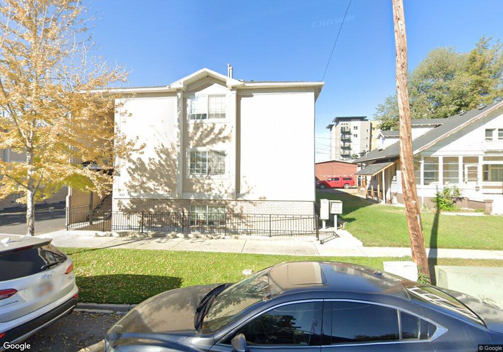
443 N 100 W Provo, UT 84601
Downtown Provo NeighborhoodEstimated Value: $265,000 - $362,000
2
Beds
1
Bath
768
Sq Ft
$392/Sq Ft
Est. Value
About This Home
This home is located at 443 N 100 W, Provo, UT 84601 and is currently estimated at $300,792, approximately $391 per square foot. 443 N 100 W is a home located in Utah County with nearby schools including Provo Peaks School, Centennial Middle School, and Timpview High School.
Ownership History
Date
Name
Owned For
Owner Type
Purchase Details
Closed on
Dec 3, 2013
Sold by
The Wursten Family Trust and Wursten John A
Bought by
Russell Daniel Clayton
Current Estimated Value
Purchase Details
Closed on
Jan 29, 1997
Sold by
Johnson Lori
Bought by
Whitney Stephen D and Robbins Gwen A
Home Financials for this Owner
Home Financials are based on the most recent Mortgage that was taken out on this home.
Original Mortgage
$63,000
Interest Rate
7.74%
Mortgage Type
FHA
Create a Home Valuation Report for This Property
The Home Valuation Report is an in-depth analysis detailing your home's value as well as a comparison with similar homes in the area
Home Values in the Area
Average Home Value in this Area
Purchase History
| Date | Buyer | Sale Price | Title Company |
|---|---|---|---|
| Russell Daniel Clayton | -- | Provo Land Title Co | |
| Whitney Stephen D | -- | -- |
Source: Public Records
Mortgage History
| Date | Status | Borrower | Loan Amount |
|---|---|---|---|
| Previous Owner | Whitney Stephen D | $63,000 |
Source: Public Records
Tax History
| Year | Tax Paid | Tax Assessment Tax Assessment Total Assessment is a certain percentage of the fair market value that is determined by local assessors to be the total taxable value of land and additions on the property. | Land | Improvement |
|---|---|---|---|---|
| 2025 | $1,394 | $148,280 | -- | -- |
| 2024 | $1,394 | $137,225 | $0 | $0 |
| 2023 | $1,414 | $137,170 | $0 | $0 |
| 2022 | $1,341 | $131,230 | $0 | $0 |
| 2021 | $1,127 | $192,400 | $23,100 | $169,300 |
| 2020 | $1,112 | $177,900 | $21,300 | $156,600 |
| 2019 | $968 | $161,000 | $21,000 | $140,000 |
| 2018 | $830 | $140,000 | $17,000 | $123,000 |
| 2017 | $746 | $69,190 | $0 | $0 |
| 2016 | $741 | $64,075 | $0 | $0 |
| 2015 | $705 | $61,600 | $0 | $0 |
| 2014 | $676 | $61,600 | $0 | $0 |
Source: Public Records
Map
Nearby Homes
- 567 N University Ave Unit 209
- 250 N 100 W Unit 109
- 620 N 100 St W
- 639 N University Ave Unit 10
- 343 W 300 N Unit 9
- 423 500 N Unit 9
- 455 N 400 St W Unit 25
- 270 N 400 W
- 136 E 400 N Unit 108
- 36 W 700 N Unit 206
- 209 N 400 W
- 466 N 200 E
- 194 N 100 E
- 380 N 200 E
- 232 E 400 N
- 142 N 100 E
- 246 N 200 E
- 232 E 300 N
- 433 N 300 E
- 394 N 300 E
- 443 N 100 W Unit 11
- 443 N 100 W
- 443 N 100 W
- 443 N 100 W
- 443 N 100 W
- 443 N 100 W
- 443 N 100 W
- 443 N 100 W
- 443 N 100 W
- 443 N 100 W Unit 1
- 443 N 100 W
- 443 N 100 W Unit 9
- 443 N 100 W Unit 5
- 443 N 100 W Unit 6
- 443 N 100 W Unit 4
- 443 N 100 W Unit 10
- 443 N 100 W Unit 2
- 443 N 100 W Unit 12
- 459 N 100 W
- 469 N 100 W
Your Personal Tour Guide
Ask me questions while you tour the home.