Estimated Value: $135,000 - $177,388
3
Beds
2
Baths
3,352
Sq Ft
$48/Sq Ft
Est. Value
About This Home
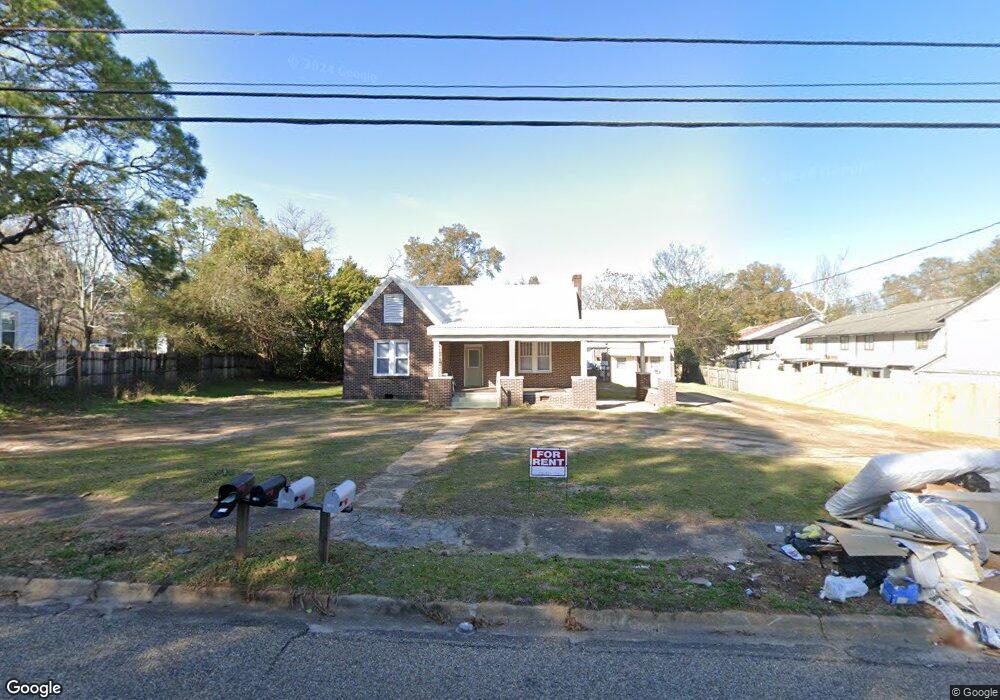
This home is located at 445 E Eufaula St Unit 451, Ozark, AL 36360 and is currently estimated at $160,097, approximately $47 per square foot. 445 E Eufaula St Unit 451 is a home located in Dale County with nearby schools including Lisenby Primary School, Mixon Intermediate School, and D. A. Smith Middle School.
Ownership History
Date
Name
Owned For
Owner Type
Purchase Details
Closed on
Dec 13, 2023
Sold by
Paseka Robert A
Bought by
Hill Country Holdings Llc
Current Estimated Value
Home Financials for this Owner
Home Financials are based on the most recent Mortgage that was taken out on this home.
Original Mortgage
$151,500
Interest Rate
7.76%
Mortgage Type
New Conventional
Purchase Details
Closed on
Dec 12, 2023
Sold by
Paseka Robert A
Bought by
Hill Country Holdings Llc
Home Financials for this Owner
Home Financials are based on the most recent Mortgage that was taken out on this home.
Original Mortgage
$151,500
Interest Rate
7.76%
Mortgage Type
New Conventional
Purchase Details
Closed on
Nov 5, 2019
Sold by
Baker Eunice and Baker Family Trust
Bought by
Paseka Robert A
Create a Home Valuation Report for This Property
The Home Valuation Report is an in-depth analysis detailing your home's value as well as a comparison with similar homes in the area
Purchase History
| Date | Buyer | Sale Price | Title Company |
|---|---|---|---|
| Hill Country Holdings Llc | $145,000 | None Listed On Document | |
| Hill Country Holdings Llc | $145,000 | None Listed On Document | |
| Paseka Robert A | $80,750 | None Available |
Source: Public Records
Mortgage History
| Date | Status | Borrower | Loan Amount |
|---|---|---|---|
| Closed | Hill Country Holdings Llc | $151,500 | |
| Closed | Hill Country Holdings Llc | $151,500 |
Source: Public Records
Tax History
| Year | Tax Paid | Tax Assessment Tax Assessment Total Assessment is a certain percentage of the fair market value that is determined by local assessors to be the total taxable value of land and additions on the property. | Land | Improvement |
|---|---|---|---|---|
| 2024 | $1,683 | $30,880 | $10,340 | $20,540 |
| 2023 | $1,559 | $29,840 | $10,360 | $19,480 |
| 2022 | $1,230 | $24,360 | $9,820 | $14,540 |
| 2021 | $737 | $14,600 | $7,340 | $7,260 |
| 2020 | $737 | $13,080 | $800 | $12,280 |
| 2019 | $661 | $13,080 | $800 | $12,280 |
| 2018 | $190 | $12,260 | $800 | $11,460 |
| 2017 | $190 | $12,260 | $800 | $11,460 |
| 2016 | $190 | $12,260 | $800 | $11,460 |
| 2015 | $190 | $12,260 | $800 | $11,460 |
| 2014 | $186 | $12,040 | $800 | $11,240 |
| 2013 | $184 | $12,040 | $800 | $11,240 |
Source: Public Records
Map
Nearby Homes
- 467 127 141 E Eufaula Depot St
- 467 127 141 Eufaula St & Depot Ln
- 546 E Broad St
- 373 E College St
- 385 E Broad St
- 174 Roosevelt Ave
- 275 White Ave
- 0 Ellens Path 23b Unit 204863
- 0 Ellens Path 26b Unit 204858
- 0 Pierce's Station 36c Unit 204851
- 0 Pierce's Station 49c Unit 204846
- 0 Pierces Station 46c Unit 207554
- 0 Pierces Station 18a Unit 204868
- 0 Ellens Path 21b Unit 204866
- 0 Pierces Station 15a Unit 204869
- 0 Ellen's Path 32b Unit 204855
- 0 Ellens Path 34b Unit 204853
- 0 Ellens Path 24b Unit 204862
- 0 Ellens Path 31b Unit 204856
- 0 Ellens Path 25b Unit 204860
- 445 E Eufaula St
- 127 Patterson Dr
- 123 Patterson Dr
- 121-145 Patterson St
- 121,123,127,129 Patterson St
- 2 Eufaula St
- 127 Depot Ln Unit E
- 127 Depot Ln Unit F
- 127 Depot Ln
- 3 Eufaula St
- 467 E Eufaula St Unit A
- 467 E Eufaula St
- 4 Eufaula St
- 141 Depot Ln Unit I
- 141 Depot Ln Unit J
- 141 Depot Ln Unit K
- 141 Depot Ln Unit L
- 141 Depot Ln
- 130 Patterson Dr
- 489 E Eufaula St
Your Personal Tour Guide
Ask me questions while you tour the home.