Estimated Value: $205,000 - $325,000
3
Beds
2
Baths
2,072
Sq Ft
$134/Sq Ft
Est. Value
About This Home
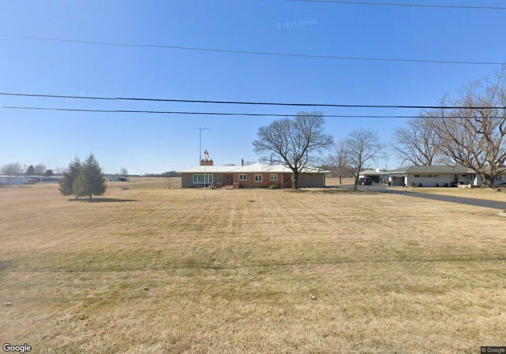
This home is located at 4459 State Route 235, Ada, OH 45810 and is currently estimated at $277,626, approximately $133 per square foot. 4459 State Route 235 is a home located in Hardin County with nearby schools including Ada Elementary School and Ada High School.
Ownership History
Date
Name
Owned For
Owner Type
Purchase Details
Closed on
Jul 28, 2022
Sold by
Kay E Mahaffey Living Trust
Bought by
Cogar Delbert R and Cogar Annette S
Current Estimated Value
Home Financials for this Owner
Home Financials are based on the most recent Mortgage that was taken out on this home.
Original Mortgage
$256,500
Outstanding Balance
$243,484
Interest Rate
5.78%
Mortgage Type
New Conventional
Estimated Equity
$34,142
Purchase Details
Closed on
Oct 15, 1997
Bought by
Mahaffey Kay E Living Tr
Create a Home Valuation Report for This Property
The Home Valuation Report is an in-depth analysis detailing your home's value as well as a comparison with similar homes in the area
Home Values in the Area
Average Home Value in this Area
Purchase History
| Date | Buyer | Sale Price | Title Company |
|---|---|---|---|
| Cogar Delbert R | $270,000 | -- | |
| Mahaffey Kay E Living Tr | $125,000 | -- |
Source: Public Records
Mortgage History
| Date | Status | Borrower | Loan Amount |
|---|---|---|---|
| Open | Cogar Delbert R | $256,500 |
Source: Public Records
Tax History
| Year | Tax Paid | Tax Assessment Tax Assessment Total Assessment is a certain percentage of the fair market value that is determined by local assessors to be the total taxable value of land and additions on the property. | Land | Improvement |
|---|---|---|---|---|
| 2025 | $3,381 | $90,690 | $9,890 | $80,800 |
| 2024 | $3,381 | $90,690 | $9,890 | $80,800 |
| 2023 | $3,357 | $90,690 | $9,890 | $80,800 |
| 2022 | $1,859 | $52,010 | $5,090 | $46,920 |
| 2021 | $2,047 | $52,010 | $5,090 | $46,920 |
| 2020 | $2,074 | $52,010 | $5,090 | $46,920 |
| 2019 | $1,758 | $45,800 | $4,880 | $40,920 |
| 2018 | $1,718 | $45,800 | $4,880 | $40,920 |
| 2017 | $1,674 | $45,800 | $4,880 | $40,920 |
| 2016 | $1,324 | $39,460 | $4,360 | $35,100 |
| 2015 | $1,642 | $39,460 | $4,360 | $35,100 |
| 2014 | $1,298 | $39,460 | $4,360 | $35,100 |
| 2013 | $1,382 | $39,730 | $4,360 | $35,370 |
Source: Public Records
Map
Nearby Homes
- 4599 Ohio 235
- 2959 County Road 60
- 318 Willeke Ave
- 820 S Main St
- 615 W Lima Ave
- 722 S Johnson St
- 710 S Main St
- 314 E University Ave
- 301 S Main St
- 510 E Lehr Ave Unit 510R
- 120 W Buckeye Ave Unit 122
- 211 S Main St
- 210 N Gilbert St
- 222 E Montford Ave
- 1689 County Road 50
- 423 N Johnson St
- 420 N Simon St
- 5594 County Road 35
- 530 N Main St
- 2864 Ohio 309
- 4459 State Route 235
- 4429 State Route 235
- 4480 State Route 235
- 4480 Sr
- 4393 State Route 235
- 4135 State Route 235
- 4353 State Route 235
- 4390 State Route 235
- 4599 State Route 235
- #23 4599 Sr
- #9 4599 Sr
- 4599 St Route
- 4599 Sr
- 4593 State Route 235
- 4317 Sr
- 4317 Ohio 235
- 4563 State Route 235
- 4316 State Route 235
- 4624 State Route 235
- 4623 State Route 235
Your Personal Tour Guide
Ask me questions while you tour the home.