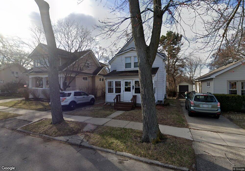
446 E Drayton St Ferndale, MI 48220
Estimated Value: $246,000 - $276,000
3
Beds
2
Baths
860
Sq Ft
$303/Sq Ft
Est. Value
About This Home
This home is located at 446 E Drayton St, Ferndale, MI 48220 and is currently estimated at $260,341, approximately $302 per square foot. 446 E Drayton St is a home located in Oakland County with nearby schools including Ferndale Lower Elementary Campus, Ferndale Upper Elementary Campus, and Ferndale Middle School.
Ownership History
Date
Name
Owned For
Owner Type
Purchase Details
Closed on
Jul 8, 2016
Sold by
Mitchell Lise Hedin and Estate Of Janet Ann
Bought by
Hedin Amber
Current Estimated Value
Home Financials for this Owner
Home Financials are based on the most recent Mortgage that was taken out on this home.
Original Mortgage
$74,132
Outstanding Balance
$59,970
Interest Rate
4.25%
Mortgage Type
FHA
Estimated Equity
$200,371
Create a Home Valuation Report for This Property
The Home Valuation Report is an in-depth analysis detailing your home's value as well as a comparison with similar homes in the area
Home Values in the Area
Average Home Value in this Area
Purchase History
| Date | Buyer | Sale Price | Title Company |
|---|---|---|---|
| Hedin Amber | $75,500 | None Available |
Source: Public Records
Mortgage History
| Date | Status | Borrower | Loan Amount |
|---|---|---|---|
| Open | Hedin Amber | $74,132 |
Source: Public Records
Tax History
| Year | Tax Paid | Tax Assessment Tax Assessment Total Assessment is a certain percentage of the fair market value that is determined by local assessors to be the total taxable value of land and additions on the property. | Land | Improvement |
|---|---|---|---|---|
| 2025 | $4,167 | $119,220 | $0 | $0 |
| 2024 | $4,006 | $112,430 | $0 | $0 |
| 2023 | $3,884 | $104,000 | $0 | $0 |
| 2022 | $3,898 | $94,120 | $0 | $0 |
| 2021 | $3,921 | $85,840 | $0 | $0 |
| 2020 | $3,720 | $80,020 | $0 | $0 |
| 2019 | $3,778 | $71,450 | $0 | $0 |
| 2018 | $3,790 | $63,200 | $0 | $0 |
| 2017 | $3,868 | $61,980 | $0 | $0 |
| 2016 | $2,101 | $56,750 | $0 | $0 |
| 2015 | -- | $52,020 | $0 | $0 |
| 2014 | -- | $43,280 | $0 | $0 |
| 2011 | -- | $43,020 | $0 | $0 |
Source: Public Records
Map
Nearby Homes
- 418 E Woodland St
- 449 E Oakridge St
- 525 E Lewiston Ave
- 535 E Lewiston Ave
- 502 E Lewiston Ave
- 260 E Cambourne St
- 564 E Lewiston Ave
- 2840 Horton St
- 187 Vester St
- 490 E Cambourne St
- 211 E 9 Mile Rd Unit 313
- 3 W Nine Mile Rd
- 88 Wellesley Dr
- 340 W Maplehurst St
- 49 Amherst Rd
- 3040 Inman St
- 3116 Horton St
- 52 Devonshire Rd
- 2808 Goodrich St
- 582 W Breckenridge St
- 446 E Drayton St
- 440 E Drayton St
- 452 E Drayton St
- 349 E Woodland St
- 357 E Woodland St
- 432 E Drayton St
- 424 E Drayton St
- 470 E Drayton St
- 335 E Woodland St Unit Bldg-Unit
- 335 E Woodland St
- 325 E Woodland St
- 319 E Woodland St
- 416 E Drayton St
- 416 E Drayton St
- 500 E Drayton St
- 408 E Drayton St
- 510 E Drayton St
- 340 E Woodland St
- 338 DEWEY ST. E Woodland St
- 405 E Woodland St
Your Personal Tour Guide
Ask me questions while you tour the home.