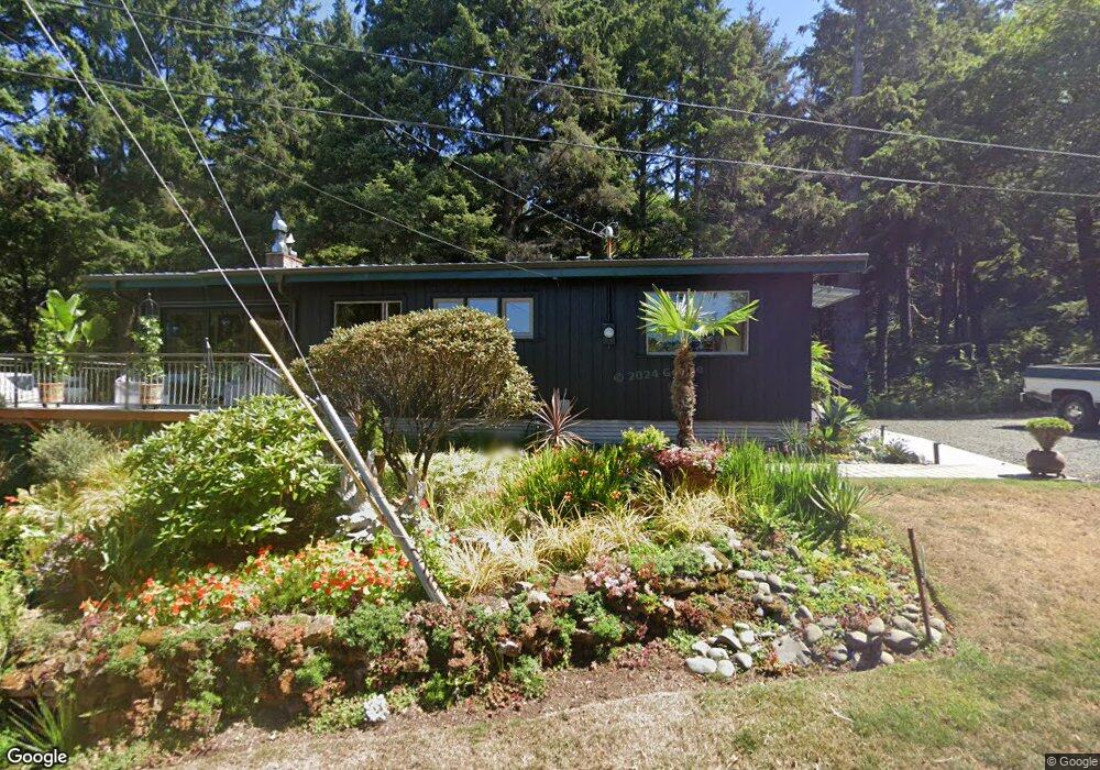
44655 Tide Ave Arch Cape, OR 97102
Estimated Value: $799,000 - $963,000
2
Beds
2
Baths
2,433
Sq Ft
$365/Sq Ft
Est. Value
About This Home
This home is located at 44655 Tide Ave, Arch Cape, OR 97102 and is currently estimated at $888,296, approximately $365 per square foot. 44655 Tide Ave is a home located in Tillamook County with nearby schools including Nehalem Elementary School, Garibaldi Elementary School, and Neah-Kah-Nie Middle School.
Ownership History
Date
Name
Owned For
Owner Type
Purchase Details
Closed on
Sep 24, 2015
Sold by
Hanson Steven D and Hanson Barbara J
Bought by
Laird Dennis R and Posey John A
Current Estimated Value
Home Financials for this Owner
Home Financials are based on the most recent Mortgage that was taken out on this home.
Original Mortgage
$304,000
Outstanding Balance
$236,710
Interest Rate
3.9%
Mortgage Type
New Conventional
Estimated Equity
$651,586
Create a Home Valuation Report for This Property
The Home Valuation Report is an in-depth analysis detailing your home's value as well as a comparison with similar homes in the area
Purchase History
| Date | Buyer | Sale Price | Title Company |
|---|---|---|---|
| Laird Dennis R | $380,000 | Ticor Title Company |
Source: Public Records
Mortgage History
| Date | Status | Borrower | Loan Amount |
|---|---|---|---|
| Open | Laird Dennis R | $304,000 |
Source: Public Records
Tax History
| Year | Tax Paid | Tax Assessment Tax Assessment Total Assessment is a certain percentage of the fair market value that is determined by local assessors to be the total taxable value of land and additions on the property. | Land | Improvement |
|---|---|---|---|---|
| 2025 | $6,119 | $465,830 | $257,030 | $208,800 |
| 2024 | $5,675 | $452,270 | $249,550 | $202,720 |
| 2023 | $5,233 | $439,100 | $242,280 | $196,820 |
| 2022 | $4,922 | $426,320 | $235,220 | $191,100 |
| 2021 | $4,779 | $413,910 | $228,360 | $185,550 |
| 2020 | $4,033 | $352,110 | $221,710 | $130,400 |
| 2019 | $3,802 | $341,860 | $215,260 | $126,600 |
| 2018 | $3,684 | $331,910 | $209,000 | $122,910 |
| 2017 | $3,585 | $322,250 | $202,920 | $119,330 |
| 2016 | $3,486 | $312,870 | $197,020 | $115,850 |
| 2015 | $3,404 | $303,760 | $191,280 | $112,480 |
| 2014 | $3,374 | $294,920 | $185,720 | $109,200 |
| 2013 | $3,371 | $293,790 | $175,720 | $118,070 |
Source: Public Records
Map
Nearby Homes
- 79274 Ray Brown Rd
- 79364 Ray Brown Rd
- 0 Clatsop Ln Unit Lot 408
- 31911 Clatsop Ln
- 79519 Ray Brown Rd
- 0 Walsh Ln
- 0 Wildwood Ln Unit 2904
- 0 Wildwood Ln Unit 26-225
- 0 Greenleaf Rd
- 32073 Cedar Ln
- 80444 Carnahan Rd
- 0 Tl 2701 Beulah Reed Rd
- 7870 Sunset Dr
- Lot 27 Meadow Loop
- 38590 Meadow Loop
- 0 Braeridge Dr Unit 10
- 0 Braeridge Dr Unit Lot 62 192646082
- 0 Braeridge Dr Unit 25-729
- Vantage Rd
- TL 2701 Beulah Reed Rd
- 44655 Tide Ave
- 44705 Tide Ave
- 44670 Tide Ave
- 0 V L Tide Ave
- 44660 Tide Ave
- 44610 Falcon Ln
- 44710 Tide Ave
- 3900 Tide Ave
- 44855 2nd Ave
- 44790 Tide Ave Unit 5
- 44790 Tide Ave
- 44805 Tide Ave
- 44805 Tide Ave Unit 6
- 0 Second Ave
- 6150 Elk Flat Rd
- 44590 Falcon Ln
- 44850 Tide Ave
- 44855 Second Ave
- 44880 Tide Ave
- 44850 Third St
Your Personal Tour Guide
Ask me questions while you tour the home.