448 Creekside Cir Central Point, OR 97502
Estimated Value: $405,496 - $457,000
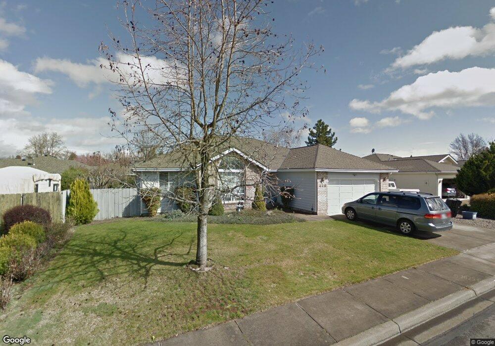
About This Home
This home is located at 448 Creekside Cir, Central Point, OR 97502 and is currently estimated at $440,624, approximately $274 per square foot. 448 Creekside Cir is a home located in Jackson County with nearby schools including Richardson Elementary School, Scenic Middle School, and Crater High School.
Ownership History
We collect this data history from publicly available records. To have your information removed, we recommend requesting removal directly through your county’s website.
Purchase Details
Purchase Details
Purchase Details
Purchase History
We collect this data history from publicly available records. To have your information removed, we recommend requesting removal directly through your county’s website.
| Date | Buyer | Sale Price | Title Company |
|---|---|---|---|
| -- | None Available | ||
| -- | None Available | ||
| -- | None Available |
Tax History
We collect this data history from publicly available records. To have your information removed, we recommend requesting removal directly through your county’s website.
| Year | Tax Paid | Tax Assessment Tax Assessment Total Assessment is a certain percentage of the fair market value that is determined by local assessors to be the total taxable value of land and additions on the property. | Land | Improvement |
|---|---|---|---|---|
| 2026 | $4,515 | $270,600 | $126,000 | $144,600 |
| 2025 | $4,404 | $264,890 | $69,360 | $195,530 |
| 2024 | $4,404 | $257,180 | $67,340 | $189,840 |
| 2023 | $4,262 | $249,690 | $65,380 | $184,310 |
| 2022 | $4,163 | $249,690 | $65,380 | $184,310 |
| 2021 | $4,044 | $242,420 | $63,480 | $178,940 |
| 2020 | $3,926 | $235,360 | $61,630 | $173,730 |
| 2019 | $3,829 | $221,860 | $58,100 | $163,760 |
| 2018 | $3,712 | $215,400 | $56,400 | $159,000 |
| 2017 | $3,619 | $215,400 | $56,400 | $159,000 |
| 2016 | $3,513 | $203,040 | $53,160 | $149,880 |
| 2015 | $3,366 | $203,040 | $53,160 | $149,880 |
| 2014 | $3,281 | $191,390 | $50,110 | $141,280 |
Map
- 109 Vincent Ave
- 752 Mallory Ct
- 10 Donna Way
- 545 Diego Ct Unit 1
- 207 Holiday Ln
- 574 Grey Hawk Way
- 50 Kathryn Ct
- 861 Mendolia Way
- 120 Nadine Ln
- 349 W Pine St
- 887 Holley Way
- 895 Holley Way
- 196 Nadine Ln
- 501 Palo Verde Way
- 429 Mayberry Ln
- 278 Tyler Ave
- 557 Glenn Way
- 1175 Lindsey Ct
- 711 Isherwood Dr
- 821 Isherwood Dr
- 462 Creekside Cir
- 297 Brandon St
- 281 Brandon St
- 467 Vincent Ave
- 317 Brandon St
- 486 Creekside Cir
- 265 Brandon St
- 449 Creekside Cir Unit 1
- 498 Creekside Cir
- 435 Vincent Ave
- 501 Vincent Ave
- 353 Brandon St
- 487 Creekside Cir
- 300 Brandon St
- 278 Brandon St
- 257 Brandon St
- 310 Brandon St
- 270 Vincent Ct
- 268 Vincent Ct
- 274 Vincent Ct
Ask me questions while you tour the home.