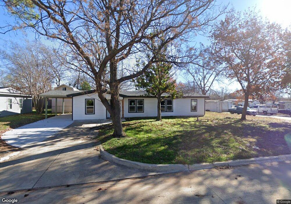
448 Michael Blvd Hurst, TX 76053
Hurst AreaEstimated Value: $244,000 - $279,000
About This Home
This home is located at 448 Michael Blvd, Hurst, TX 76053 and is currently estimated at $266,200, approximately $179 per square foot. 448 Michael Blvd is a home located in Tarrant County with nearby schools including Bellaire Elementary School, Hurst J High School, and L.D. Bell High School.
Ownership History
We collect this data history from publicly available records. To have your information removed, we recommend requesting removal directly through your county’s website.
Purchase Details
Purchase Details
Purchase Details
Purchase Details
Purchase Details
Home Financials for this Owner
Home Financials are based on the most recent Mortgage that was taken out on this home.Purchase Details
Home Financials for this Owner
Home Financials are based on the most recent Mortgage that was taken out on this home.Purchase Details
Home Values in the Area
Average Home Value in this Area
Purchase History
We collect this data history from publicly available records. To have your information removed, we recommend requesting removal directly through your county’s website.
| Date | Buyer | Sale Price | Title Company |
|---|---|---|---|
| -- | Spartan Title | ||
| -- | Spartan Title | ||
| -- | Fidelity National Title Agcy | ||
| $65,500 | -- | ||
| -- | First Fidelity Title | ||
| -- | Alamo Title Company | ||
| -- | Alamo Title Co |
Mortgage History
We collect this data history from publicly available records. To have your information removed, we recommend requesting removal directly through your county’s website.
| Date | Status | Borrower | Loan Amount |
|---|---|---|---|
| Open | $220,000 | ||
| Previous Owner | $133,200 | ||
| Previous Owner | $63,300 | ||
| Previous Owner | $50,230 |
Tax History
We collect this data history from publicly available records. To have your information removed, we recommend requesting removal directly through your county’s website.
| Year | Tax Paid | Tax Assessment Tax Assessment Total Assessment is a certain percentage of the fair market value that is determined by local assessors to be the total taxable value of land and additions on the property. | Land | Improvement |
|---|---|---|---|---|
| 2025 | $2,018 | $95,885 | $50,000 | $45,885 |
| 2024 | $1,958 | $95,885 | $50,000 | $45,885 |
| 2023 | $1,577 | $78,728 | $35,000 | $43,728 |
| 2022 | $1,789 | $77,721 | $35,000 | $42,721 |
| 2021 | $4,347 | $180,261 | $35,000 | $145,261 |
| 2020 | $3,467 | $144,124 | $35,000 | $109,124 |
| 2019 | $3,326 | $135,889 | $35,000 | $100,889 |
| 2018 | $2,764 | $112,932 | $15,000 | $97,932 |
| 2017 | $2,523 | $99,715 | $15,000 | $84,715 |
| 2016 | $2,197 | $86,834 | $15,000 | $71,834 |
| 2015 | $1,663 | $63,400 | $15,000 | $48,400 |
| 2014 | $1,663 | $63,400 | $15,000 | $48,400 |
Map
- 307 Terry Rd
- 321 Holder Dr
- 624 E Ellen Ave
- 625 Caduceus Ln
- 237 Corinna Ct
- 307 Norwood Dr
- 108 Reaves Ln
- 4104 Linkwood Dr
- 1200 Tanglewood Trail
- 904 Ascension Dr
- 721 Norwood Dr
- 931 Park Forest Dr
- 727 Norwood Dr
- 841 Forest Hollow Dr
- 743 Norwood Dr
- 802 Brown Trail
- 800 Lee Dr
- 429 Harmon Rd
- 905 Forest Hollow Dr
- 808 Lee Dr
- 452 Michael Blvd
- 503 Brookfield Dr
- 507 Brookfield Dr
- 460 Michael Blvd
- 436 Michael Blvd
- 449 Michael Blvd
- 445 Michael Blvd
- 504 Brookfield Dr
- 453 Michael Blvd
- 441 Michael Blvd
- 511 Brookfield Dr
- 457 Michael Blvd
- 504 Greenway Dr
- 508 Brookfield Dr
- 432 Michael Blvd
- 508 Greenway Dr
- 437 Michael Blvd
- 512 Brookfield Dr
- 512 Greenway Dr
- 433 Michael Blvd
Ask me questions while you tour the home.